by Weatherflow Meteorologist, Kerry Anderson
After completing my morning forecast I went for a hike here in the Conejo Valley. The hike started at about 800 feet and as expected I was above the marine layer. The marine layer has been scarce this season and what has formed has been shallow. This was the case again this morning. The inversion which forms a cap to the marine clouds was only at 600 feet; below where I was standing when I took these photographs. When the marine layer is that shallow it does not penetrate far inland and can quickly burn off when the sun hits it, which is exactly what happened this morning.

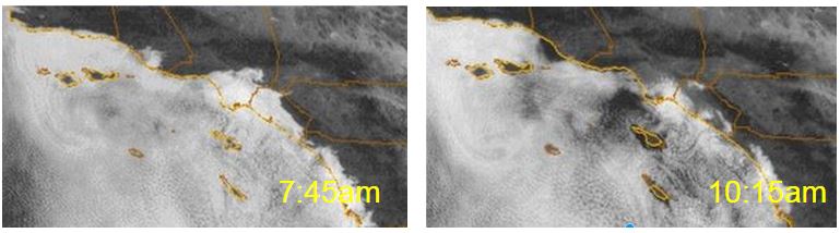
Photographs and satellite pictures of Marine Layer Clouds over Southern California, March 31, 2015. Note how quickly the inland clouds dissipate and the layer over the water thins.
Marine layer clouds develop frequently in Southern California due to the cold ocean currents that cool the air to its condensation point. Wind plays an important role in determining whether a marine layer will form. The air has to be moving slowly enough so it remains in contact with the water long enough to cool. Just like Goldilock’s porridge winds have to be just right in order for the marine layer to develop. If they are too weak then the marine layer isn’t stirred enough and will remain shallow and won’t penetrate inland. If the winds are too strong warmer air can be mixed in from above which dries the air near the ocean and dissipates the clouds.
