by WeatherFlow meteorologist Shea Gibson
We have discussed short wave troughs (known as “short waves”) before in previous blogs, but here is a quick recap:
According to NOAA’s definition, this is, “A disturbance in the mid or upper part of the atmosphere which induces upward motion ahead of it. If other conditions are favorable, the upward motion can contribute to thunderstorm development ahead of a shortwave trough.”
Also see my focused blogs on past short wave events:
June 2, 2015: https://blog.weatherflow.com/what-is-a-short-wave-and-how-can-it-affect-winds/
April 19, 2016: https://blog.weatherflow.com/never-forget-the-short-wave/
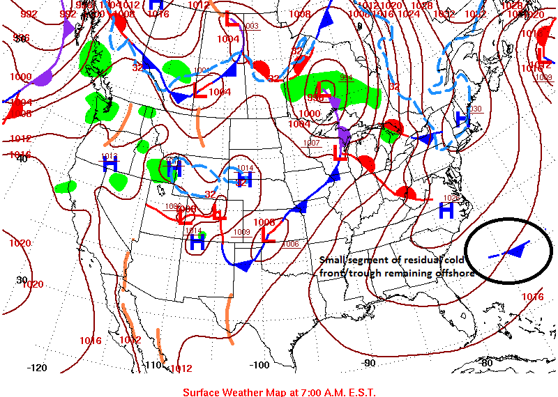
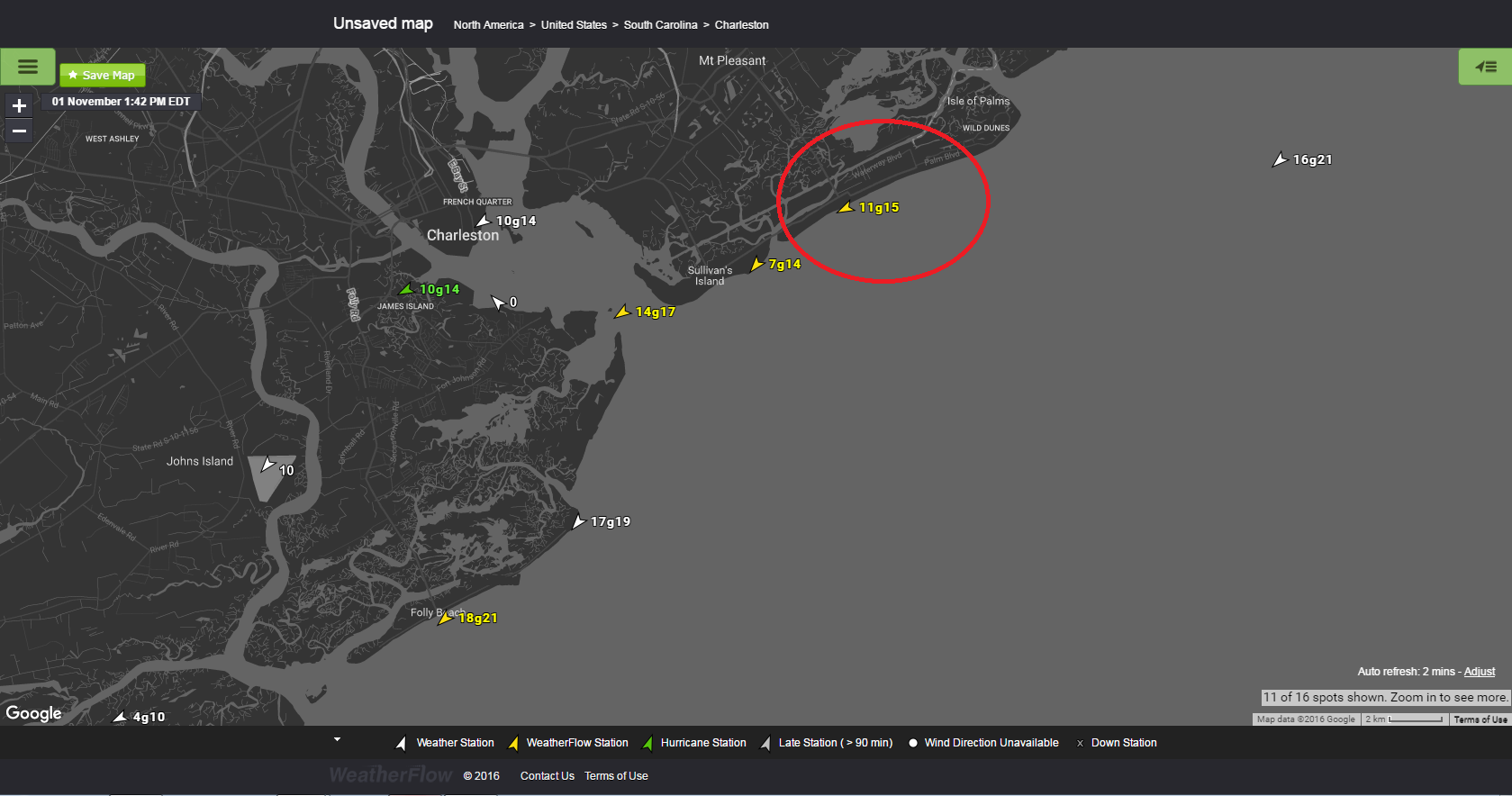
On November 1, 2016, we saw High pressure to the north set up a fairly solid and moderate NE Wedge down the SE Coast. Specifically, Charleston, SC is know for accelerations of speeds due to Sea Breeze coupling as cool air dives down over warmer waters and intensifies along the barrier island beaches. This is known as “backdoor Sea Breezing” when a “backdoor” cold front has moved down the coast and High pressure wedges in down behind it. In this case, a weak cold front moved through and slowly fizzled out over SC/GA.
Here in the WPC NCEP surface map from 7:00am, a tail end of troughing still remained offshore.
At 7:47AM, the NE/ENE winds picked up to 16kts g20 (gusting to 20kts) due to the sun coming up, the gradient tightening and speeds elevating according to the onshore turn/acceleration process of initial Sea Breezing.
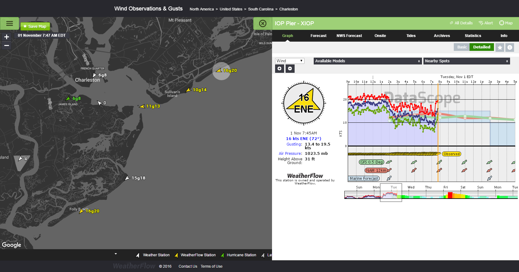
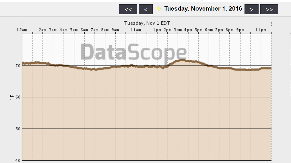
Quick note: Air Temps were already in the upper 60’s, so the radiational heating process in the atmosphere got things going earlier once the sun came up.
By midday to 12:55pm, the backdoor Sea Breeze process had winds up to 18kts g22, which we consider a moderate flow.
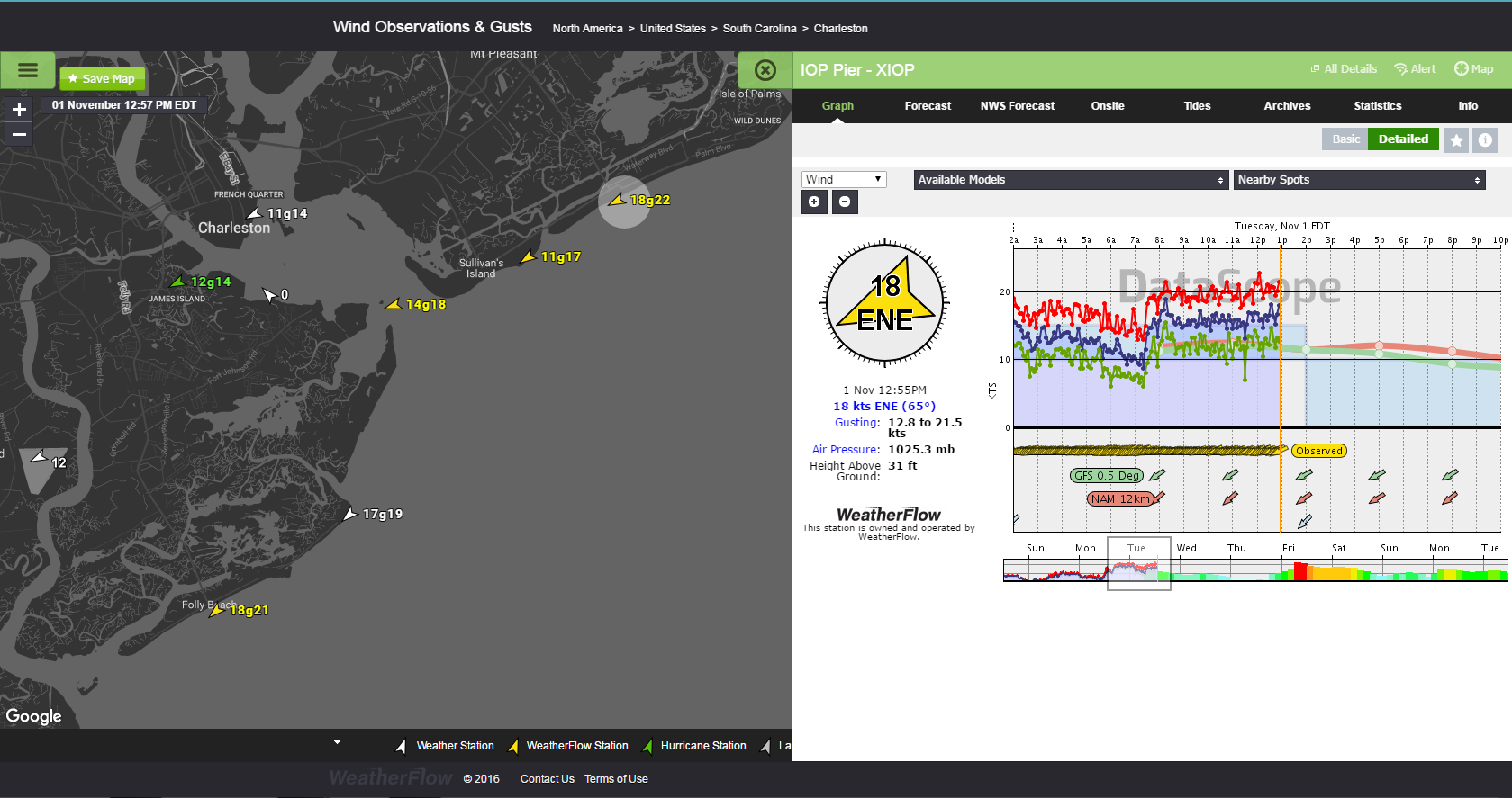
A little after 1pm, the drain got pulled on the winds and speeds plummeted. By 1:38pm-1:42pm speeds north of the Charleston Harbor had dropped to 10/11kts. Folly Beach kept its speeds to 18kts g21.
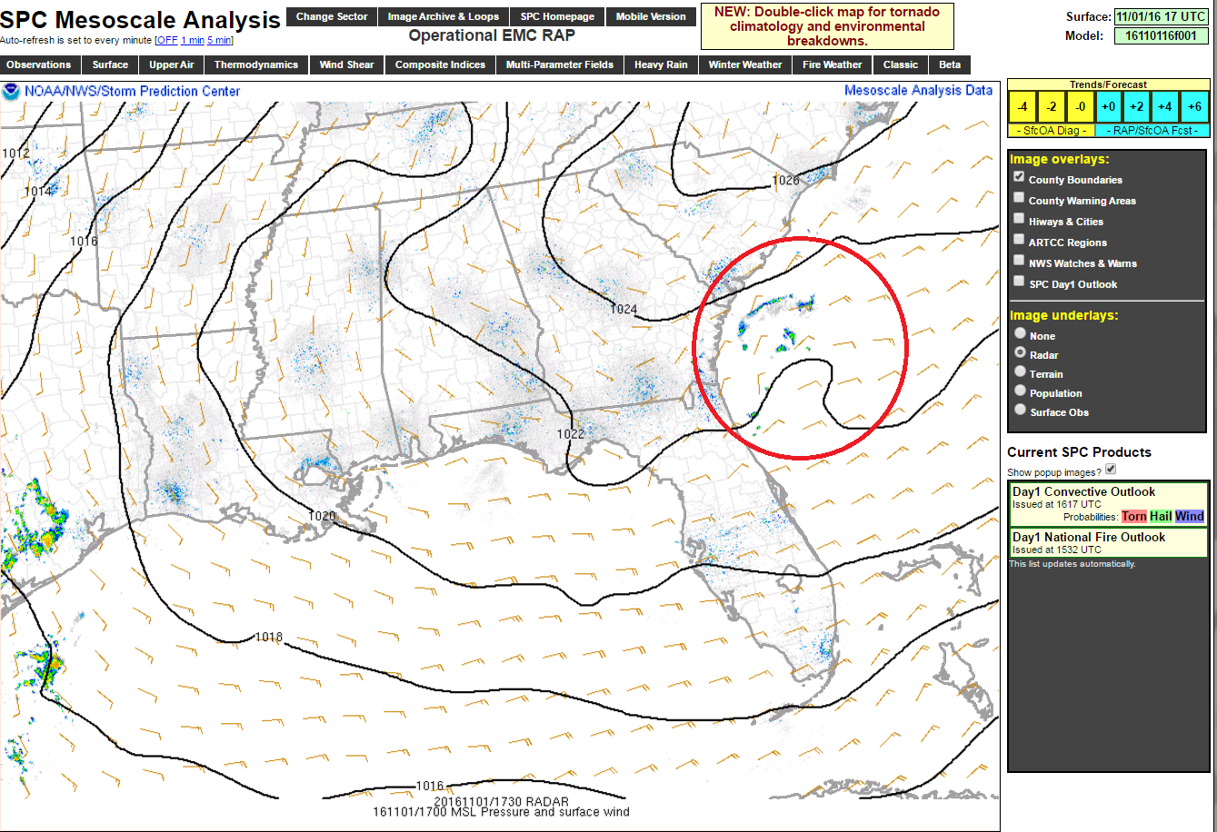
My first reaction was to check radar, but no precip showed up. Took a look at the sky and saw cloud layering with overcast-type skies. That was my first clue that short waving was occurring somewhere nearby. I brought up the SPC Mesoanalysis, which I have set to update every 1 minute – and caught a small atmospheric disturbance to the south:
The positive tilt (upwards bow) in the High pressure 1022 isobar (equal line of pressure) was representative of a short wave trough developing. Counter-clockwise rotation in the surface wind barbs are a classic signature of a short wave beginning to allow for weak surface low pressure development. You can see the showers showing up on the radar imaging. This was likely initiated by a bit of rotation intensifying over the warm waters of the Gulf Stream.
So looking at our Datascope viewer, I was able to capture the short wave developing into a weak low (mesolow) and heading into northern Georgia. The outflow aloft showed that the gradient held up just south of the Charleston Harbor, but clouding aloft cut off the flow to the north. It was actually sunnier to the south within an open pocket in the clouding, which kept the Sea Breeze alive to Folly Beach a bit longer.
Here is a different perspective from WSV3:
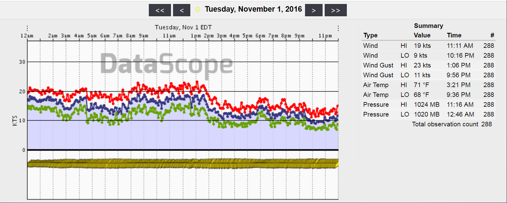
Eventually, areas to the south including Folly Beach saw the drop in winds. Just took a little longer. Here is the graph of Folly Beach that day – you can see the downward trend around 1:45pm:
All-in-all, this is yet another way we can detect short waves by first analyzing our coastal mesonet and then using the sky as another reference point before even checking regional radar or the regional mesoanalysis. Many times, just knowing the NE/ENE wind behavior and knowing that a sudden drop of onshore flow usually means either a) a short wave/area of low pressure weakens the gradient from nearby (common) or b) the overall gradient weakens just that fast (not very common).
Until next time – stay safe out there.
Cheers!
Shea Gibson
WeatherFlow Forecasting Team
East Coast/ SE Region
Outreach/New Station Projects
Twitter: @WeatherFlowCHAS
Sources: NOAA SPC, NOAA WPC NCEP archives, WSV3, and our own WeatherFlow Datascope Professional Viewer