by WeatherFlow meteorologist Shea Gibson
We are currently seeing a very seasonal summer setup with vast blocking subtropical ridge known as the “Bermuda-Azores High pressure” over the North Atlantic Ocean. As it assumes its typical 1024mb status and keeps more of a near-Bermuda presence, we encounter periods of strengthened Sea Breezes along the SE Region off the synoptic Southerly flow it brings. We usually see a few types of scenarios unfold with some variances as High pressure meanders back and forth:
1. Center(s) of pressure holds to the east with some north or south movement. The subtropical ridge extend westwards from the Azores with weaker synoptic flow…sending axis placement somewhere along the Carolinas to keep light or modest flows and increased moisture.
2. Centralized pressure builds closer to Bermuda and becomes more robust for a solid synoptic flow along the eastern seaboard of the United States. In this case, the ridge axis usually drifts south into southern Florida for their typical light-to-modest seasonal flow and builds Sea Breeze profiles to the north (as seen the 2nd week of July).
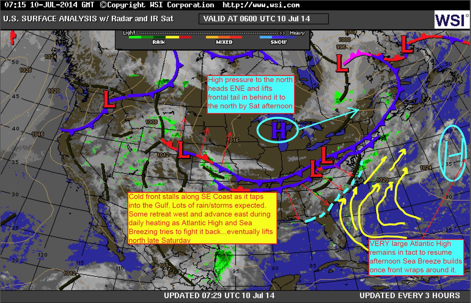
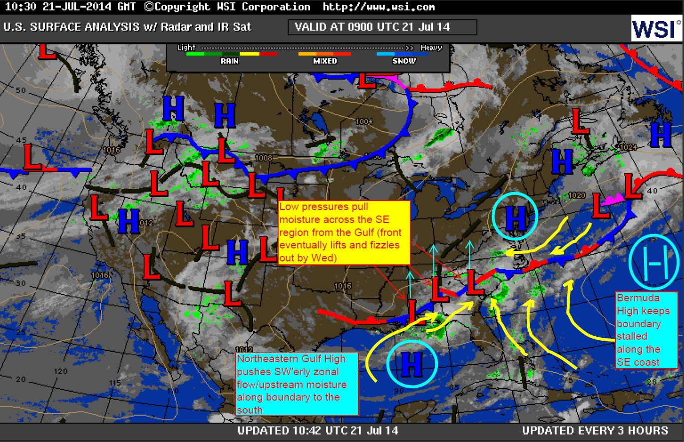
3. Bermuda High blocks cold fronts from progressing offshore and holds them along the SE Region. EAST-WEST positioning occurs where northeast Gulf High lays it horizontal as northern continental High pressures pass to the east. This leads to a monsoonal type of environment with Gulf moisture being pulled along the boundary by Low pressures tracking along it (visible in the 4tht week of July).
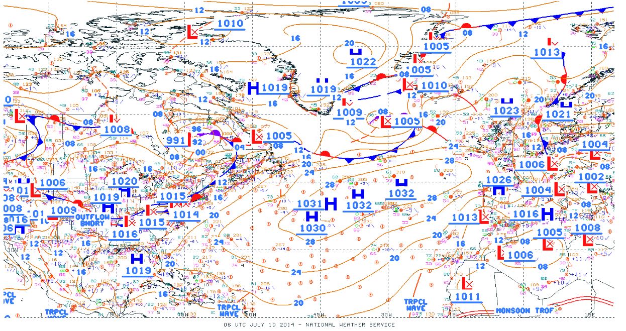
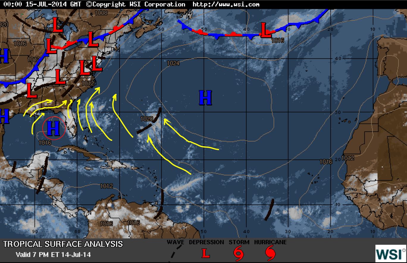
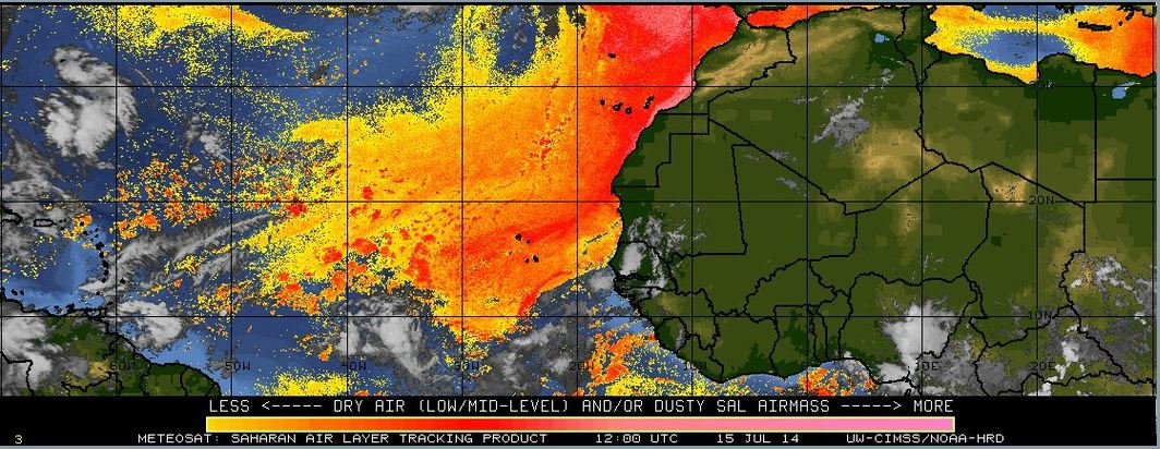
One impressive feature for the second week of July was how vast this area of High pressure became. Notice how pressure built to 1032mb’s and took up the entirety of the North Atlantic above the ITCZ (Intertropical Convergence Zone). The Saharan Air Layer (SAL) to the south remained fairly strong as dust storms in Africa continued to spill desert dust in the low/mid levels out over the Atlantic. This kept the southern portion of the High very dry… and dissipated several tropical waves.

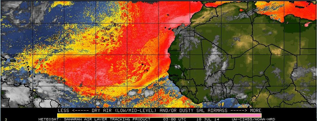
Here’s the Saharan Air Layer for the 2nd week of July…
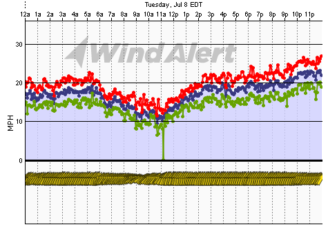
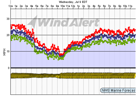
And here are the resulting afternoon Sea Breezes along South Carolina from July 7 to July 10 (Isle of Palms Pier sensor). You can see how the 4 day stretch starts out weak and ends weak during the nocturnal periods. This is significant in the fact that cold fronts have been stalled just inland or overhead of the coast.


Here are the local effects to the SE coast:
The 2nd week of July brought another round of strengthening Sea Breezes where the High pressure centralized closer to Bermuda and assumed the natural 1024mb status:
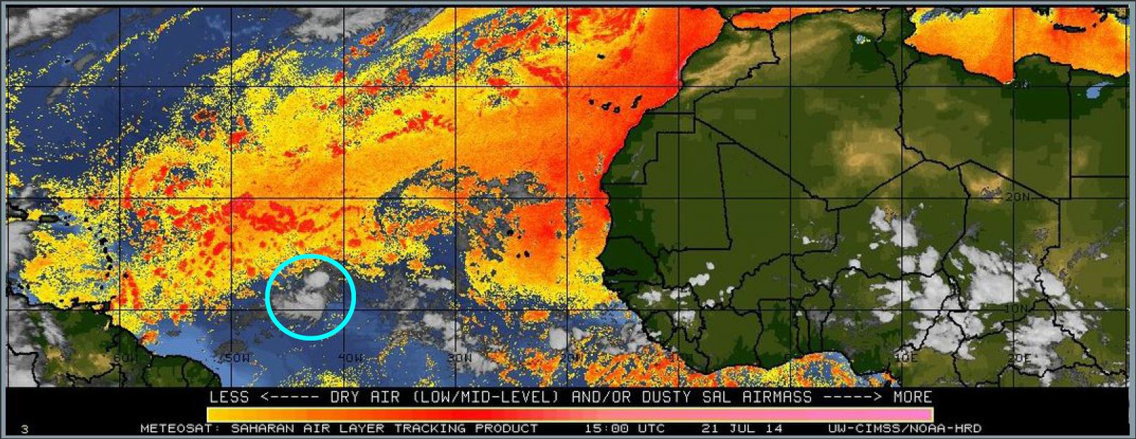
And here is the Saharan Air Layer that looks to be easing off the extended dusty stretch for the 3rd week of July…may finally allow some of those weak tropical waves to make it to the Caribbean and/or GoMex.
And here is the pattern continuing to block frontal progression off the SE coast through July 21 with northeast Gulf High keeping the EAST-WEST bending of fronts while northern High pressures pass to the north. Lots of precipitation through the SE Region due to abundance of Gulf moisture being pulled along the boundary.

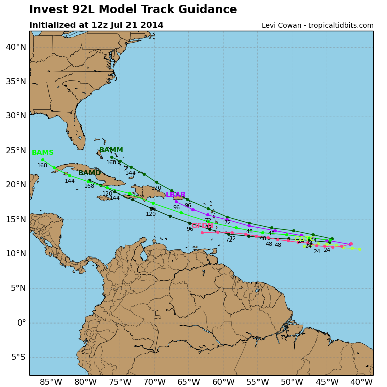
The Saharan Air Layer has relaxed this 4th week of July enough to even allow for tropical development. Went from 20% chance to 70% chance within just a few hours, so we shall see what happens. Ya never know – it might be in the next WeatherFlow blog from the SE Region. Currently labeled as Invest 92L and will be “Bertha” if named. We shall see.

This blog may be updated to include the final 5th week of July so stay tuned…the goal here is to get the entire month.