by WeatherFlow meteorologist Shea Gibson
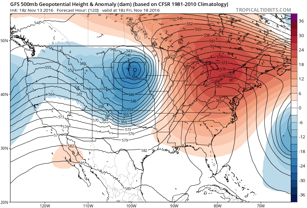
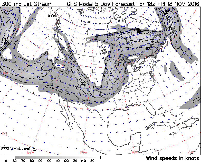
Get ready Great Lakes for a possible “November Witch” to broom into the area by Thursday/Friday with a cauldron of warm air, cold air and violent gales! The name comes from intensifying Low pressures with a clashing of warm air, rain and storms ahead drawn up from the Gulf of Mexico…and cold Canadian air with heavy snow wrapping down around it. At times in the past, we have seen hurricane category force 1 and 2 winds generated over the Great Lakes as the two air masses collide. This is typically a more frequent event to see this time of the year; however, the effects of a La Nina pattern have kept warmer air up across the upper midwest until this week as we see the pattern begin to act more like the fall season.
The old saying goes: “Beware the Witch of November!”
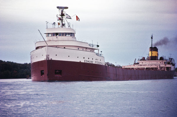
The Witch of November phrase was used in the famous song “The Wreck of the Edmund Fitzgerald” (happened in 1975) by Canadian singer-songwriter Gordon Lightfoot, which was a tribute to one of the most well-known Great Lakes shipwrecks known in that area.
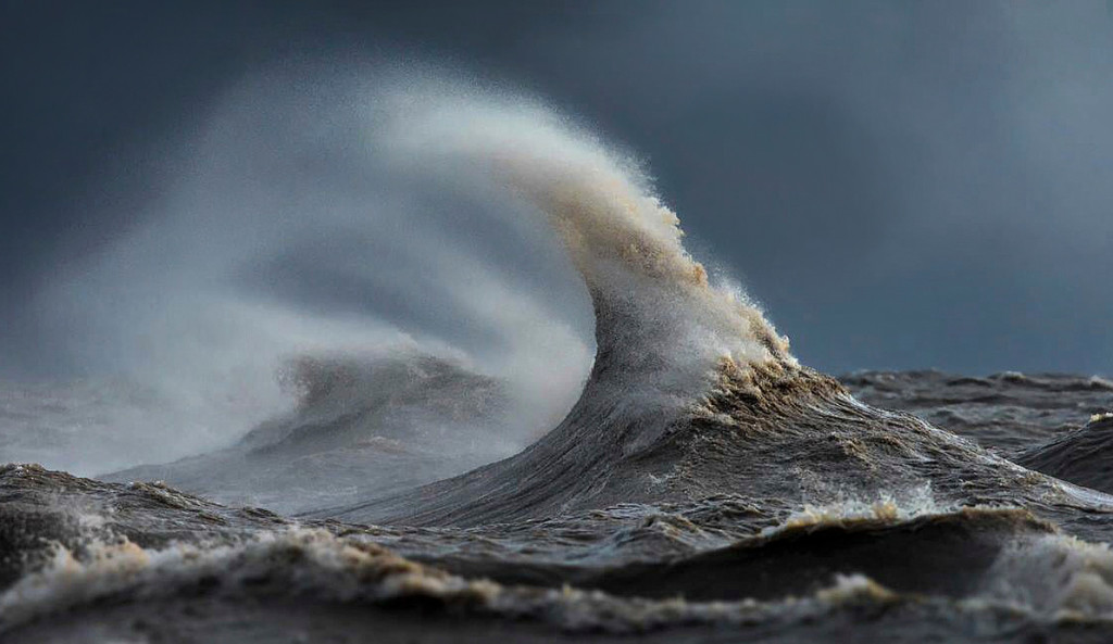
Artistic rendition of an angry and cruel Lake Michigan.

And the “pointy hat” of a “cruel witch” from Photographer Dave Sandford.
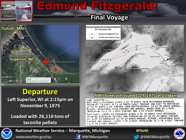
S.S. Edmund Fitzgerald before it went down in Lake Superior on November 10, 1975. All 29 of its crew perished. Between 1878 and 1987, 6,000 ships have been lost on the Great Lakes…with upwards of 25,000 individuals losing their lives over the last 300 years.
Sadly, the National Weather Service Marquette, WI did issue fair warning ahead of their departure, but they went anyways.
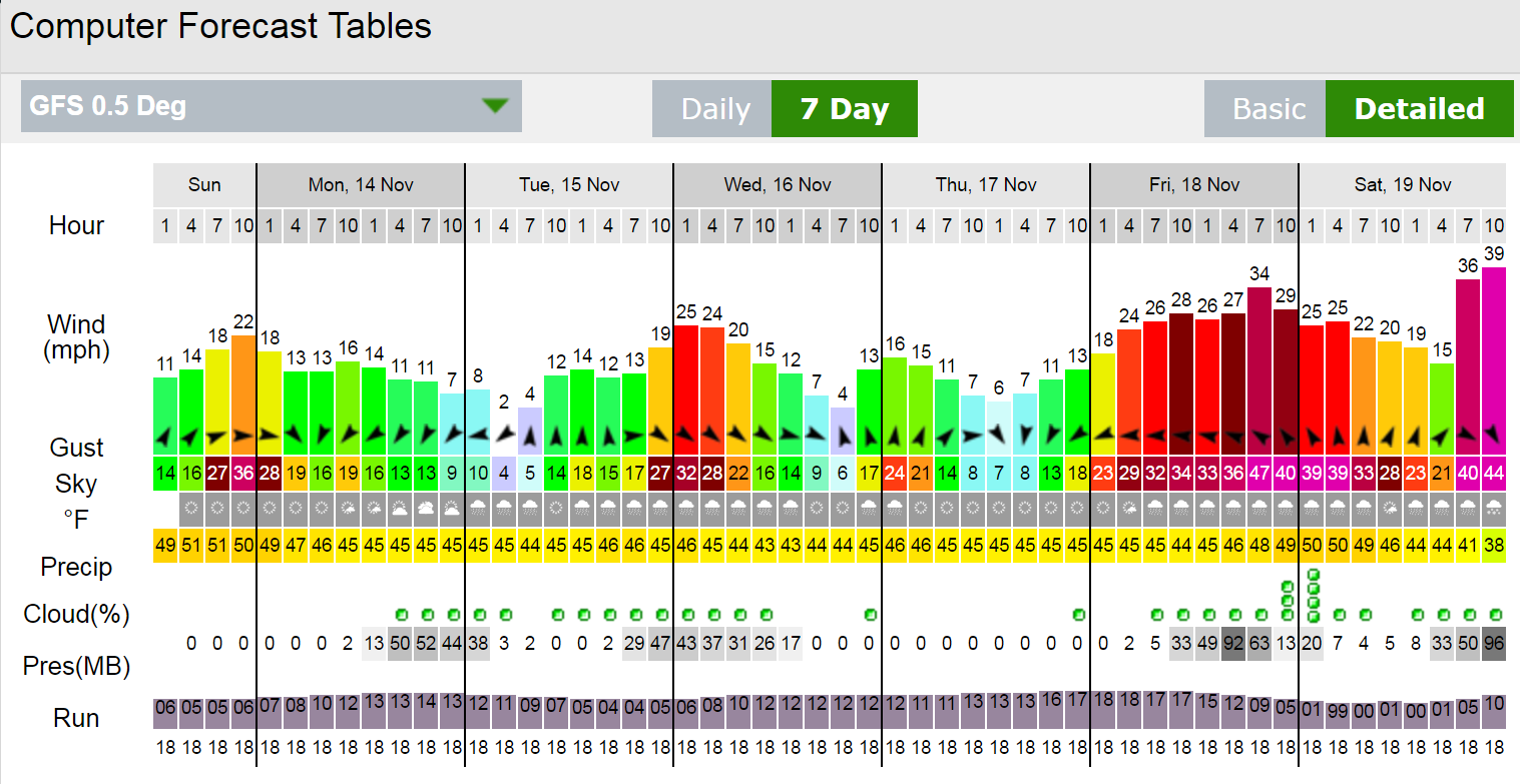
GFS model surface run showing a possible 987mb Low (very strong winds are typically generated at this pressure)
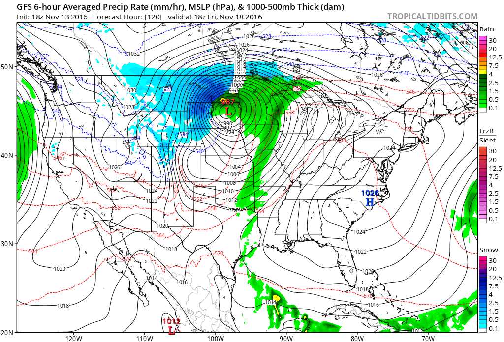
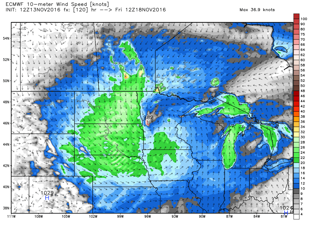
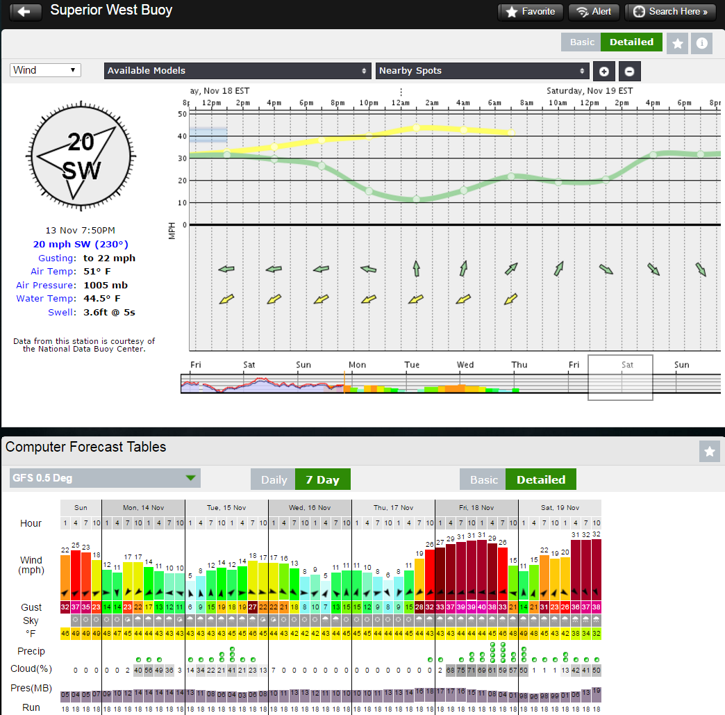
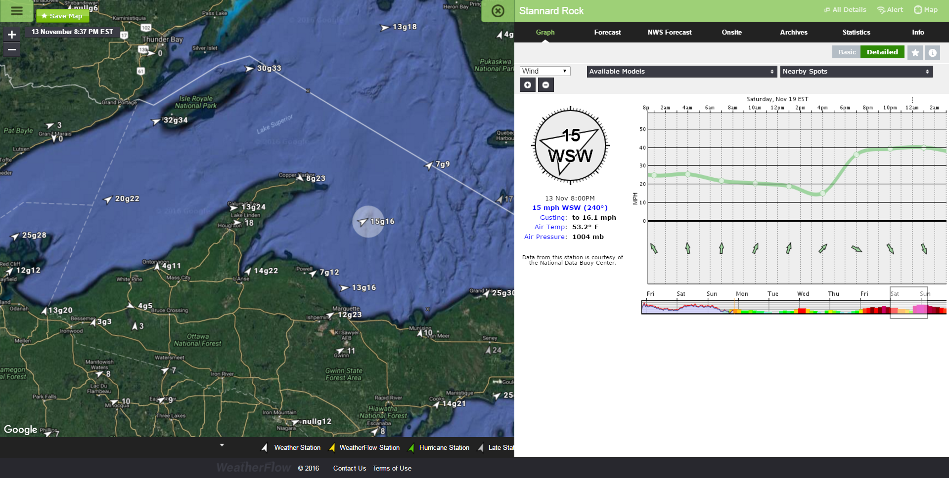
As we head into Saturday, we see winds pick up across the Great Lakes:
UPDATE 11/18/16: Looks like this storm verified with wind in excess of 50mph over Lake Superior and other locales where the wrap-around winds are really cranking up. Here is a video of the system and the winds + gusts. Snow and blizzard conditions are on the N/NW/W/SW side of the system where cold air is wrapping into it… with white-out conditions for many locales.
Stay safe everyone!
Shea Gibson
WeatherFlow Meteorologist/Wind Forecaster
SE Region/East Coast/Tropics
Outreach & New Station Projects
How to find me:
Twitter: @WeatherFlowCHAS
Facebook:
Wind Alert – https://www.facebook.com/windalert/
WeatherFlowCHAS – https://www.facebook.com/WeatherFlowCHAS/
Chucktown Wind Report – https://www.facebook.com/groups/ChucktownWindReport/
Sources for this blog: Our own Datascope viewer, Tropical Tidbits (Levi Cowan), WeatherBell Analytics, NWS Marquette, WI , SFSU.edu, Photographer Dave Sandford