2 Videos: Surface low forms below Cut-Off Low and combo push
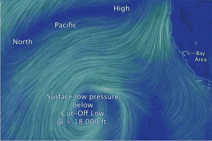
the North Pacific High to the north.
by Mike Godsey, mike@iwindsurf.com
I will add more text the blog later but you can see the big news in those two videos. By themselves these critters are not too exciting wind wise BUT once they depart……
A Cut-Off Low at ≈ 18,000 ft. and about 900 miles WSW of the Bay Area is moving towards Southern California.
Below the Cut-Off Low at surface the Cut-Off Low has induced a weak surface low pressure storm with the typical counter-clockwise spinning winds.
Looking at the first video you can see this surface storm.
The second video shows the clouds and moisture above 10,000 feet up the the jet stream at about 30,000 feet. This is where this Cut-Off Low resides. The dark green areas are where the moisture level is high and given the right conditions these areas can produce rain. Notice the broad band of clouds moving from the SW south of the Cut-Off Low. This is the subtropical jet stream.
Think of the Cut-Off Low and the surface storm as being a double layer cake with one layer right a the surface and the other layer mostly around ≈ 18,000 ft..
Looking back at the top video you can see ho they have pushed the North Pacific High and its NW winds to the north. Notice the strong NW wind along the Oregon coast.
This Cut-Off Low is targeting Southern California in the next few days and may mess up the wind there.
BUT once the Cut-Off Low departs to the east this weekend get ready!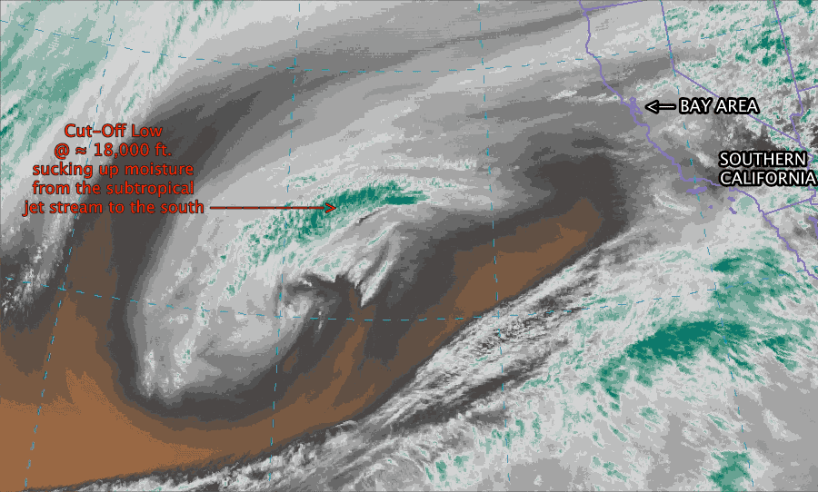
The North Pacific High, which you see in the video crunched to the north is poised to bring NW clearing winds to much of California as it reclaims it home waters.
With thanks to http://earth.nullschool.net