Weird wind pattern for the Bay Area.
by Mike Godsey, mike@iwindsurf.com
So I am gearing up for resuming Bay Area forecasting last night by looking at all the models. And looking at the WRAMS I see something impossible. I went to sleep assuming that is was just a bug in the model output and the forecast would return to reality by dawn today. No such luck.
As you know when we have powerful NW winds at the surface at the ocean buoys always flow smoothly to the Bay Area coast. Then they are funneled through NW to W facing gaps in the coast range, accelerate and thine hit the Bay Area water.
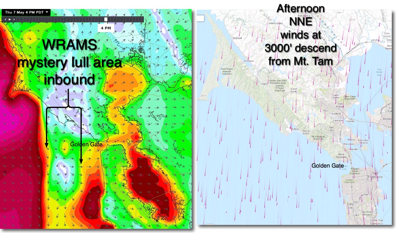
Looking at the LEFT image note that the WRAMS model output shows a huge lulll inbound from the west just north of the Golden Gate. This is the same “BUG” that bugged me last night. So I had to start doing some real bottomsup meteorology to dig into all the empirical data to see if this lull was possible..
I soon realized that 850mb portion of the NPH t about 5000 feet was pushing a ridge over far Northern California and there would be NNE winds over the bay which atypically were not dying in the afternoon. And Mt. Tam would be creating lee side turbulence from this flow that would interfere with the inbound NW wind for Crissy, Coyote & 3rd.
The same thing would be triggered by the North Bay mountains which could disrupt the inbound wind for Pt. Isabel and Berkeley.
While Mt. Livermore on Angel Island could do the same for Treasure Island.
We will have to wait until this afternoon to see how all this pans out. Maybe the models and I are a bunch of Chicken Littles.