Quite common in the early summer setups are these high pressure surface ridges that just… barely…nudge…. off.. the… coast. People don’t believe me when I say yes there are situations with Rhode Island will see stronger winds than Cape Cod, but days like this is one of those situations.
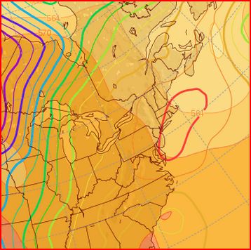
Here is the general Sea Level Pressure prediction for this afternoon: Note the ridge slipping slowly east which still supresses the winds on eastern Massachusetts but enhances the sea breezes in Rhode Island:
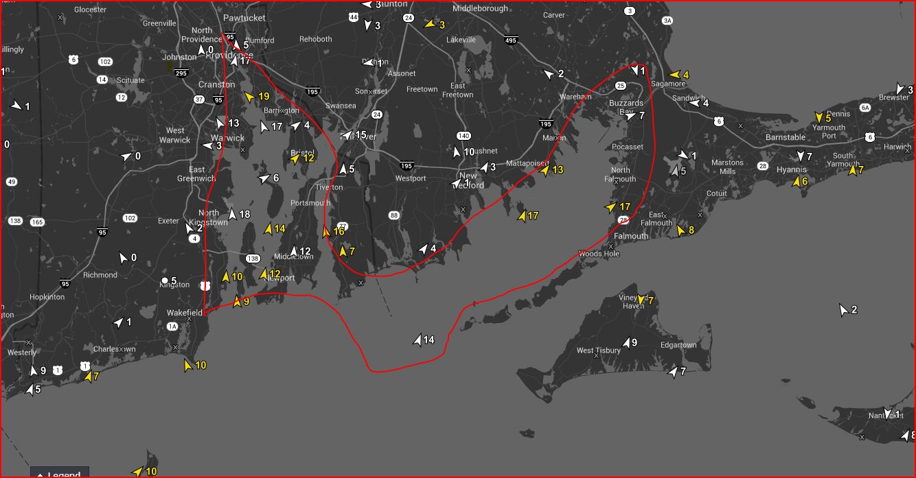
Here is what happened as of early afternoon. Note I marked the area where the winds are favored to couple into inner RI and Buzzards Bay. Why doesn’t the wind get stronger on the RI south coast? Well… the ocean temps are still quite chilly and there are winds there, but the synoptic winds tend to be warmer and skip over the south coast but mechanical mixing and venturi effects in the inner Bay help the winds accelerate there.
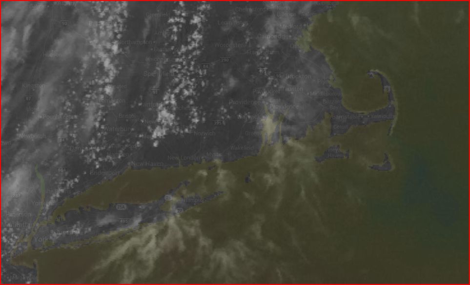
Another item to look at is the visible satellite because what can kill these winds are overblown thermal cloud buildup, or high clouds. Note the shot from this afternoon and popcorn like clouds indicating good thermals and not much cohesion to stop the sea breeze circulation:
So how did we do? Not too bad (if I do say so myself)…. given all models were showing not more than 6-10 knots for the afternoon, we bumped all inner Bay sites up for the afternoon in RI and did the same for Buzzards Bay. In hindsight I should have listened to my gut instinct more and upped the numbers earlier in the day:
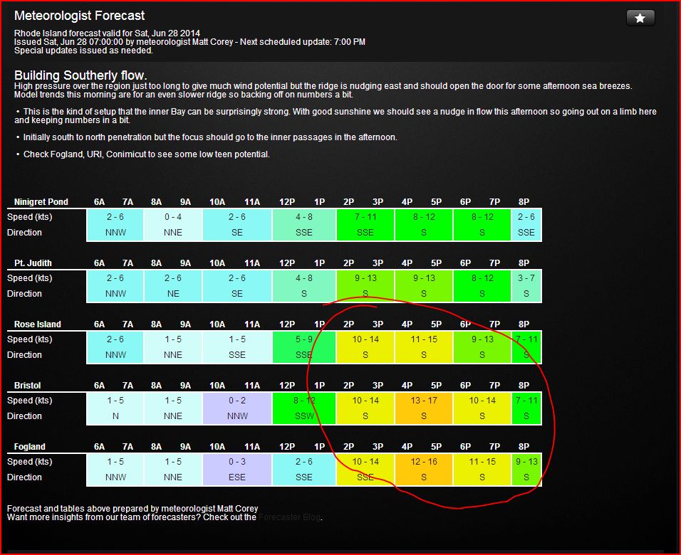
How did the National Weather Service marine forecaster do? Well… even though we are urging them to use our data, here was their forecast for today: S winds 5-10.

We’ll keep on the NWS to help them improve but since we have the stations located on the water for 20+ years, we have learned and are continuing to learn the nuances of these complex coastal areas and can verify our forecasts thereby learning from our mistakes.
We encourage our members to give us direct feedback at the bottom of every forecast that comes straight to our forecasters to help us improve.