
 Typical wind reversal and strong beach winds may not happen.
by Mike Godsey, mike AT iwindsurf.com
UNDER CONSTRUCTION.
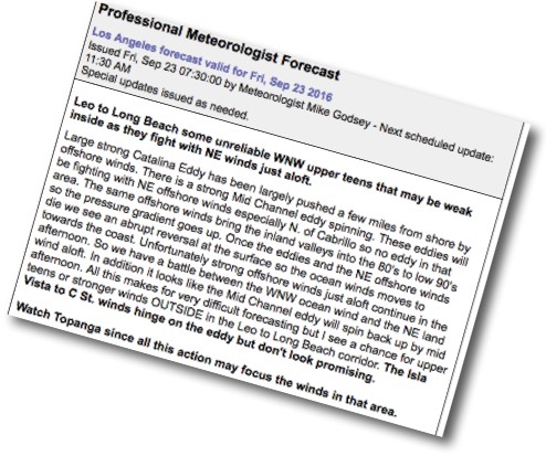
Check out all the weasel words in the Sept. 23 forecast and the extended forecast. Why was this and today’s forecast so iffy?
The short answer is in the animation below which shows the surface winds at 5PM then goes on to show the wind aloft at different levels from 1000 feet to 5000 feet.
Notice how the surface winds are a favorable westerly direction at the coast. But as we go aloft the wind becomes progressively more NE.
Why should you care about winds that far above your kite?
Because those NE winds interact with surface winds to a certain extent. As these NE winds come over the mountains they become turbulent with lots of 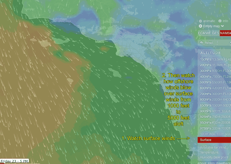 up and down motion. So at times they transfer momentum to the surface winds. Given the NE direction of the winds aloft they will tend to “push” the surface winds away from the coast.
At the same time this NE flow aloft helps the thermal trough (aka “heat bubble”) expand towards the coast spoiling the pressure gradient especially in the Belmont to Seal zone.