The cold water temps of this Spring are producing quite a strong engine for thermal assisted sea breezes. One area the typically is a firecracker for the sea breezes is the inner passages for Rhode Island. Today I suspected this might happen but I shied away from it due to the large amount of mid level moisture on the models. I did hedge that with full sunshine we might see stronger winds and indeed that is what happened.
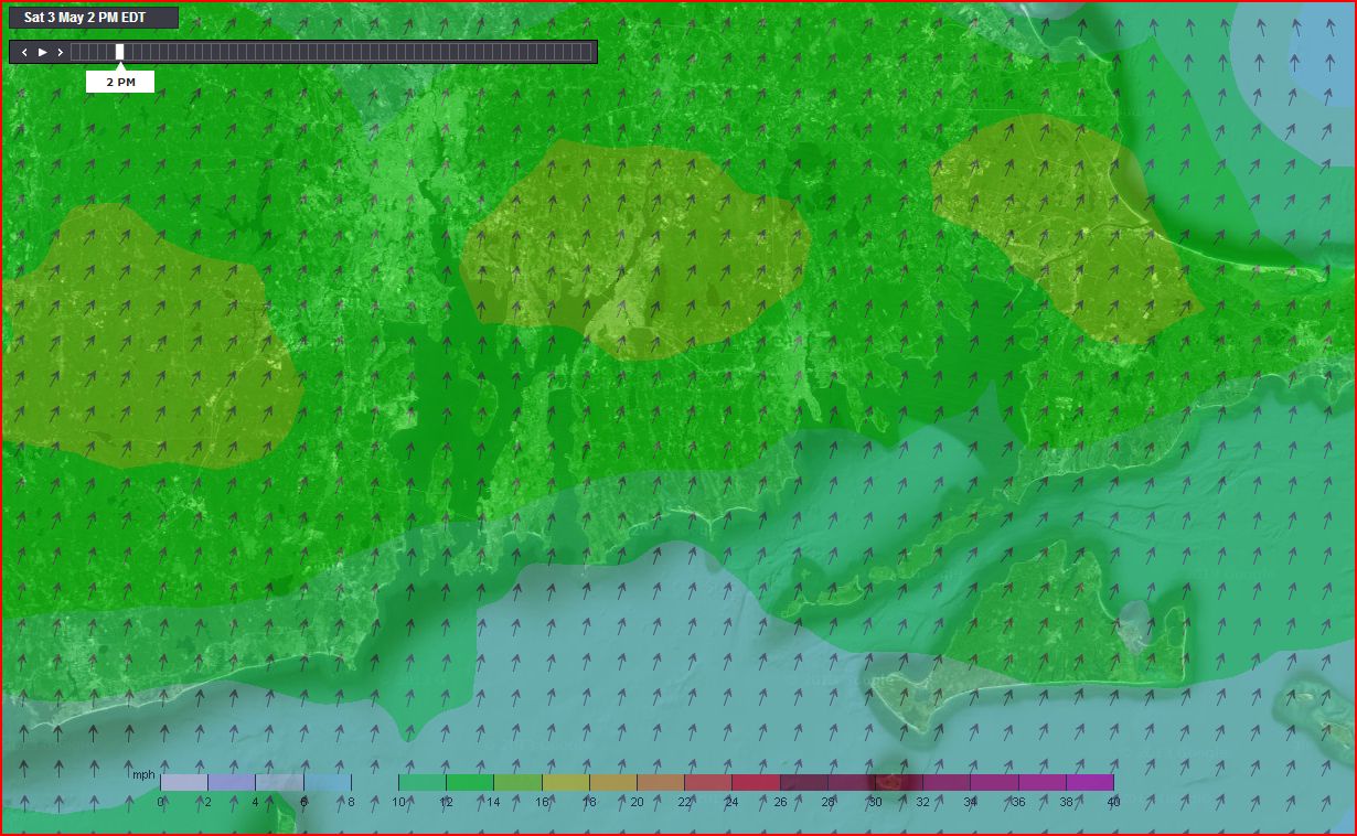
Note that the WeatherFlow WRAMS model got the prediction almost spot on while the 5km ETA model was much more generic and underpredicted.
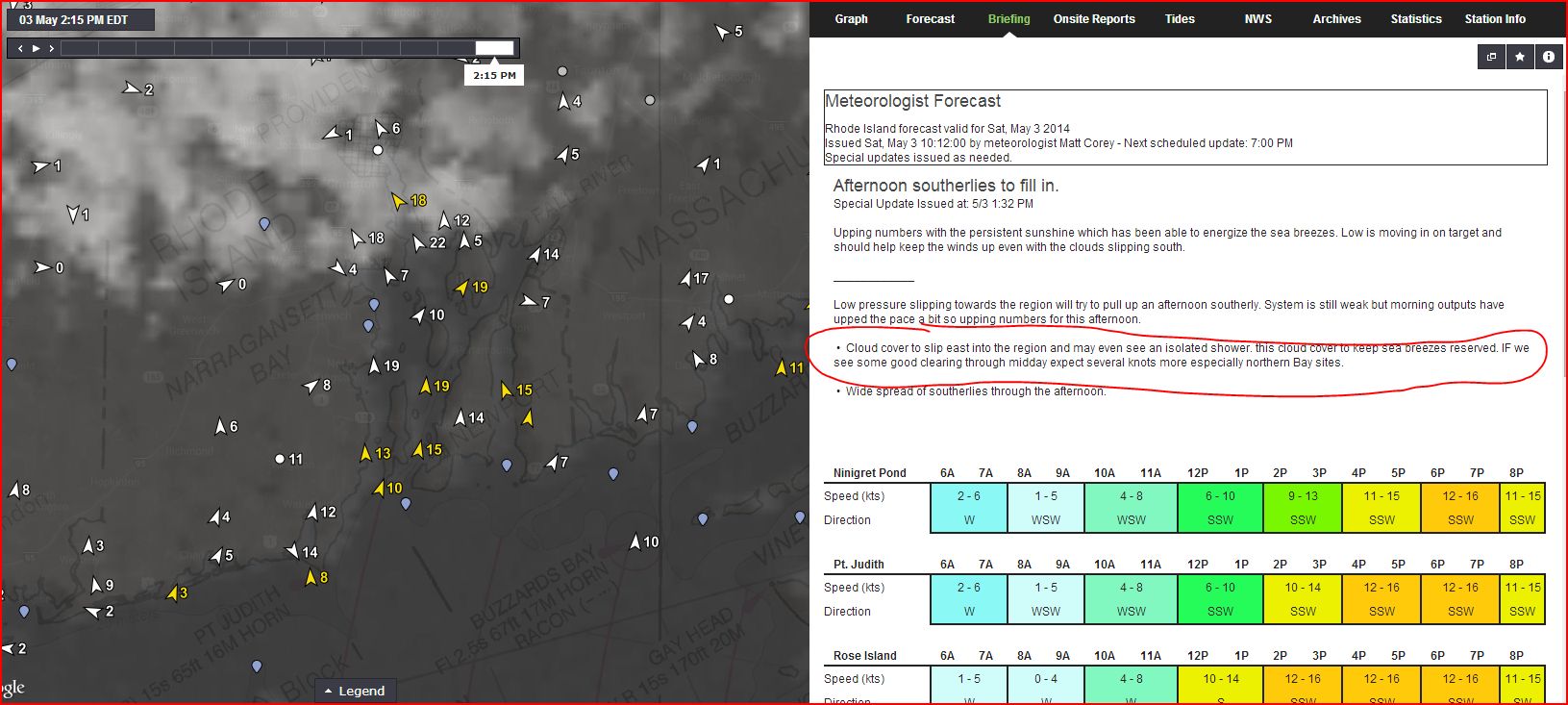
2:15pm Satellite- note the cloud line.

WRAMS 2km model prediction:
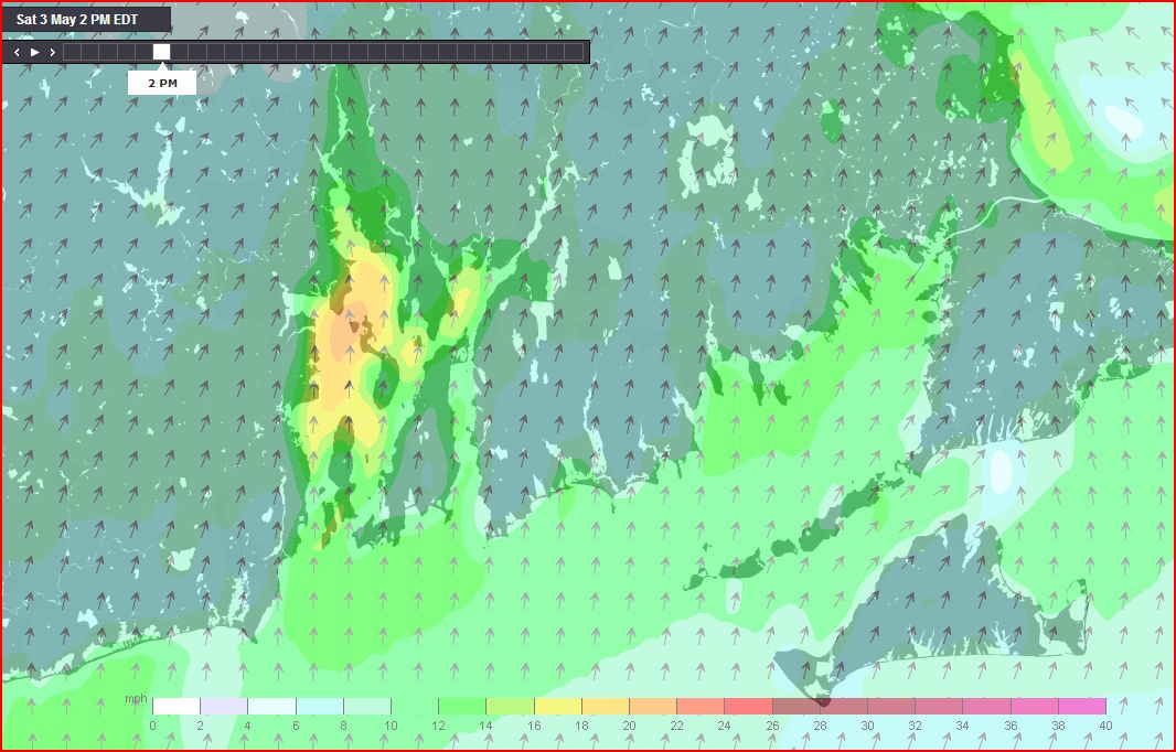
NAM 5km prediction:
Regional snapshot of current winds on satellite.

Sabin Point graph: Note the WRAMS prediction line.

My Forecast from this morning: