by WeatherFlow meteorologist Shea Gibson
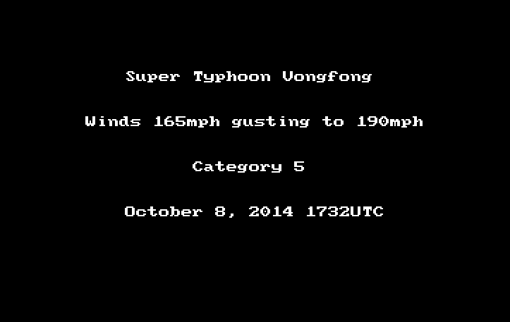
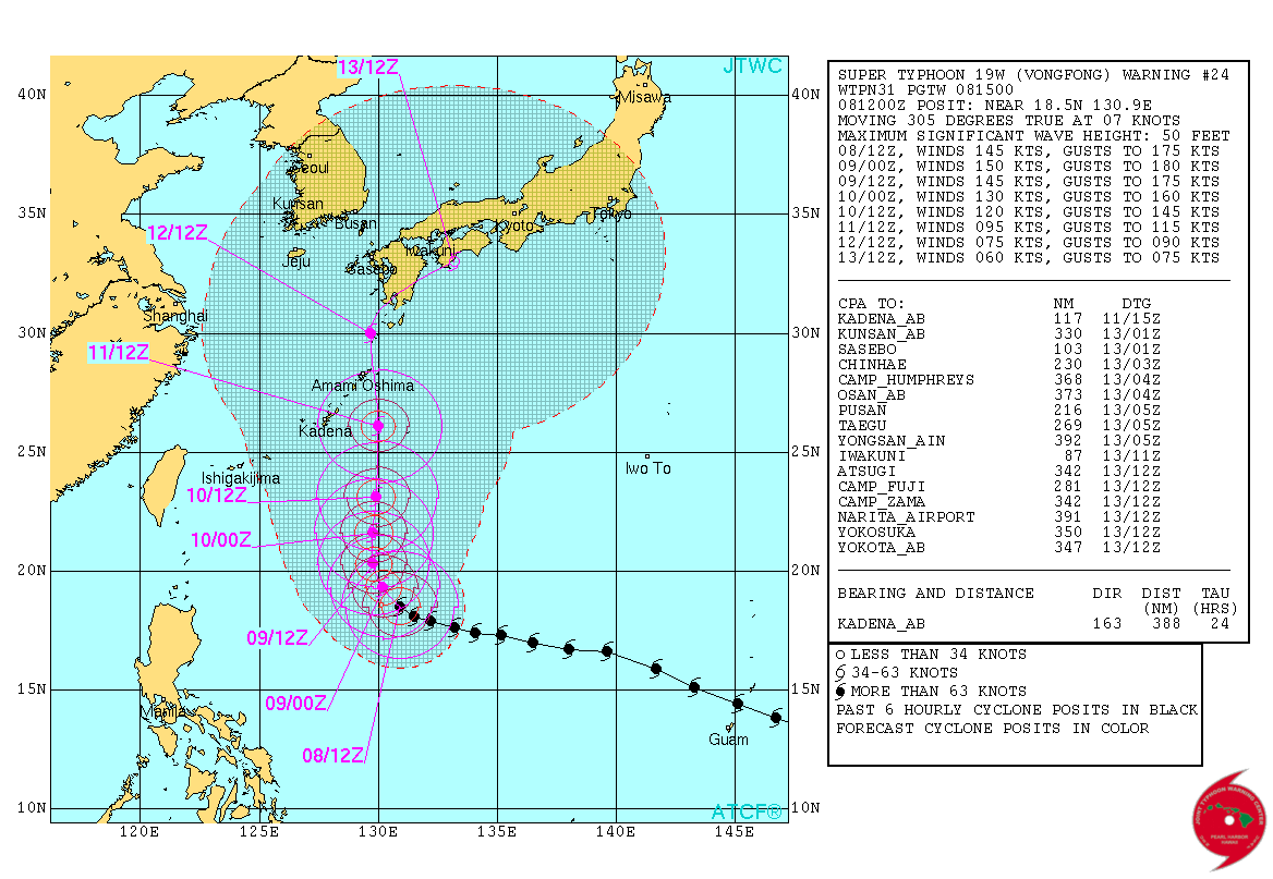
Here is Super Typhoon Vongfong at 165mph winds with gusts to 190mph as of 1500UTC October 8, 2014. Still a Cat 5 from yesterday (October 7, 2014) and pressure still holding 900mb’s. Heading for southern Japan with a projected path to weaken and turn NE. Could this one break the record of Haiyan last year at 895mb’s or pressure and 195mph winds?
Here’s a vid snippet from the NOAA rainbow loop. Very symmetrical in shape. Wave heights are at 50feet.
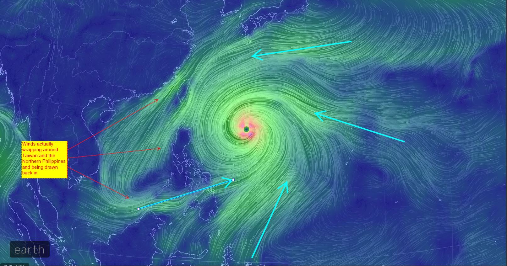
Here is the Nullschool view of winds at the surface – super impressive wind field:
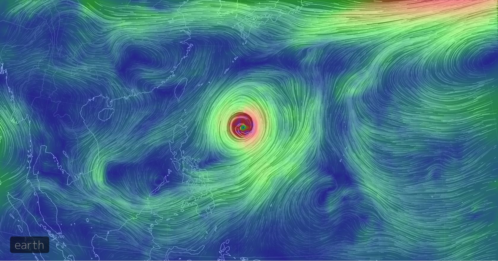
500hpa (~18,000 feet in altitude):
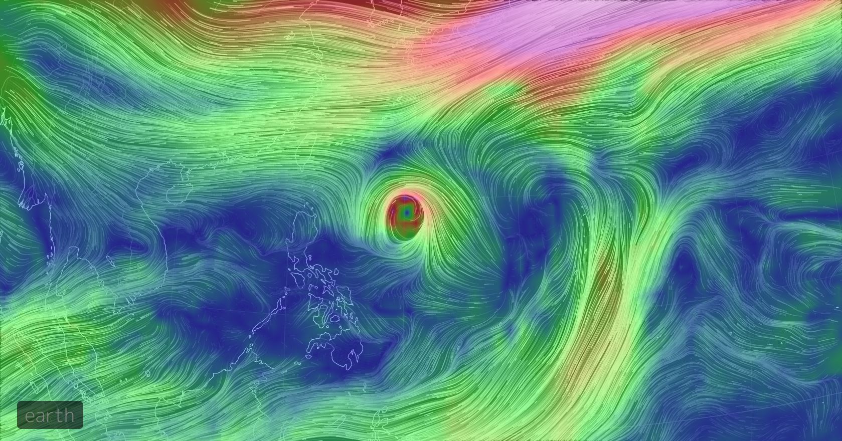
250hpa (~35,000 feet) – you can see how it will be swept towards the east as time goes on by those strong West-to-NE jets. Impressive height and vorticity of the storm!
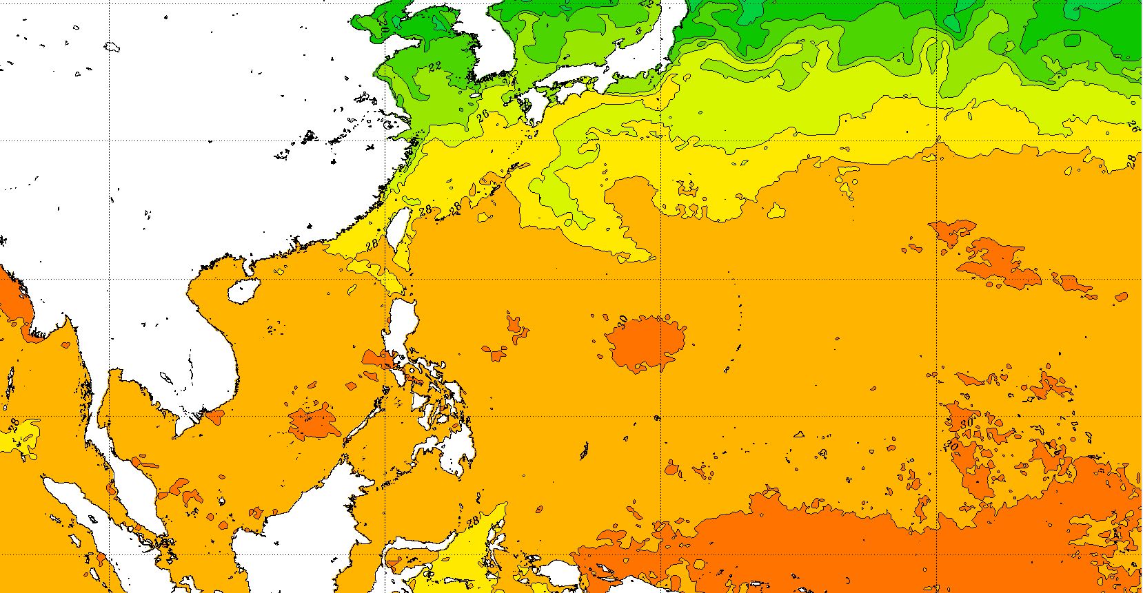
Current Sea Surface Temps for reference… about 82°F – 86°F