The video for today July 10 shows what a major North Pacific High looks like on a typical April and July and September day.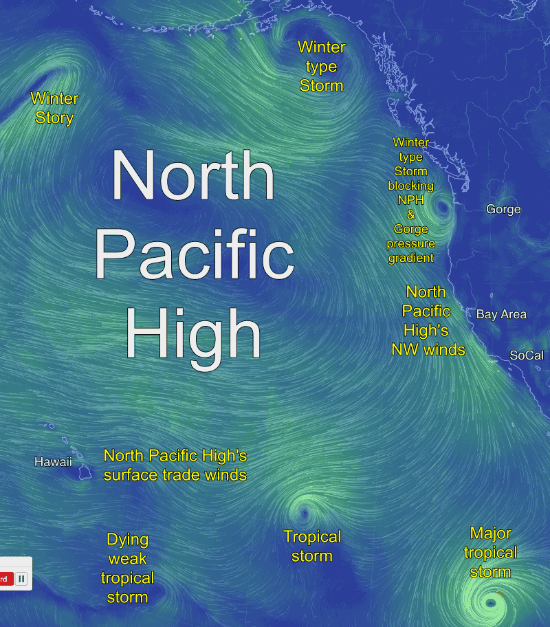
by Mike Godsey, mike AT iwindsurf.com
In April the NPH is often huge and is often interacting with storm systems in the Gulf of Alaska and along the coast of the Pacific Northwest. This tends to kill the Gorge winds and enhance the Southern California and Bay Area winds. As you can see in the video such will be the case today in July.
In July wintry storm are a memory and the NPH anchors west of the Gorge keeping the winds strong and the skies blue. In reality this July day brings showers, clouds and weak winds. Meanwhile in July the NW ocean winds are weakening in for Southern California and the Bay Area as fog and milder thermal winds rule. In reality NW winds will rip the Bay Area to Southern California coast today.
In September the North Pacific High is shrinking fast and has departed the Gorge is heading to the SW while being buffeted by passing tropical storms and hurricanes way to the south. In reality today the NPH is spring time huge but its trade winds are encountering a parade of tropical storms.
After getting paid to forecast the North Pacific High 3X daily for 25 years you get a sense of what is within the normal range of variation. It is increasingly common to see patterns that are not within that range. Today is such an example.