We don’t talk much about hurricanes here in So Cal, until this year that is. Usually we leave all the talk about tropical storms to our forecasters on the eastern seaboard. But this year the Eastern Pacific has been particularly active, producing 14 named tropical systems and we have felt their effects here in the Southland. Today the beaches were once again pounded with high surf churned up by the former Hurricane Norbert. Overhead we’ve had cloudy skies and some showers. All this has combined to produce a lackluster day at the beaches as far as winds go.
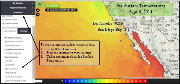
So why so many storms this year? The answer lies in our oceans. The Eastern Pacific ocean water is warmer than usual. Oceanographers aren’t ready to call this a predictor of an El Nino yet, but you may have noticed that you haven’t needed your wet suit as much. Usually our ocean water temperature peaks at around 66 degrees at the beginning of September. Today Los Angeles topped that temperature with a reading of 70.2 F. San Diego had a reading of 76.1 F. These abnormally warm ocean waters extend down into Baja which has been an active breeding ground for these Tropical Storms.
 The good news, for those of you who like high winds and small waves, is that Norbert’s moisture is on the way out. But don’t think its over yet, a new storm is developing down by Acapulco. Kerry Anderson