
by Mike Godsey ikitesurf.com/iwindsurf.com, mikeATiwindsurf.com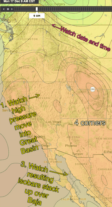
So, as you all know wind, is created by a pressure gradient from high pressure to a low-pressure zone.
Baja is a bit complicated because there is sometimes just a very local pressure gradient between to the inland valleys that makes local very steady thermal winds in the low to weak upper-teens range.
And sometimes there is a much larger pressure gradient between a massive high-pressure area in the USA’s Great Basin and 4 corners zone and low pressure south of Baja. This makes for strong very gusty winds often unreliable near shore
And sometimes we have both pressure gradients which makes for the combo of winds so it is the strongest pattern.
Tuesday, Dec 18, we get that combo pattern of moderate El Norte winds + local thermal wnds. The nagging clouds from the subtropical jet vanish allowing the thermal winds to develop. Then the scenario you see in this animation develops.
To get started check out the date and time as it changes.
First, watch the isobars of the high-pressure west of Northern California as it moves towards the Great Basin.
Second note how the high pressure settles in the Great Basin to 4 corners region.
Third watch how this makes the isobars cram into Baja’s Sea of Cortez. This means a strong pressure gradient from the North to the South so El Norte winds really ramp up. And the long fetch means that we will see building big swell.