by Mike Godsey, mike AT iwindsurf.com
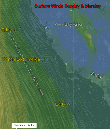
Looking at the top animation of the surface winds from Sunday through Monday it looks like we transition into an unusual wind event for the Bay Area to Southern California regions starting tomorrow.
At first glance if looks like a just a huge surface Golden Gate “eddy” for the Bay Area and a huge surface “Catalina Eddy” for Southern California.
But as you can see in the animation below its cause is much more complex and clearly involves a elongated mid level low just off the California coast.
And this in turn appears to either cause or at least greatly enhance the surface eddies.
But the cause of this mid level low pressure is somewhat mysterious at least to me.
So take a look at the animation below for 6AM July 1.
Especially notice the the wind patterns from the surface to 500mb in the animation.
