The Isla Vista to Ledbetter to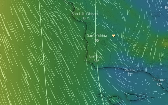 Ventura winds
Rough Draft Part One
You have probably noticed that it is very hard to forecast the winds in the Isla Vista to Ledbetter to Ventura corridor despite the very strong winds that are very close to this area.
This first image shows a common wind pattern. The yellow-green colors show areas of higher pressure. The blue color shows areas of lower pressure. The size of the streaks shows the wind velocity and direction. Notice the strong NW wind of the North Pacific High to the west. But also notice the moderate winds coming over the mountains due north of Santa Barbara. As this wind climbs up the mountains and then descends towards the coast it compresses and heats.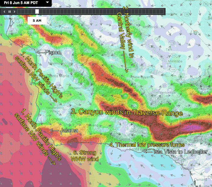
You can see this by comparing the temperature in the image at Coleta compared to nearby location. Warmer air expands creating lower pressure. This makes some of the NW ocean wind curve in towards Santa Barbara creating the Mid Channel Eddy. This eddy acts to block the NW ocean winds from curving into the Vista to Ledbetter to Ventural corridor. If the eddy dies midday then solid winds are likely to reach those sites. If the eddy lingers then there are strong winds just offshore but weak winds at the beaches. The key to when the eddy dies is the time the canyon winds descending from the mountains fade. The earlier they fade the greater the likelihood of solid wind.
The next animation shows the modeled winds for today. Can you see why I am forecasting weak winds for the Vista to Ledbetter to Ventura corridor? More later.