Nagging storm system diverts NW wind.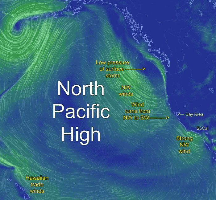
by Mike Godsey, mike AT iwindsurf.com
Recall that we started the California forecast season in February for the first time in the history of our company. We did this because the North Pacific High’s surface NW winds started to hit the California coast earlier than usual
Since we started the forecasts there has been an NW wind drought for the S. F. Bay Area. The following animations show one of the causes of this lack of NW wind.
Today, March 15, 2018, is a good example of the drought. In the first animation notice the clockwise spiraling of wind from the North Pacific High. The NPH spans the waters from Hawaii to the Gulf of Alaska to California. Note the NPH’s Hawaiian trade winds and the strong NW that will curve into Southern California this afternoon.
Also note the strong NW winds several hundred miles west of the Bay Area. Now check out the surface storm just west of the Pacific Northwest. Typically this time of this storm would move off to the east. Then the North Pacific High’s surface NW winds would move to the coast of the Bay Area.
But the pattern we have seen lately is for small storms to linger off far Northern California to the Pacific Northwest. When this happens the North Pacific High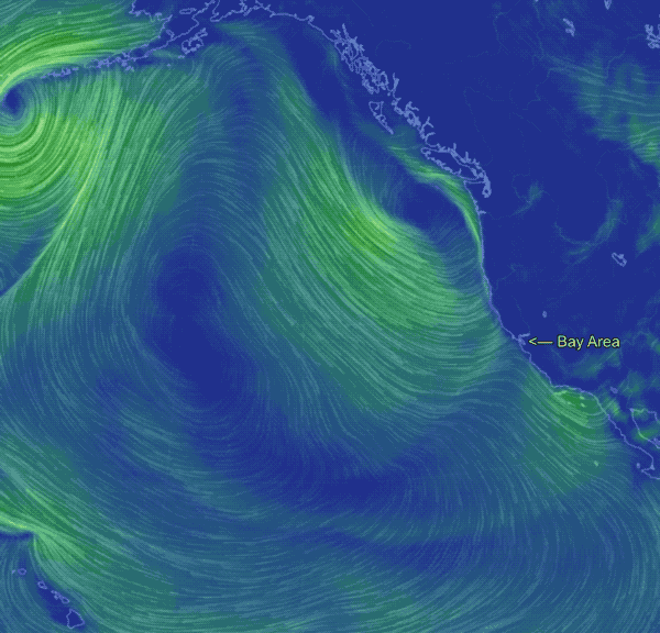 is held further from the coast. And today we can see that the storms low pressure creates a pressure gradient that diverts the NW wind as it nears the Northern California coast so it turns West then WSW then SW. So the Bay Area sees a combo of southerly storm winds and diverted wind from the North Pacific High
So why have the NW winds been so infrequent for the Bay Area? The next animation shows part of the answer.
The first part of the animation shows the NPH and the storm. The second part shows the upper-level winds at ≈ 18,000 ft. The northward excursion of the upper winds is called an upper ridge. This upper ridge steers and supports the NPH. The southward loop in the upper winds over the western USA is known as an upper trough. It supports and steers surface storms. This upper trough has been stalled over the USA for days now. This, in turn, has often kept the NPH and its NW winds south and west of the Bay Area.
2. Southern California in the current pattern.