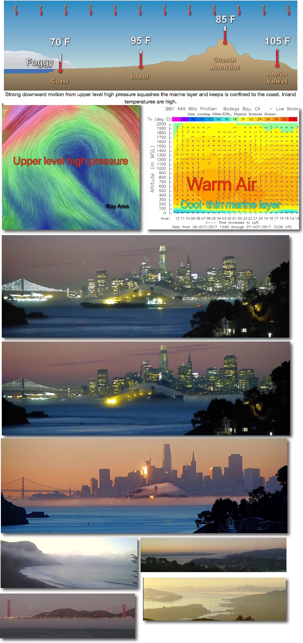
From a scientific perspective the shorter days of fall and the decreasing angle of the sun bring weakening pressure gradients while the North Pacific High moves further from the San Francisco Bay Area coast. This all means weaker winds. This week saw all of that plus an upper ridge of high pressure at ≈ 18,000 ft. moved over the west coast. Upper high pressures create strong downward motion of the air as depicted in the top image. In the second image you can see the winds and distribution of this upper high pressure over the pacific near the Bay Area. In the 3rd. from the Bodega 449 MHz profiler you can see how the high pressure aloft has crushed the marine layer into the sliver of its summer time plumpness.
All this captures the thinning of the marine layer with scientific precision. However the cam images below are better for capturing the beauty.