By WeatherFlow Meteorologist Shea Gibson
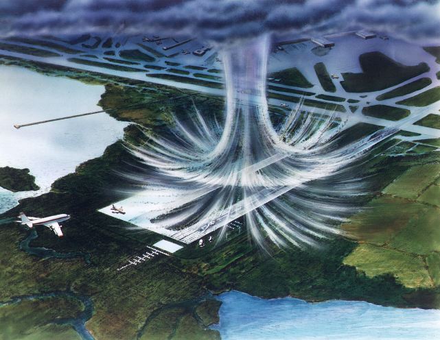
Ever been in a thunderstorm and a sudden burst of strong winds and rain comes down at the same time? This is called a “wet microburst”, which packs quite a punch when it comes to the strong winds associated with them. They can be particularly dangerous for airplanes and can level trees in forest areas. Not to be confused with tornadoes, winds can reach up to 100mph or higher (equal to an EF-1 tornado) as the moisture core of the storm cell drops all at once (due to updraft weakening) and slams to the ground.
By the NOAA definition, a microburst is a localized column of sinking air (downdraft) within a thunderstorm and is usually less than or equal to 2.5 miles in diameter. Microbursts can cause extensive damage at the surface, and in some instances, can be life-threatening. There are two primary types of microbursts: 1) wet microbursts and 2) dry microbursts. Wet microbursts are accompanied by significant precipitation and are common in the Southeast during the summer months. (Anything larger than 2.5 miles in diameter is called a “macroburst“.)

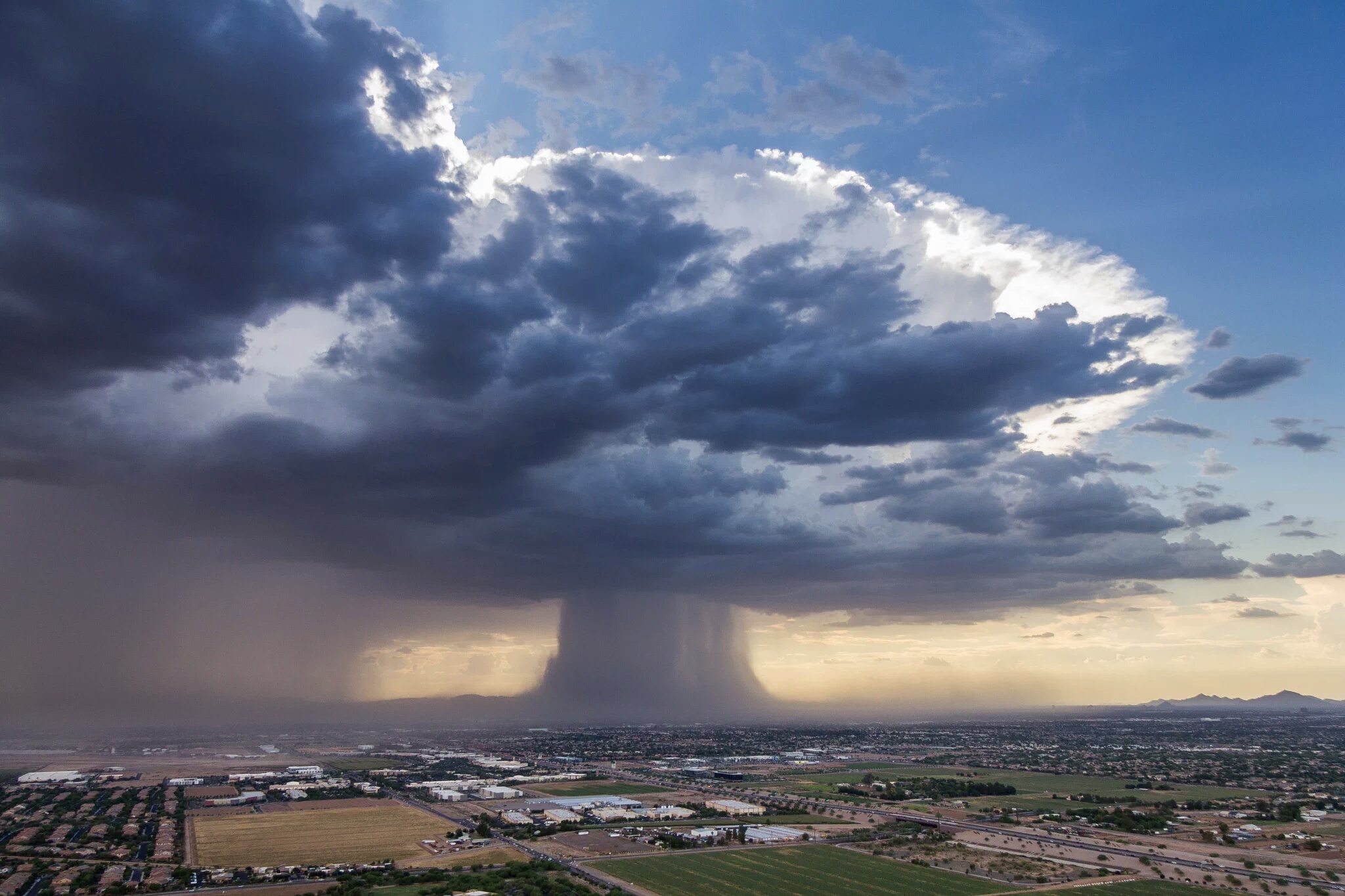
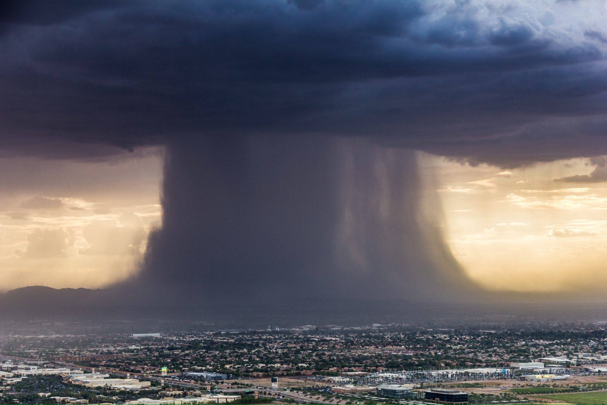
Just recently in Phoenix, AZ on July 18, 2016, an incredible picture was captured of a wet macroburst dropping from a storm cell. It was taken by Bruce Haffner using a drone. He is a television helicopter pilot/reporter in Phoenix, Arizona. Check out their aerial HD videos at http://Chopperguy.com
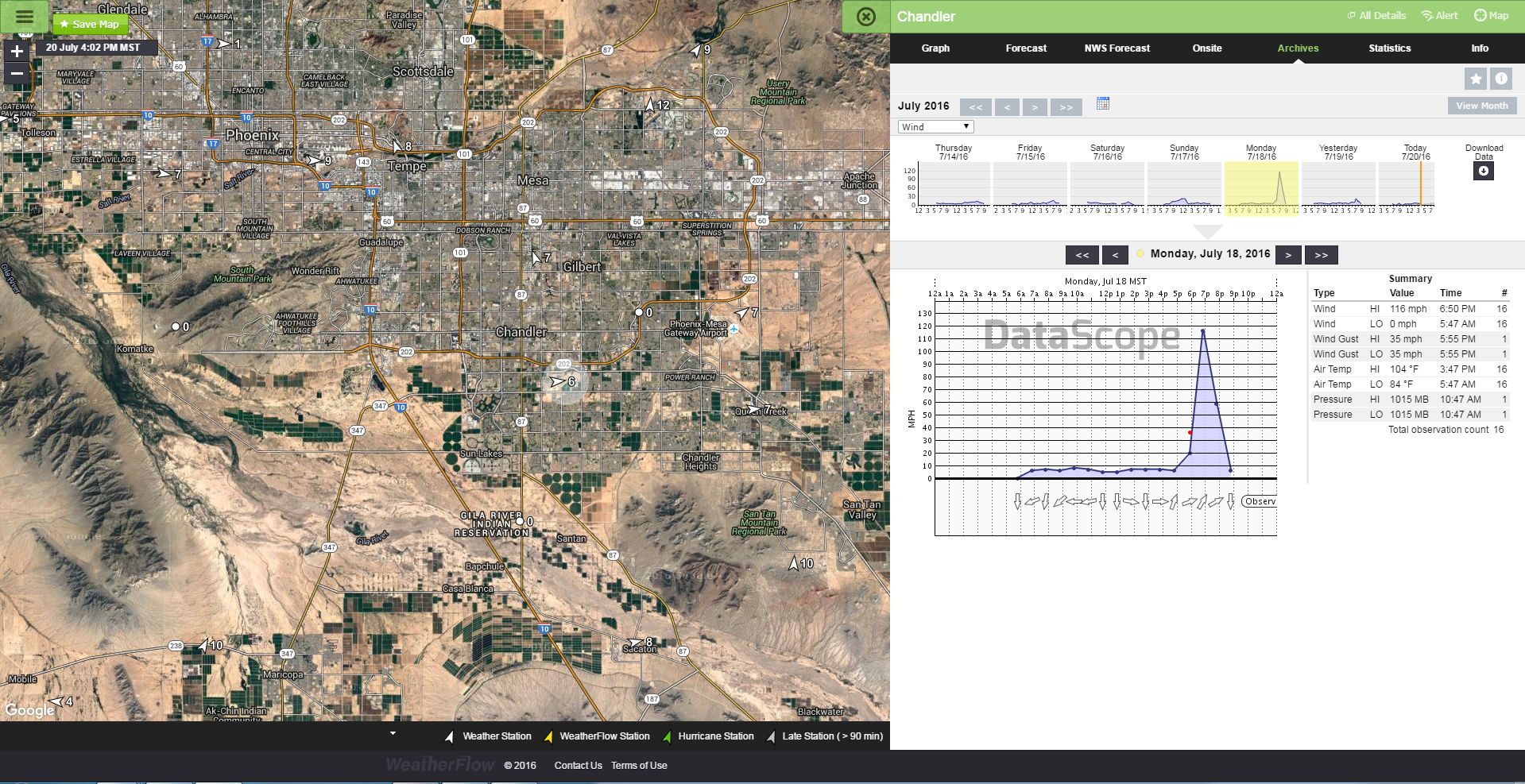
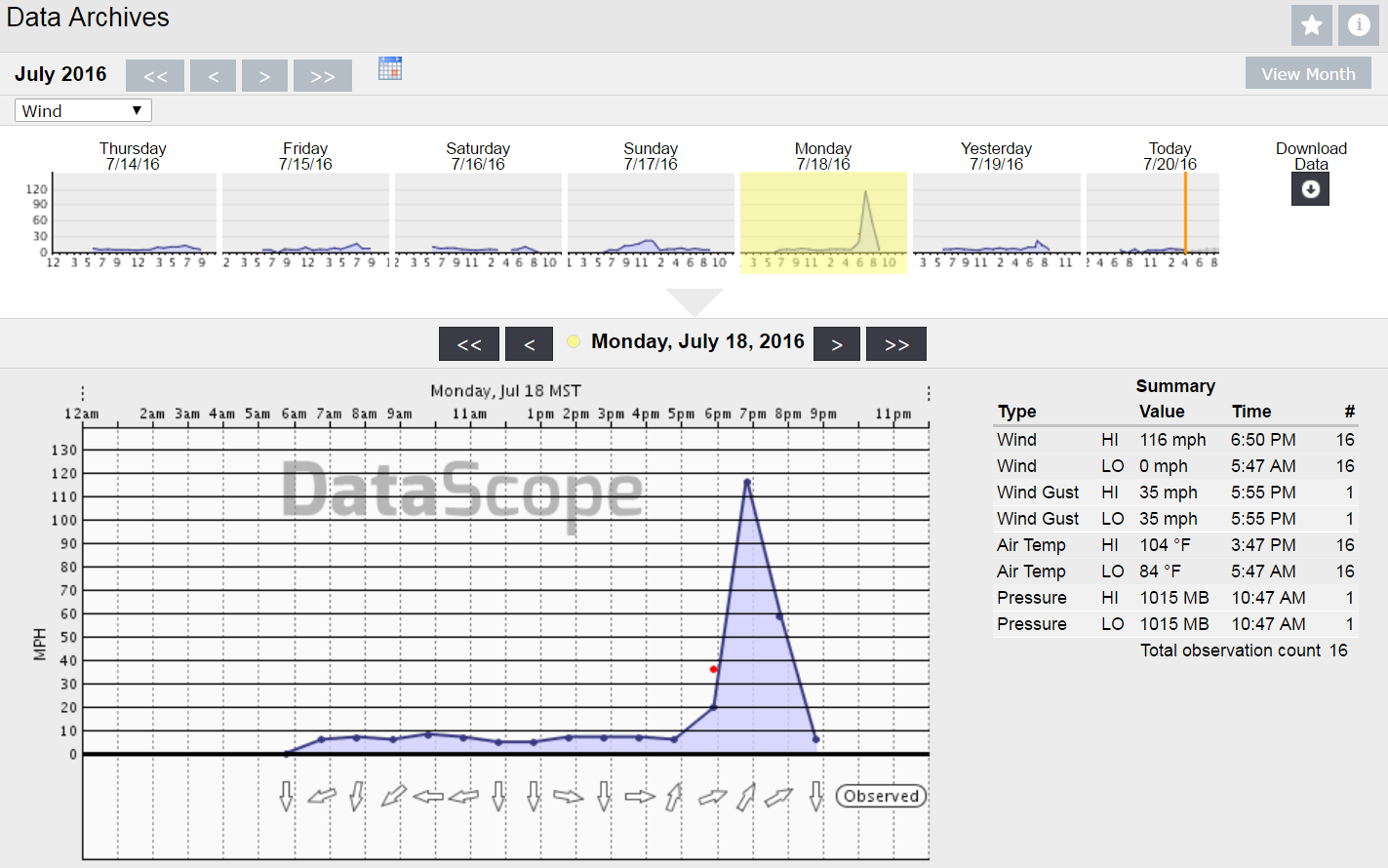
Here is a report we got from the Chandler Airport, AZ (southeast Phoenix) with 116mph winds at 6:50PM.
Stay safe out there.
Cheers!
Shea Gibson
WeatherFlow Meterologist
SE Region/ EC / Tropics
Outreach/ New Station Projects
Twitter: @WeatherFlowCHAS