North Pacific High makes an early move to its summer home. But is should return, briefly……
by Mike Godsey, mike@iwindsurf.com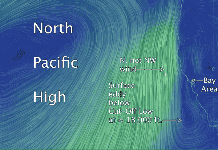
Every spring the North Pacific High slowly moves up the coast from west of Baja ending up west of the Pacific Northwest. Of course it gets bumped southward with most storms or upper troughs passing to the north. But its average location moves up the coast bringing NW wind first to Punta San Carlos on Baja Norte, then Southern California, then the Central California coast, then the S. F. Bay Area. Then by mid June its usual average location is west of the California/Oregon border. And finally is settles down for a while off the Pacific Northwest. Come autumn the North Pacific High begins shrinking and its average location drops southward.
For the Bay Area this means that the coast often has strong NW winds in March through early June. Then the NW winds fade a lot as the focus of the North Pacific High is to the north. So Bodega often dies in the 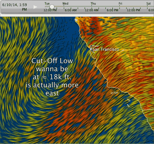 summer and Waddell sees a combo of weak NW winds and local winds generated by warmth inland from Santa Cruz to the Salinas Valley. And in spring and early summer the Peninsula winds are also helped by the NW flow of the North Pacific High.
This late spring the North Pacific High suddenly departed the Bay Area waters and for over 10 days has been parked in its summer location off the Pacific Northwest. This has created NORTH wind along the far Northern California coast. And due to the major points north of the Bay Area like Cape Mendocino this north wind is far from shore much of the time.
In the first video you can see the North Pacific High in this northerly home. Note how this location makes the wind NORTH and far from shore near the Bay Area. These northerly winds often create a tiny eddy just west of the Golden Gate which I have dubbed the Golden Gate Eddy. And for tallest 10 days this eddy has weakened the coast wind and thrown southerly wind at the Bay Area.
Today however the southerly flow is caused by a much larger eddy which you can also see in the first video. Note that this eddy spans the waters for Bodega to Southern California.
This eddy seems to have been triggered by a Cut-Off Low way up at ≈ 18,000 ft. You can see this Cut-Off Low in the 2nd video although its actual location is probably closer to the California coast. 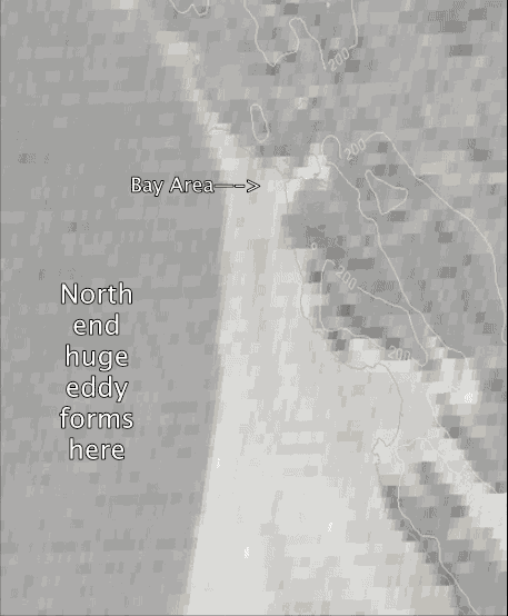
Rarely these Cut-Off Low are able to induce counter-clockwise flow at the surface. This seems to be happening today hence the surface eddy you see in the first video.
This surface eddy in return is causing the marine layer clouds along the coast to curve as they push up the coast. This creates a sort of marine surge like flow. Hence the solid winds forecast for the East Bay and Sherman Island today.
The 3rd video, from predawn to about 10 AM shows the fog sliding up the coast and then forming a loop as it gets caught up in the eddy. The fog stops moving westward once it encounters the strong NORTH winds over the outer waters.
All of this makes forecasting really difficult. When will all the SW wind end? Like I said a week ago it looks like the North Pacific High will rerun to our waters this Thursday. Cross your fingers.