By WeatherFlow meteorologist Shea Gibson. On May 12, the US National Weather Service in Charleston, SC made a Facebook post to see what would happen when outflow boundaries collide. An “outflow boundary” is also known as a “gust front” and is generated from the outflow of air in the downdraft of a thunderstorm that crashes…
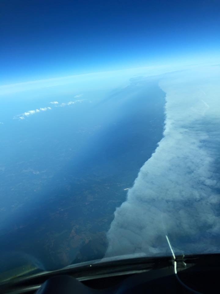
By WeatherFlow meteorologist Shea Gibson. A friend of mine, Mike Maguire, sent me some fascinating pictures of what was believed to be a frontal boundary. He is a pilot and was up at FL380 – or Flight Level 38,000ft at 8:37AM Friday, May 8, 2015. The following 5 photos taken by Mike Maguire. …
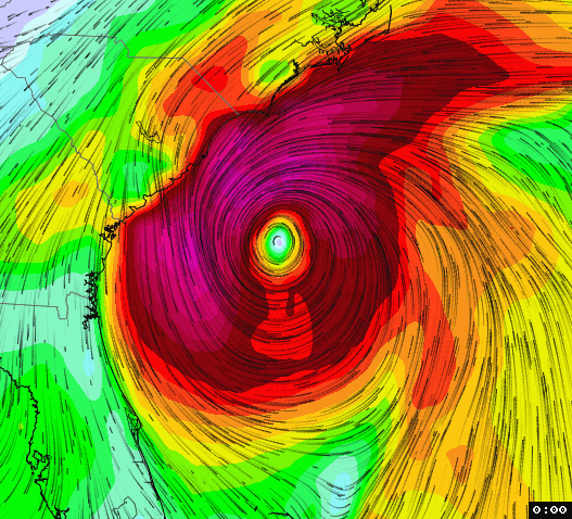
By WeatherFlow meteorologist Shea Gibson. We’re getting warmed up here in the pre-season and lots of sites are discussing possible tropical development with all the model agreement. ECMWF (European), GFS (American) and CMC (Canadian) computer models all continue to have this closed Low developing along the Gulf Stream and deepening off our coast. These are for…
By WeatherFlow meteorologist Shea Gibson. Besides being a great place to visit with more miles of beach than any other state in the US (663 miles to be exact), the title above actually eludes to a stagnant weather pattern that develops during the hotter months along the east coast of Florida. During the spring, the subtropical…
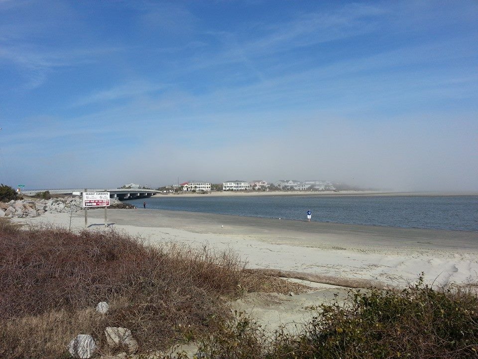
By WeatherFlow meteorologist Shea Gibson. Every spring and fall during the warm surging of Southerly winds, forecasters along the coastal SE Region are plagued with quite a dilemma. It’s called “marine layering”. This presents itself in subtle and not-so-subtle ways – such as a thin haze just over the top of the water …or a visible…
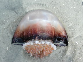
By WeatherFlow meteorologist Shea Gibson. Original article from 5/6/14: https://blog.weatherflow.com/cannonball-jellyfish-signify-the-end-of-marine-layering-along-sc-coast/ Last year, we saw the Cannonball Jellyfish arrive as Sea Surface Temperatures (SST’s) climbed into the 70’s at the beginning of May. This year- they arrived earlier- specifically April 11th/12th along a ENE flow from a nearby surge in the Gulf Stream. Other than being a delicacy…
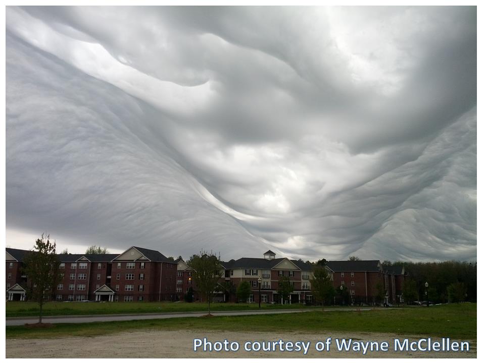
by Weatherflow meteorologist Shea Gibson On March 30, 2015, Mother Nature put on quite a show in the lowlands of SC and GA as a relatively new classification of cloud types called Undulatus asperatus (Latin for “agitated waves”) rippled through the sky – appearing as rolling waves with incredible marbling effects. These are often known to follow in the…
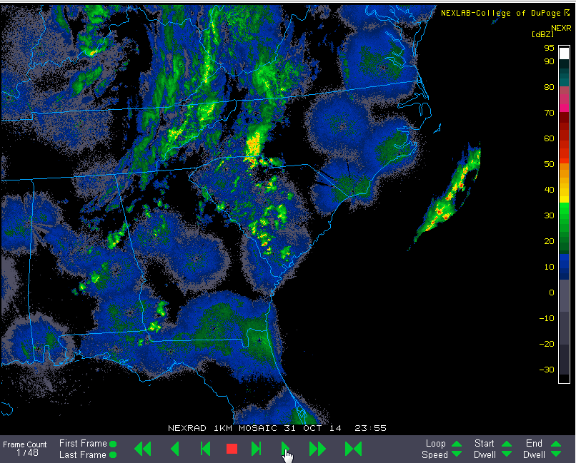
By WeatherFlow meteorologist Shea Gibson. On November 1, 2014, we had quite a unique winter event occur in the SE Region. There have been quite a few anomalies in the weather this year pointing towards a stronger winter pattern in the south, with this event in particular sparking an unusual surge of cold arctic air and wintry precipitation into SC/GA. A cold…
by WeatherFlow meteorologist Shea Gibson. As we enter fall 2014, we are starting to see a colder-than-normal climate set in along the eastern half of the United States. Typically fall brings a mixed bag of cold air and winds with warm air masses still showing overall milder air temperatures as averages; however early snow and…
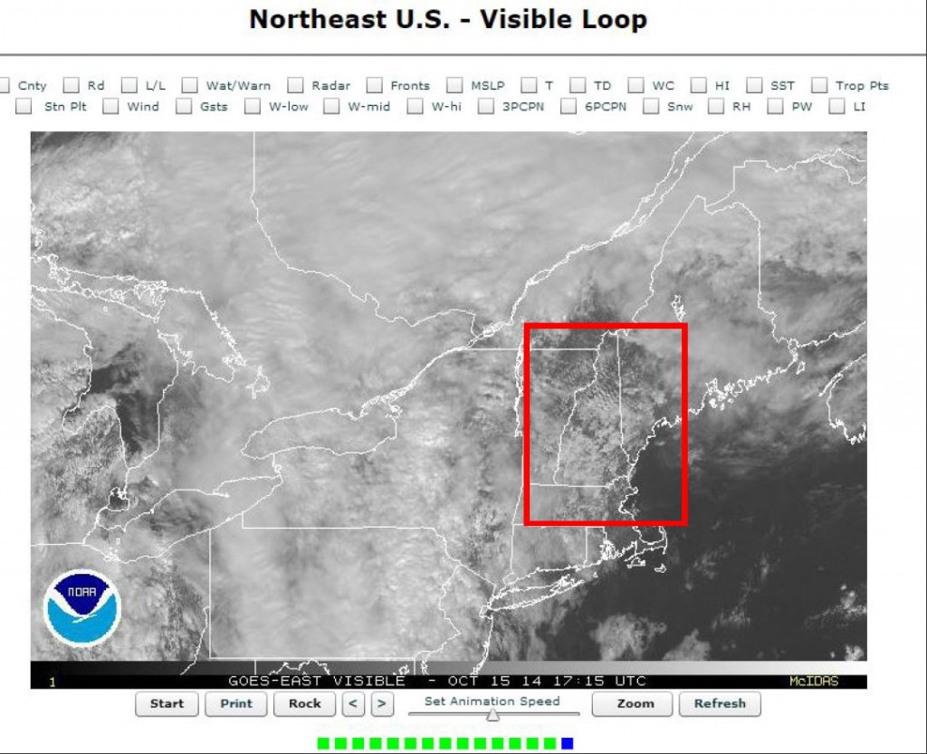
by WeatherFlow meteorologist Shea Gibson. October 15, 2014 proved to be an interesting setup over the central United States and Ohio Valley region. We had a significantly tight dipping of the jet stream from Canada down to Florida and back up – also known as a Rossby Wave. A closed upper level Low was caught…