by Weatherflow Meteorologist Kerry Anderson
The first thing I did this morning was go outside on my deck and check to see if the marine layer was back. I know that is pretty atypical but as a meteorologist I want to check whether my forecast is accurate. My friends know that I don’t always care what the weather is, just that it is what I said it would be.

Yesterday WeatherFlow’s RAMS model, available exclusively via WeatherFlow products like windAlert, was showing the hints of a large Catalina Eddy developing. Well it was right on the money. This morning’s wind observation network shows the the south easterly flow along the east side of the eddy. Because it is so large we don’t have stations far enough out to catch the northwesterly flow on the back side but the computer models clear show the rotating air flow in the California Bight.
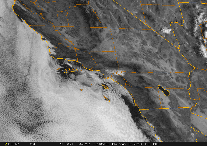
The marine layer depth has grown to 2400 feet allowing the cloud deck to move into the the San Fernando and San Gabriel valleys, which will help to shut down the extreme heat we have been seeing but also, as expected, drop the strength of the afternoon sea breezes.