WEST COAST WIND BLOG: Forecast Decoder, Baja has weak winds today due to a “Col”. Mike Godsey December 30, 2023
WEST COAST WIND BLOG: Forecast Decoder, today battle between Good and Evil (simplified). Mike Godsey December 27, 2023
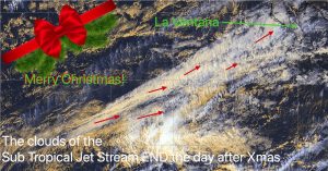
West Coast Wind Blog: Images of past Baja Christmas days. Open your present at the bottom of this page!!! Mike Godsey December 24, 2023
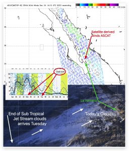
West Coast Wind Blog: The end of the clouds in sight in the satellite imagery! Mike Godsey December 24, 2023
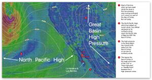
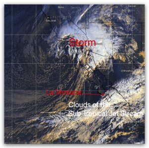
West Coast Wind Blog: Tracking the California storm, Jet Stream clouds and Baja winds Mike Godsey December 21, 2023
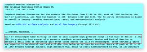
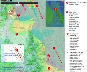
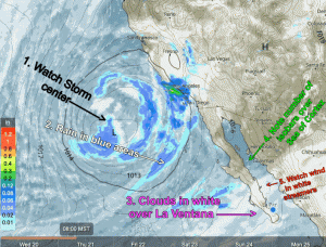
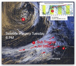
West Coast Wind Blog: Dreaded Sub Tropical Jet Stream pounds the final nail into La Ventana’s wind coffin but makes for beautiful sunrises. Mike Godsey December 20, 2023
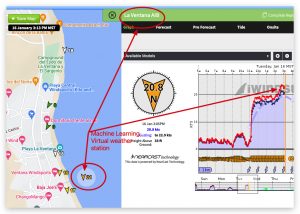
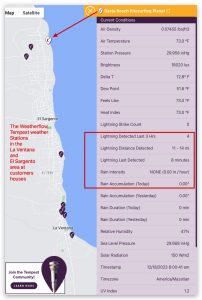
West Coast Wind Blog: Lightening today, The expanding Tempest weather station in La Ventana Mike Godsey December 18, 2023