By WeatherFlow meteorologist Shea Gibson 6/30/2020
Well the Sahara Air Layer sure made the news with quite a dazzle this past month (June 2020), but just know that this is normal to see these giant plumes of dust aloft at the mid levels stretch across the Atlantic basin all the way to parts of the US this time of the year. Btw – it is not called “Godzilla” as many news sources reported. The only nickname we have for it is the ‘ole “Dusty Tongue of the Sahara”.
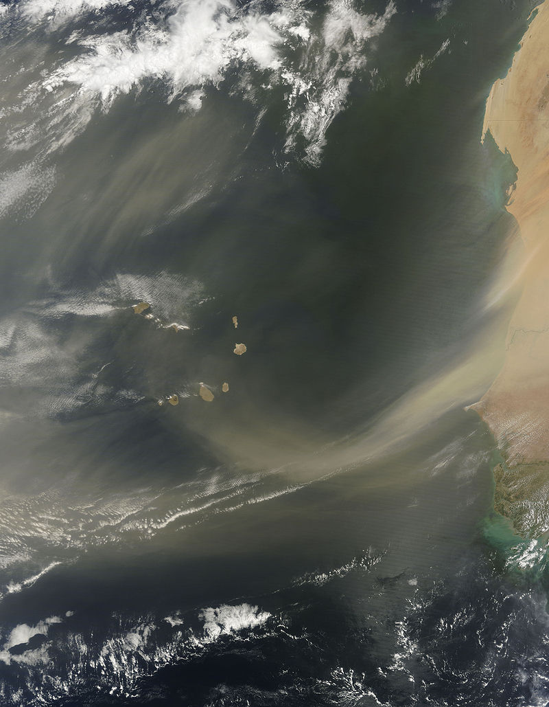
A look at a thick plume coming off the African coast (from 2014 via NASA)…
This is NOT apocalyptic at all as the year 2020 would have you think after all that is going on (COVID19 pandemic, “Murder Hornets” and other items in the press). In fact…
1. This is normal this time of the year as the ITCZ (inter-tropical convergence zone) lifts north and creates stronger jetting over the desert mostly at night to lift the dust.
2. The dust is dry, iron-rich and reflects light,…making the atmosphere along and underneath it relatively stable. This helps to greatly deter tropical cyclone formation. Thus…our friend!
3. Makes for great sunsets where the dust stretches overhead to the west where it is not as thick.
4. The air quality may be affected, but only harmful to us in concentrated amounts where the dust heavily affects air quality and to those who have respiratory issues. Otherwise, it is disbursed rather safely.
Here was the loop from 6/22/2020 showing the plume and its stretch over the Caribbean:
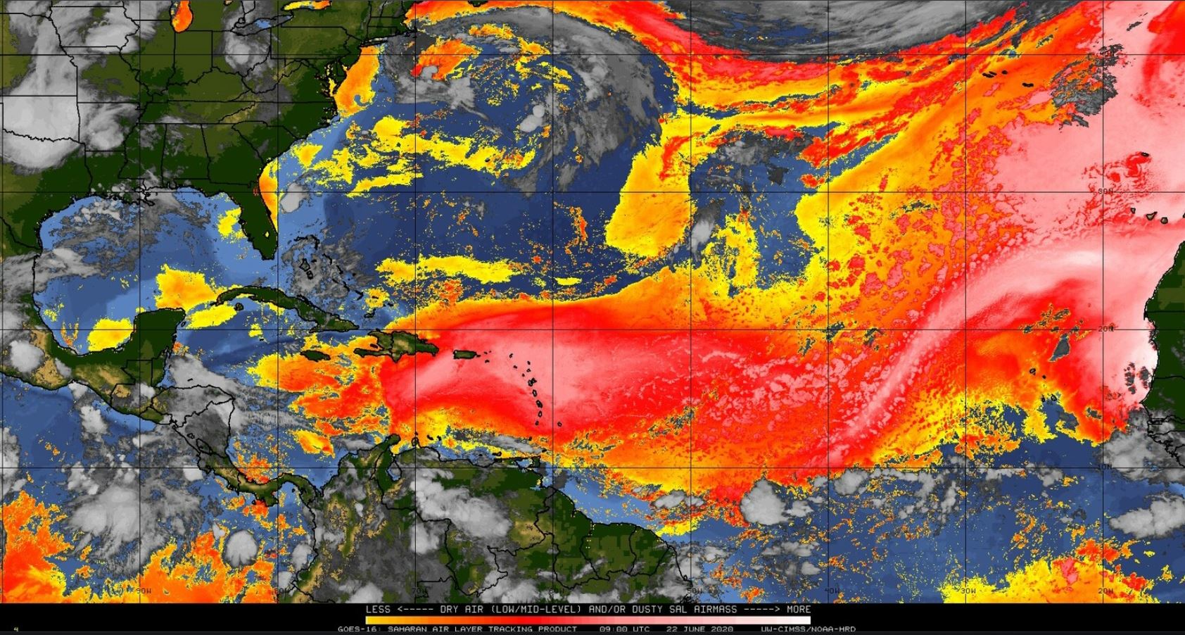
This was one of the thicker ones I can remember as it definitely affected air quality over the Caribbean to Texas and even up into parts of the Carolinas.
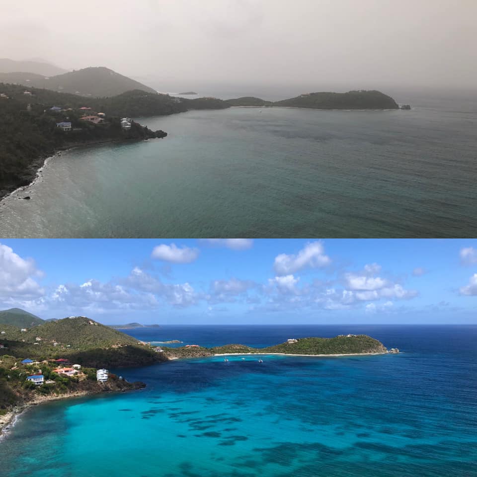
This was taken by “SUP St. John” on June 22…you can see the distinct difference in the air quality!
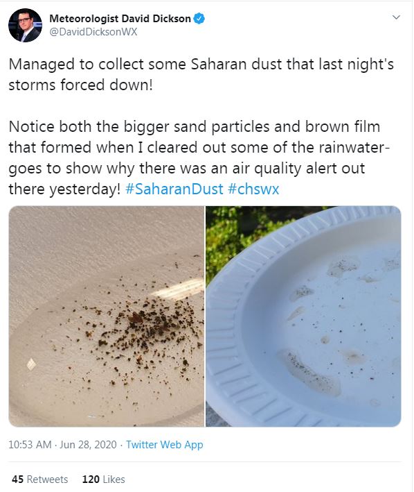
And even here in the SE Region in Charleston, SC where some of it precipitated out of the sky during storms. Some of the Saharan dust was collected from the rain gauge of Meteorologist David Dickson of News 2 in Mt. Pleasant, SC. Incredible! He ended up keeping it in alcohol solution to preserve for showing others.
https://twitter.com/DavidDicksonWX/status/1277253892145889280?s=20
So how can it affect wind at the surface? Great question!
When the layer gets very thick, it inhibits convection and keeps storming down. Along coastal environments where the Sea Breezes occur during these warmer months, speeds tend to be lighter as a result of lack of instability and inland convection. In other words, more stability within and below the layer = weaker winds. Model guidance would likely not show this, so keep that in your hat if you live where Easterly trades exist across the Caribbean, or where S’rly Sea Breezes are affected along the Gulf and Carolina coastlines.
Here is an old blog I did where I explained about and watched its performance through en entire summer (3 parts to this blog). https://blog.weatherflow.com/sal-ty-atlantic-the-saharan-air-layer/
All in all, the SAL is our friend during our tropical season, but when it subsides, tropical waves usually waste no time in trying to aggregate across the MDR (main development region) from Africa and across to the Caribbean. Just know that it thwarts dozens of storms every year. We’ll be keeping an eye on it!
Stay safe and always stay weather aware!
Shea Gibson
WeatherFlow Meteorologist/Wind Forecaster
SE Region / East Coast / Tropics
New Stations Projects & Outreach
Twitter: @WeatherFlowCHAS
Facebook: https://www.facebook.com/WeatherFlowCHAS/