by Mike Godsey, mikeATwindsurf.com
I put out a marine surge alert this morning and at 11:47.
Now at 5 PM it is clear I was right about the marine surge arriviing tomorrow.
In the satellite animation below you can see how fast the southerly marine surge has moved since dawn.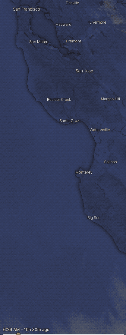
If it continued that march it, and its powerful foggy winds would arrive this afternoon.
But I expect the surge to pause for a while today at Monterey as it curves and fills up the hot Salinas Valley.
Then it should pause again to set up a Monterey Eddy late this afternoon.
Then overnight it will zoom up the coast with a brief pause to fill up the Hwy. 92 gap.
Then it blasts up and through the Golden Gate…. according to my meteorological reasoning.
If I am wrong it will arrive late this afternoon.
Here is my forecast for tomorrow
Fri, Jun 19 2020
The thermal trough over the coast develops into a rea low-pressure area extending from Sacramento to about 50 miles west of the Golden Gate and about 3000 feet vertically in the AM.
This and NNW ocean winds create a large counter-clockwise spinning air mass and southerly coast winds from Big Sur to past Bodega creating an atypical marine surge.
It now appears that this low pressure/eddy never fades which would make for very strong SSW winds in the mid Golden Gate to Larkspur to Brickyards/Peacock Gap to Davis Pt. zone. A bit weaker winds for Shimada Park. Rest of the Bay is largely bypassed.
Bottom Line:
Bodega and Waddell SW/WNW sub-teens. Crissy north tower SSW low to mid 20’s, TI Point Blunt upper-teens to low 20’s. 3rd Ave weak SW. Pt. Isabel upper-teens to 20 and much stronger towards Shimada Park & Berkeley upper teens. Alameda mid-teens. Sherman PM upper-teens to 20 late afternoon.