by Mike Godsey, mikeATiwindsurf.com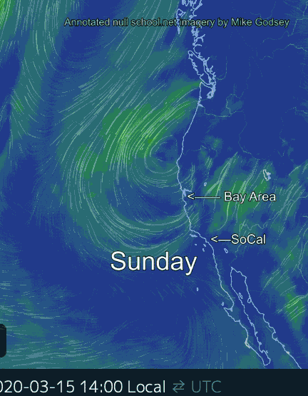
Usually, in March we have NW wind clearing winds after a storm. But this storm will seem like it will go on for days. The low pressure of storm system is normally steered from west to east by the upper-level troughs and ridges at the 500mb level at ≈ 18,000 ft. But today and the next several days we have a Cut-Off Low at ≈ 18,000 ft. that is disconnected from the flow of upper-level winds.
Once this happens the Cut-Off Low wobbles about somewhat unpredictably. And if the Cut-Off Low is supporting a surface storm as it is today then the storm’s rains and winds will continue until the Cut-Off Low opens up into a more normal upper trough and departs eastward. You can see all this happening in this annotated model imagery.