Very tricky forecasting but the Bay Area keeps on blowing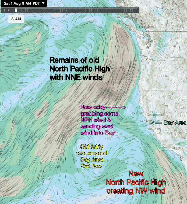
by Mike Godsey, mike@iwindsurf.com
The funny thing about Bay Area wind it that upper teens to low 20’s wind always feels about the same to your kite or sail even when the actual cause of the wind can vary radically from day to day.
Today is the perfect example. Off Cape Mendocino north of Sonoma county there is a 200 mile in diameter counter-clockwise spinning eddy. You can see it in this animation. Watch how how the eddy in this position grabs some of the NE wind from an unusually positioned “old” North Pacific High and steers into the Bay Area as mostly WEST wind. At the same time the “old” eddy that provided us with SW flow this last week also adds some juice to that west wind.
And once inside the Bay some of that west ocean wind shoots straight in through the Golden Gate or San Bruno Gap where it is turned into SW or WNW winds by the relative pull of the Redding, Sacramento and Bakersfield pressure gradients.
So to the average sailor the upper teens to low 20’s forecast seem obvious. But in fact I have to look at the mess of spinning system you see in this animation plus many other variables that the models don’t see to come up with that 7AM forecast.