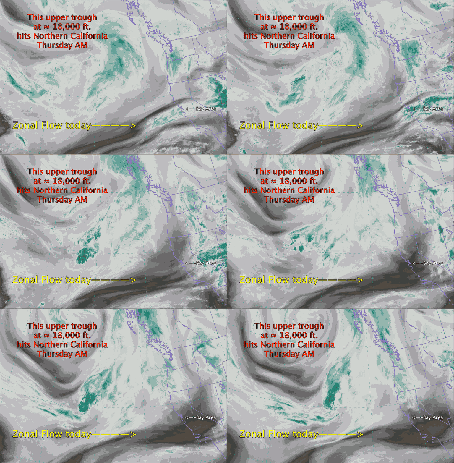
So the endless Northern California NW ocean wind fades and SW flow and marine layer clouds ramp up in the Bay Area and Southern California
by Mike Godsey, mike@iwindsurf.com
In the previous video blog on Zonal Flow we saw why the Bay Area wind pattern and weather has been so stable the last 5 days. There has been nary a trace of “June Gloom” except in the early morning and the NW winds have been roaring down the coast non stop.
But as I have been saying for days this Wednesday night or Thursday morning we see an abrupt change in the wind pattern. Why? Because the current pattern of Zonal Flow has locked the North Pacific High’s surface NW winds along the Northern California coastal But far to the NW near the Gulf of Alaska there is an inbound upper trough at ≈ 18,000 ft. And as the closes on the California coast mid week it will weaken the North Pacific High and bring SW flow and a deeper marine layer to Northern California.
Let’s look at this video taken from a satellite that shows the water vapor and clouds above 10,000 feet. So the cloud movements we see are happening way aloft. These are NOT surface winds.
First find California and then the Bay Area. Notice how the upper level winds are almost directly from the west over the Bay Area. This straight West to East movement of the upper winds is called Zonal Flow. Usually we see an endless succession of inbound upper ridges (northward loops in the upper level winds) and upper troughs (southward loops in the upper level winds). And it is these loops that bring changes in the wind pattern. Hence with the current Zonal Flow the weather has been pretty much the same each day.
But looking at the upper left corner of the video notice the southward extending loop that is slowly chugging southeastward. This upper trough at ≈ 18,000 ft. should arrive off the Northern California coast late Wednesday or early Thursday. Notice that the leading edge of these upper level wind are from an SW direction . This will create SW flow over California and since the atmosphere is thinner within the upper trough the inversion over the Bay Area will rise allowing the marine layer clouds to deepen. And with SW flow these clouds will rush inland. So it all of this happens as I expect you will see stronger winds in the East Bay and Sherman Island with weaker winds along the coast.
And for Southern California this means several days of “June Gloom” and weak coast winds while Isabella blows.
