 Strong
 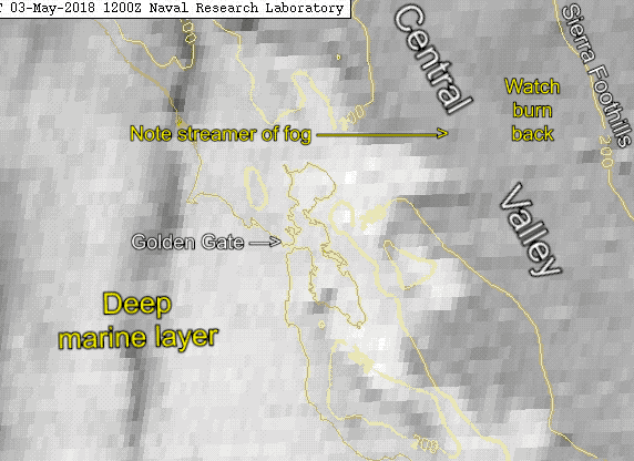 pressure gradient to the Great Basin!
by Mike Godsey
So we all learned in on-the-beach meteorology 101 that the pressure gradient to Sacramento is critical in Sherman Island winds.
Then in advanced beach 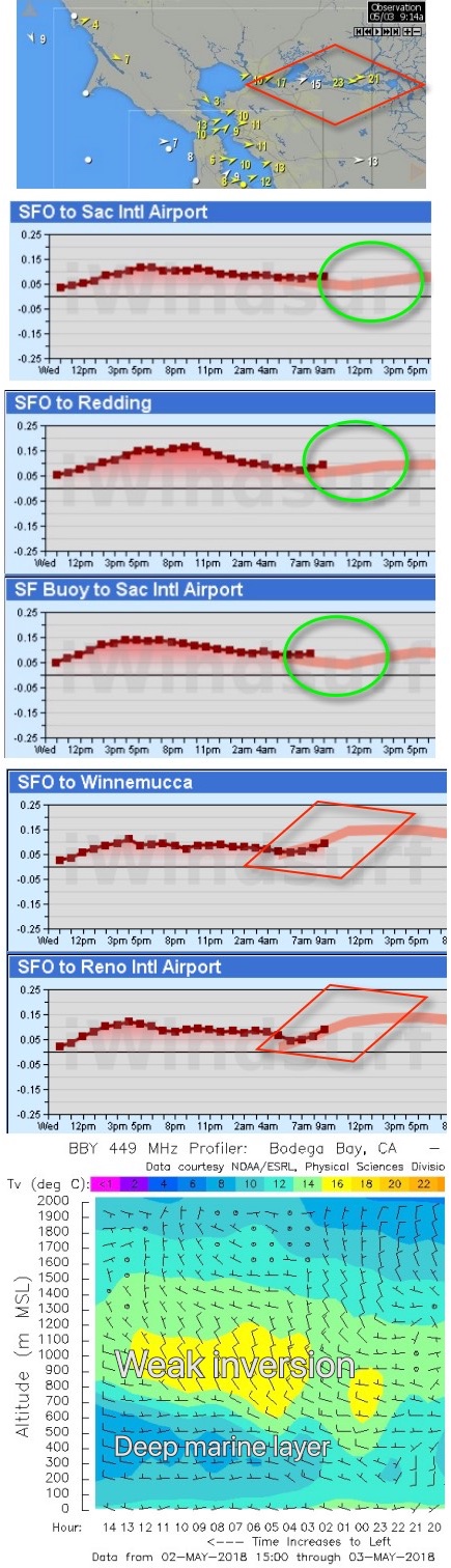 lore you may have heard that the gradient towards Redding is also important in setting up the SW flow that Sherman Island thrives on.
And looking at this satellite animation from 9AM this morning, May 3, you can see the fog burying the greater Bay Area and even streaming over Sacramento and turning northward.
Also, notice the fast burnoff that is just starting. We will come back to that.
In the next image of the Bay Area wind map you can see strong winds blowing from Benicia to Sherman Island.
Also, notice the overall SW wind flow inside the Bay despite the weak West ocean wind at the ocean buoys.
Then check out the pressure gradients from SFO airport to Sacramento. It is actually quite modest at 9:30 AM and the pink line that shows the modeled pressure gradient is also mild.
The same is true of the pressure gradients from SFO-Redding and the gradient from the ocean buoy to SFO. So where is all of this wind coming from?
To get the answer check out the very strong pressure gradient from SFO to Winnemucca in the northern Great Basin and the SFO to Reno gradient on the western edge of the Great Basin.
It is those strong pressure gradients that are shooting the streamer of fog across the Central Valley. Meanwhile, the pressure gradient towards Chico and Redding is producing the turn to the west you see in the fog streamer.
The last image comes from the Bodega Bay 449 Mhz profiler. The blue area you see in the bottom of the image roughly shows the depth of the marine layer.
Notice how it increased overnight. Now notice the lighter color area above the marine layer. This is the inversion layer of warmer air above the marine layer.
In the summer this layer would be much warmer and would try to keep the marine layer clouds intact. Since this is a weak inversion I would expect the clouds to burn back fairly fast today.
That is part of the reason I am forecasting weaker PM winds for Sherman Island and better clearing today at Crissy compared to yesterday. And that means stronger Crissy winds.