 by Mike Godsey, mikeATiwindsurf.com
With low swell already hitting the beaches and UP AND DOWN winds sometimes hitting 18 mph at the campground sensor it is clear that El Norte winds will develop just outside today.
But to get those winds to the beach we need a local pressure gradient to the Los Planes Valley and the valleys near Los Barriles.
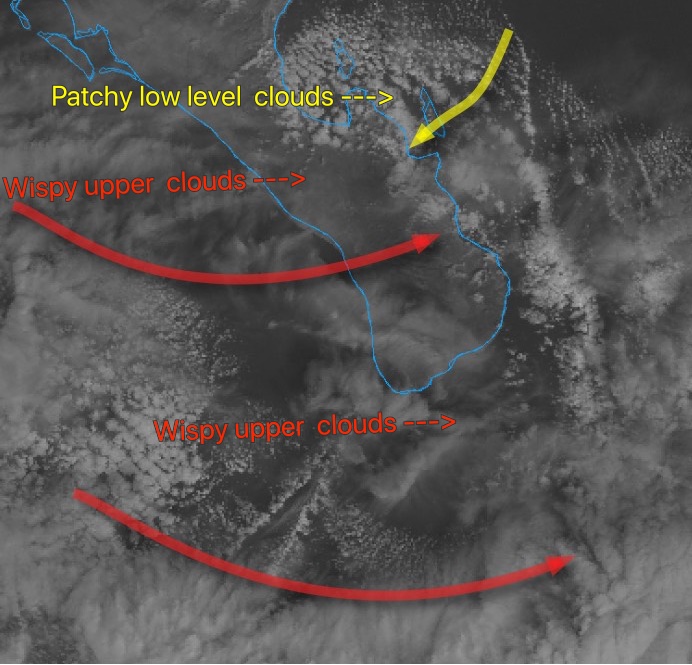
At dawn, there are lots of low-level gray clouds over the region as indicated by the yellow arrows. Notice how those clouds fade away north Isla Cerralvo. So those clouds should not be in an issue. But the wispy upper-level clouds streaming towards us may be an issue if they thicken, We need those clouds to largely dissipate to heat the valleys and product the local pressure gradient.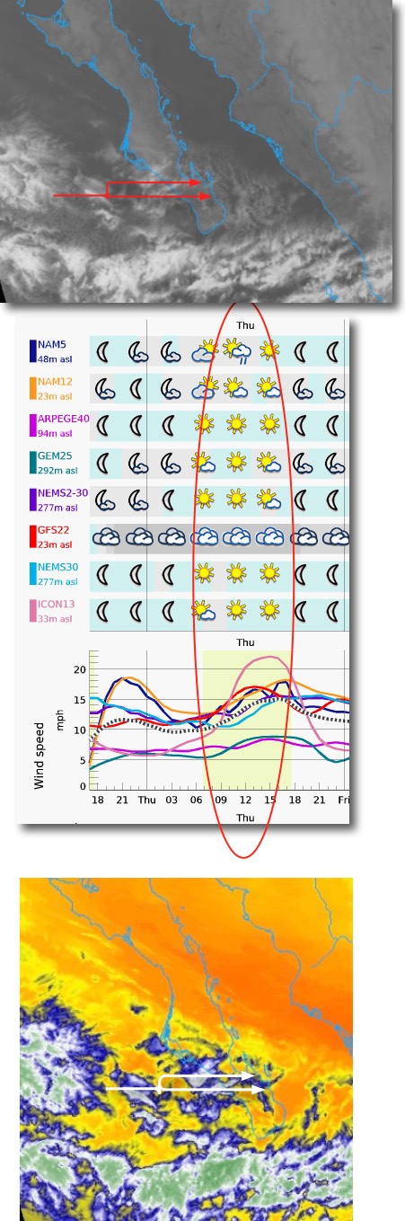
In the 2nd image note how the great mass of the clouds are to our south. That is encouraging. The second image shows that most of the low-resolution models have the clouds mostly clearing. These low-res models are not very useful for forecasting local winds but they are better for large features. So this is also encouraging.
The bottom image shows the low level water vapor. This suggests that clouds could form very easily.
Hence the iffy nature of my forecast.