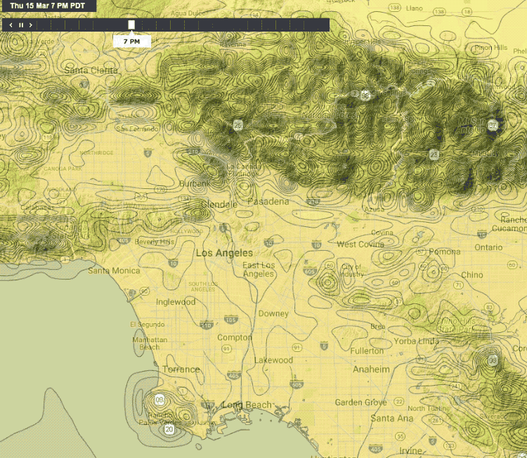
Take a look a the close-up animation I made of the WRF Southern California Isobars.
1. It appears to be far higher than 3km res.
2. Note the exceptionally tight isobars are all over the mountains at all times of the day.
3. The isobars around mountains do not shift as you would expect from night to day
I wonder if all of this is an artifact of how they tweaked the model to account for the importance of local topography in wind flow?
eg. Notice the tight isobars over the Palos Verdes Peninsula upwind of Long Beach.