The North Pacific High returns!
by Mike Godsey, mike@iwindsurf.com
For 8 days my guesstimate on the blogs and extended forecast has been that the EDDY pattern and SW flow that has ruled the Bay Area wind for many days would end tomorrow June 11.
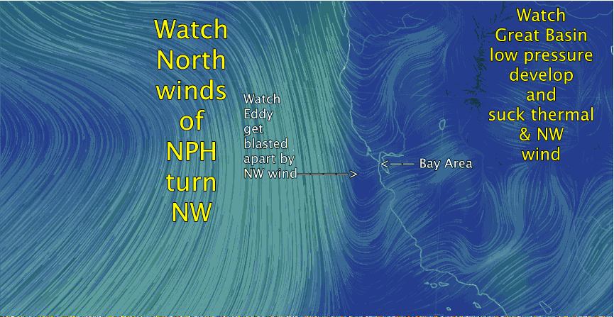
A casual look, (I am on vacation right now), at the most recent model GFS output supports that prediction. This is great news for the coast and Peninsula sailors. But it comes with a bonus. It looks like an upper low pressure passing to the north will create a low pressure in the Great Basin which should jazz up the wind almost everywhere tomorrow.
Of course if I am totally wrong about this I will scraping mud off my face tomorrow when I am back on duty. But with my optimistic nature I will probably be rejoicing about starting a new career in pottery making.
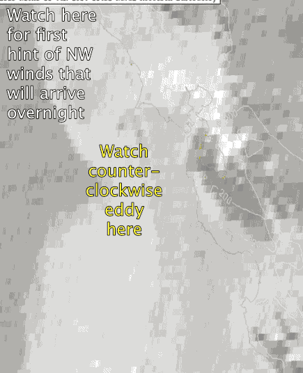
The first video shows the satellite imagery of today’s huge eddy. Look carefully at the upper left corner and you can see the beginning of the NW wind that will blast the eddy apart.
In the second video notice the eddy west of the Bay Area that is making Sherman Island and the East Bay rock today, Wednesday June 10. Then watch as the eddy is blasted apart tomorrow as NW wind roars down the coast. Then notice how the NW wind is sucked into the Bay and then to the Great Basin.