Anatomy of lee-side trough/piedmont trough, convergence zone and fairly solid regional Sea Breeze all put together.
By Shea Gibson
…by WeatherFlow meteorologist Shea Gibson 6-6-14
Ingredients for a near-perfect Sea Breeze in the Southeast.
June 3 – June 5 we saw a moderate Sea Breeze build all along the SE coast, with June 4 being very consistent all day and into the night, where nocturnal jetting kept the higher numbers through Thursday AM.
Two High pressures involved here- one over the northeastern Gulf and one off the SE Coast – not quite the robust Bermuda High setup, but it worked. Seems the Gulf High dominated the westerly zonal flow inland to the coast at night and into the morning hours, and the Atlantic High dominated during the day along the coast to allow SW Sea Breeze frontal development to push westward and undercut the zonal flow aloft. The resulting pressure gradient increased synoptic scale Southerly winds by several knots during Sea Breeze enhancements.
The day started out normal for most locales, with land breezing W/WNW’erly flow backed by northeastern Gulf High showing until the Sea Breeze front pushed in along the coast, backing winds from the S/SSE to GA, SSW/SW to SC and SW to SENC.
Firstly, let’s take a peek at the larger picture…

Looking upstate, here shown in the picture is some low level blanketing where stable moist air associated with lee-side troughing was residing. This was taken in Seneca, upstate SC by pilot Dan Schmiedt.


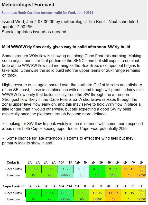
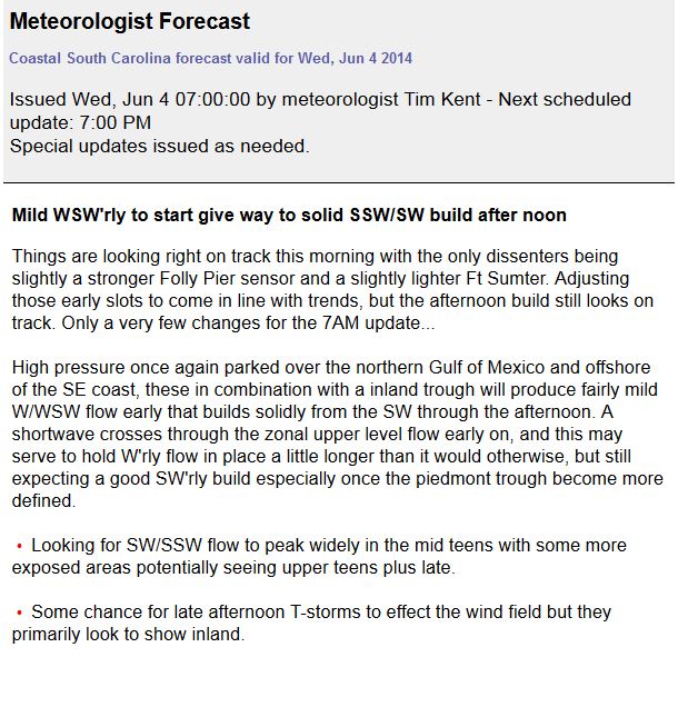
Now let’s take look at Tim Kent’s well constructed forecast for all 3 zones from north to south:
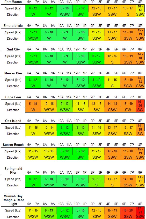
SOUTHEAST NC
SOUTH CAROLINA:
GEORGIA:

Next we have the Sea Breeze front location at Charleston, SC at 12:25pm as a prime example how the Land Breeze meets the Sea Breeze.

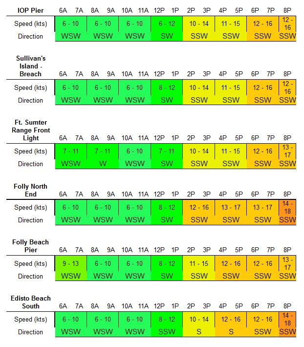
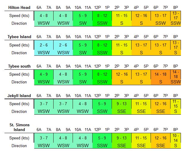
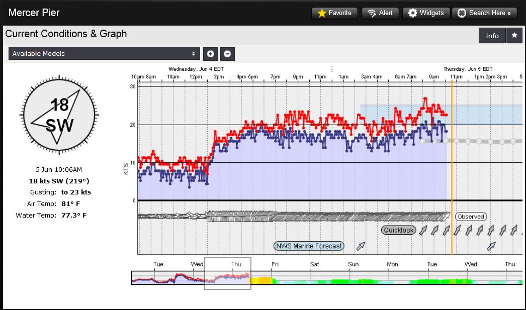
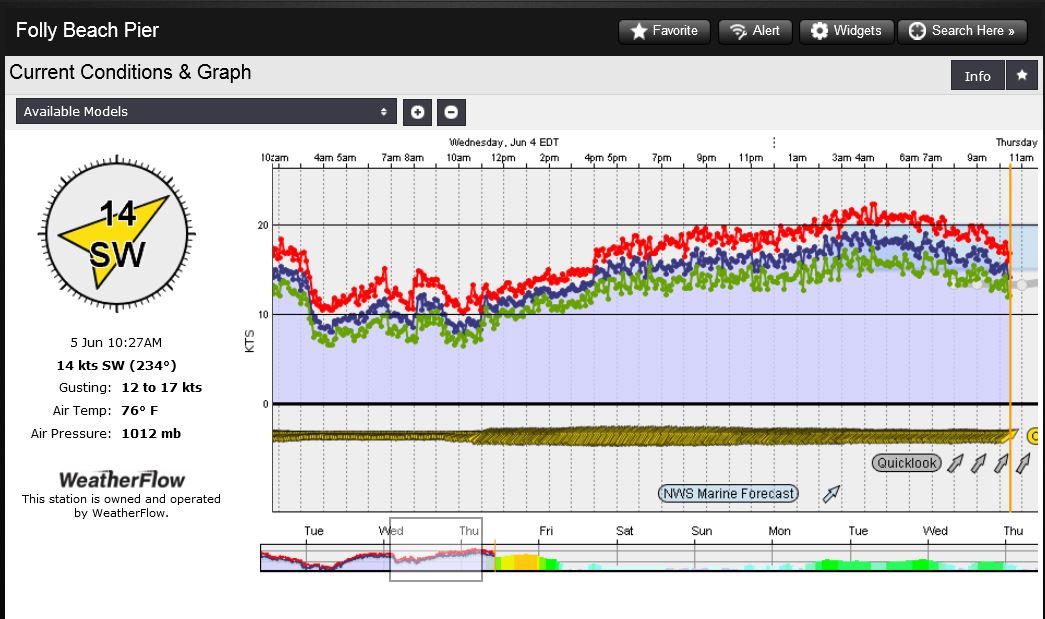
Here are the graphs for all three zones to show what occurred as the day progressed:
SENC middle zone at Mercer Pier – notice the nocturnal surge held through the night.
SC Folly Beach Pier – again the nocturnal jet holds, but builds between 2-6am
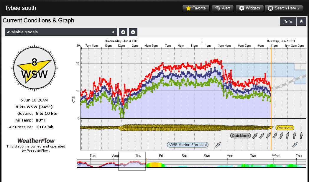
GA Tybee South Sensor – later arrival of winds with increasing nocturnal jet, which falls off at 3:00am as winds go WSW
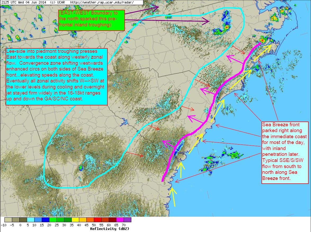
Ok now let’s take a look at the Convergence Zone and regional radar for the day to show the pattern. Lots of typical moisture scatter, but you can see the general flow (had to keep this below 5mb in size, but earlier outputs had solid westerly flow from mid AM–>PM). Lee-side cool moist air spilled down into the upstate off the Appalachians and into the midlands overnight and into the morning hours, where it was ingested by piedmont troughing pressing East towards the coast along a westerly zonal flow from the northeast GoMex High pressure. The afternoon Convergence Zone (with visible outflow boundaries) pushing westwards ahead of Sea Breeze front enhanced circulations on both sides …elevating speeds along the coast with a healthy return flow. Eventually all zonal activity shifts from W over to SW during cooling into the evening… with the overnight jet remaining firm widely in the 14-18kt ranges up and down the GA/SC/NC coast ,with GA being to the only area where it fell off.
Regional Radar Loop – outflow boundary shows up along SENC and southern SC/northern GA:
And here is the mock-up of what was going on on that radar during inland penetration of Sea Breeze front and the outflow boundary: