Wind Recipe: Note: Good chance late afternoon fog shuts down Crissy. 1- Weak elongated counter-clockwise eddy and its southerly coast winds expanded overnight less than expected, with southerly coast winds from Pismo to near Pt. Area. 2- The eddy spins all day as it gains southerly support from a low-pressure that extends up to ≈…
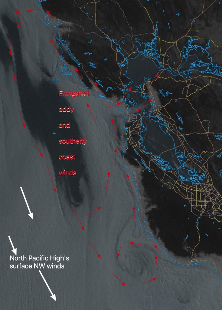
A massive eddy off San Francisco to Jalama divert the North Pacific High’s surface NW winds away from the Central California coast all day. However, these eddy winds help the Lopez and maybe Isabella winds. The eddy you see from north of San Francisco eddy to past Jalama diverts the North Pacific High’s surface NW…
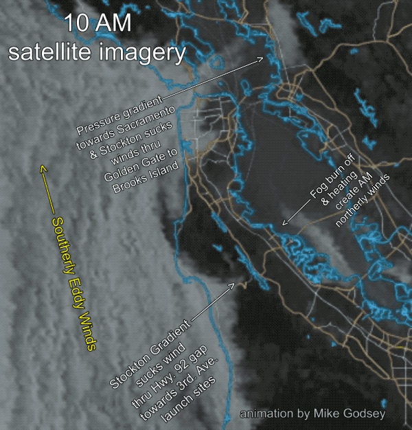
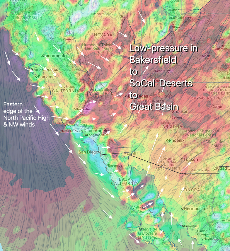
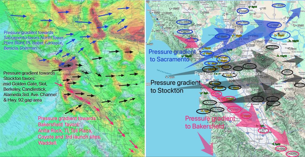
Forecast Jargon Decoder Big Eddy delivers low/mid 20’s Anita Rock to Slot to Brooks Is. to Larkspur/Clark’s & bit lesser Tigers, Benicia to Sherman. 1- Overnight, the NPH shoved a huge ridge into far Northern California and the Pacific Northwest causing low-pressure to develop from Stockton to Pt. Arena. 2- The satellite imagery shows this…
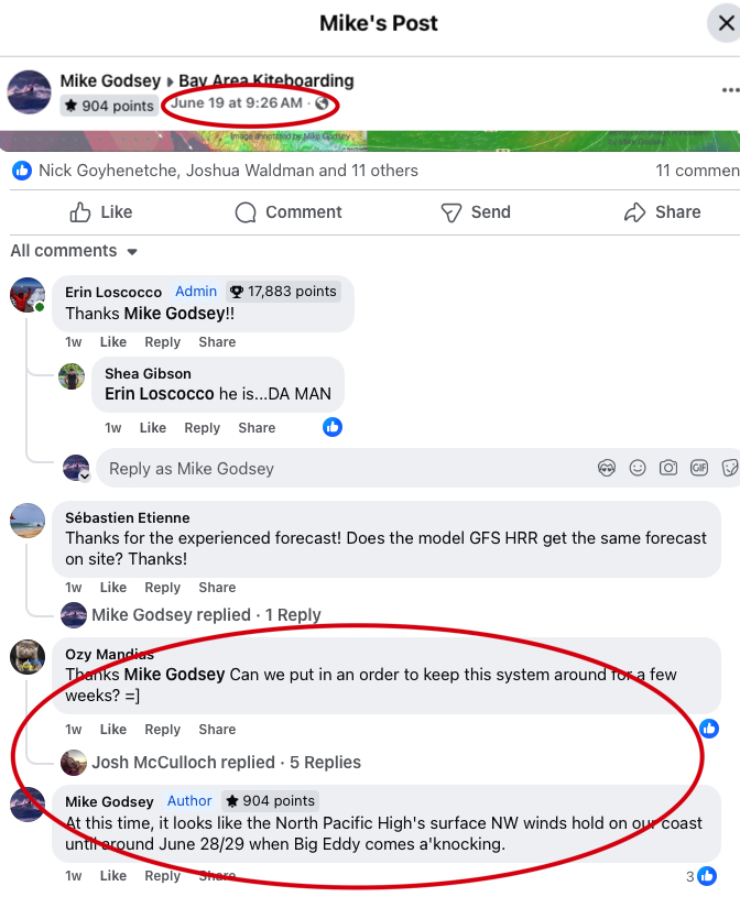
Way back in June 19, during a very strong NW wind pattern, I was asked on Facebook how long the NW ocean winds would last. Here is my Facebook reply: Now, over a week later here is my forecast for June 28. It is not polite to brag. But sometimes you just can’t resist in…
June 20 & 21 the Bay Area saw a significant high-wind event, marked by a notable absence of the typical June Gloom marine layer clouds and ferocious surface gusts exceeding 50 knots. These winds had the clear signature of an exceptionally powerful and unusually low-altitude California Coastal Low-Level Jet (CLLJ). The powerhouse behind any wind…
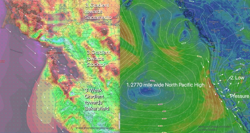
Very EARLY GUSTY low to mid 20’+ ENTIRE coast & Bay mid-Golden Gate south past 3rd. Ave. + Sherman, Rod & Gun. Bit weaker in Benicia and Alameda. 1- Beefy 2770 mile wide North Pacific High compacts isobars along West Coast from Pistol River to Baja so northerly ocean winds roar!2- This wind is accelerated…
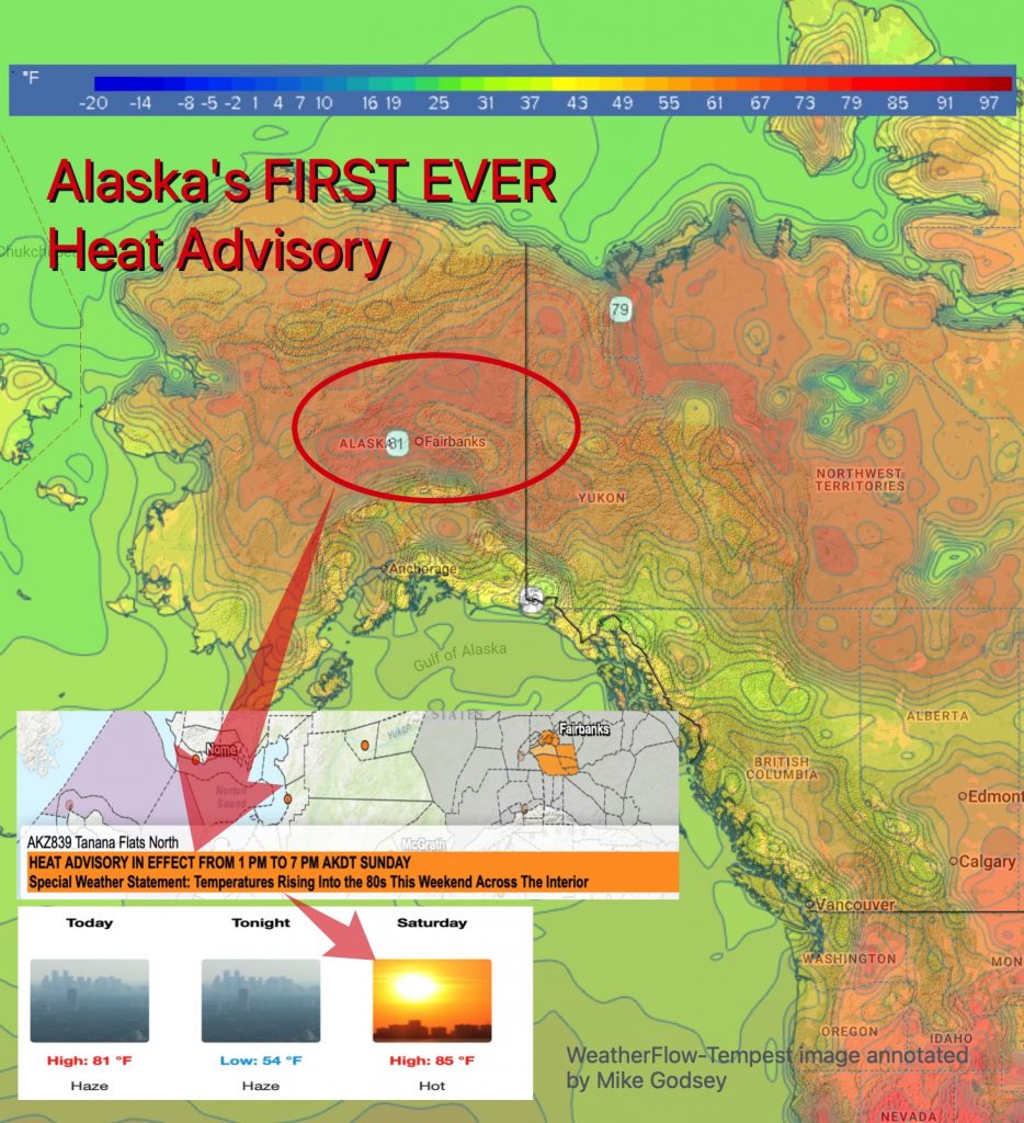
In response to significant long-term climatic shifts, the National Weather Service (NWS) has updated its public notification protocols for temperature hazards in Alaska. Climatological data reveal that Alaska is experiencing anomalous warming at a rate approximately double that of the contiguous 48 states, with a recorded increase in the statewide average annual air temperature of…
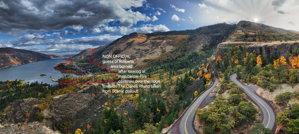
One of the most beautiful, accessible, and photographed places in the Gorge is the Rowena area. This area also has two popular Gorge launch sites, Doug’s Beach and Rowena. The last week has seen non-stop powerful winds in most of the Gorge. Meanwhile, lingering high-pressure has dropped the humidity and crushed the marine layer clouds….
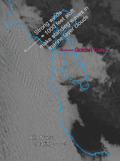
Now at 11:30 AM: Very good Año Nuevo clearing so Waddell south is building nicely. Standing waves in marine layer clouds confirm strong winds just aloft so keep eye on Ocean Beach, Pt. Isabel and 3rd. Ave. launch site winds. From 7:30 AM:Wind Recipe Thursday: 1-Gonnabe a complex day as various forces battle, so be ready…
Yesterday the North Pacific High’s surface NW ocean winds were exceptionally weak yet my forecast was for strong upper-teens to low 20’s winds for almost every water location in the San Francisco Bay Area. There are 2 keys to Bay Area summer winds. The first is the many gaps in the Coast Range and East…