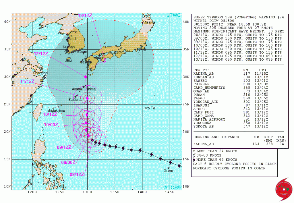
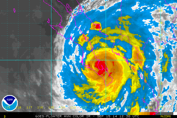
by WeatherFlow meteorologist Shea Gibson Here is Super Typhoon Vongfong at 165mph winds with gusts to 190mph as of 1500UTC October 8, 2014. Still a Cat 5 from yesterday (October 7, 2014) and pressure still holding 900mb’s. Heading for southern Japan with a projected path to weaken and turn NE. Could this one break the…
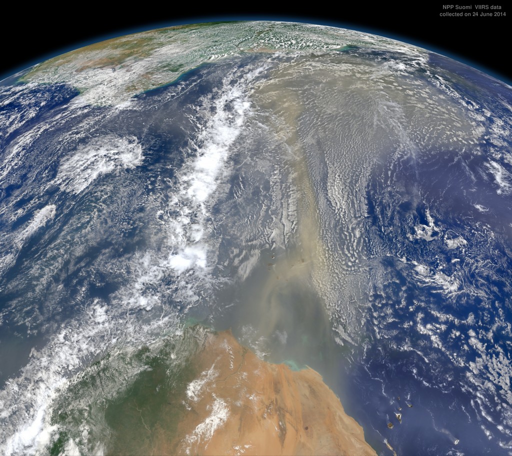
by WeatherFlow meteorologist Shea Gibson. As a quick recap, The Intertropical Convergence Zone where tropical storms form, or the “ITCZ”, is heavily impacted by the Saharan Air Layer (or “SAL”), which is a dust layer off the western African coast along the lower and mid levels of the atmosphere. This dry, dusty more stable air rides just over the…
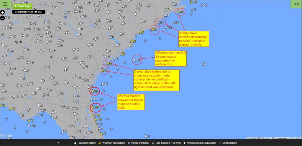
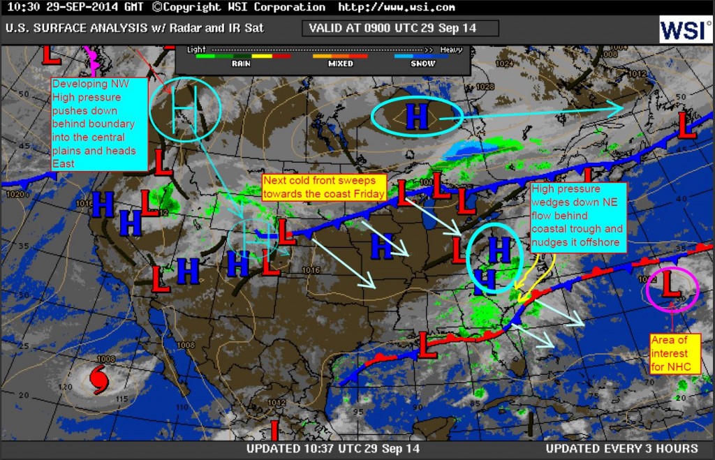
…by WeatherFlow meteorologist Shea Gibson. This is a follow up from the Blog done on 9/29/14 questioning the possible arrival: https://blog.weatherflow.com/post-summer-frontal-approach-to-the-se-region-first-marine-layering-event/ Friday, October 3 we had an approaching strong cold front from the west. Most everything lined up very similar to last year’s November 1, 2013 frontal approach; however, it appears that this year started earlier with…
by WeatherFlow meteorologist Shea Gibson Last year we saw our first recorded marine layering event during the summer-to-fall transition as water temps started to cool, which kept winds down along the immediate beaches 5-10kts lower than what computer models were mostly in agreement with. 16-20kt predictions turned out to be 10-14kts with many UP’s and…
By WeatherFlow meteorologist Shea Gibson Hurricane Odile made land fall just over Cabo San Lucas as a Category 3 Hurricane at 9:45PM PDT, making it the strongest one to ever hit the Baja peninsula with winds packing 125mph and rains expected 6-12 inches or more. This is very recently after Category 3 Hurricane Norbert took a…
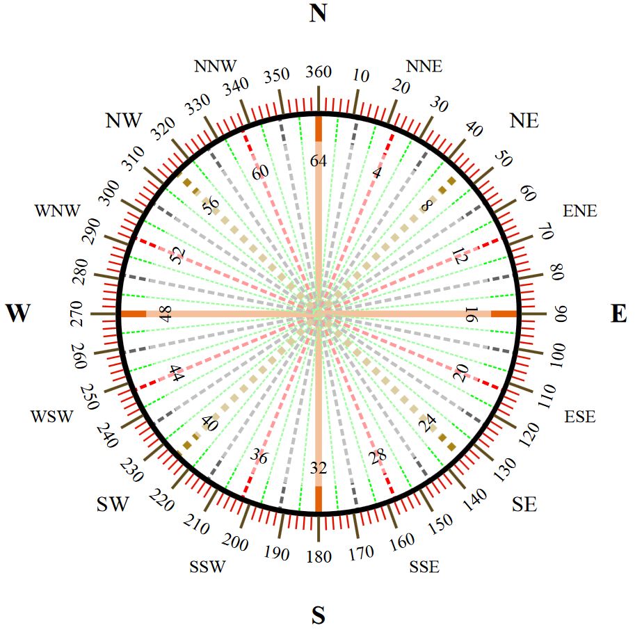
By WeatherFlow meteorologist Shea Gibson For Coastal South Carolina: As we get into the cooler months of fall and winter, we start to see more NE events unfold along the SE Region as colder High pressures to the north wedge down behind cold fronts that push through. For NE winds, as a cardinal direction we…
by WeatherFlow meteorologist Shea Gibson For SAL-ty Atlantic Part I of this series, please see: https://blog.weatherflow.com/sal-ty-atlantic-the-saharan-air-layer/ For SAL-ty Atlantic Part III of this series, please see: https://blog.weatherflow.com/sal-ty-atlantic-part-iii/ So far, the Atlantic Season has seen two named storms: CAT 2 Hurricane Arthur – which formed off the SE coast and made landfall over coastal NC… and Hurricane Bertha,…
by WeatherFlow meteorologist Shea Gibson We are currently seeing a very seasonal summer setup with vast blocking subtropical ridge known as the “Bermuda-Azores High pressure” over the North Atlantic Ocean. As it assumes its typical 1024mb status and keeps more of a near-Bermuda presence, we encounter periods of strengthened Sea Breezes along the SE Region…
…by WeatherFlow meteorologist Shea Gibson, July 9, 2014. There has been evidence of birds becoming trapped in tropical storms and hurricanes in the past as several species have mysteriously showed up in places where they would not normally inhabit nor breed following these storms. Locations include far inland areas where sea-faring birds have been found. …
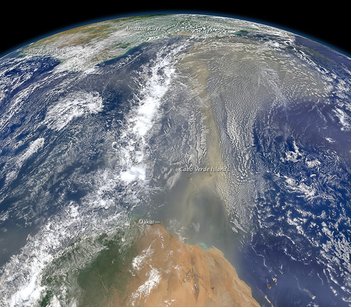
by WeatherFlow meteorologist Shea Gibson 6/25/14 See part II of this series here: https://blog.weatherflow.com/sal-ty-atlantic-the-saharan-air-layer-part-ii/ See part III of this series here: https://blog.weatherflow.com/sal-ty-atlantic-part-iii/ The “Dusty Tongue” of the Sahara keeps the northern ITCZ and Eastern Caribbean dried out through June 2014. The Saharan Air Layer, or SAL, is fed by Easterly mid-level jetting over the deserts of Africa…