Mike Godsey Forecast Jargon Decoder: Friday, May 17, 2024 Long ago eddies off San Francisco were rare events. Sure, each summer we had major Marine Surges that brought deep fog and strong wind all the way to Sherman Island. But those Marine Surge events were triggered by a heat wave and started near Southern California…
Mike Godsey Forecast Jargon Decoder: Wednesday, May 15, 2024 Despite the deep fog at 7 AM, the winds are already ripping in the SW-facing gaps in the Coast Range and at Point Blunt, Benicia, and Sherman Island. If you glance at a low-resolution model of the Pacific Ocean winds, you might expect strong NW winds…
The winter 2019-2021 season in Baja was atypical in a number of ways. It started off with a bang in November but from that point on the winds were often unreliable unless you were on foils or big kites or sail. Or if you were there during one of the few strong wind periods. But…
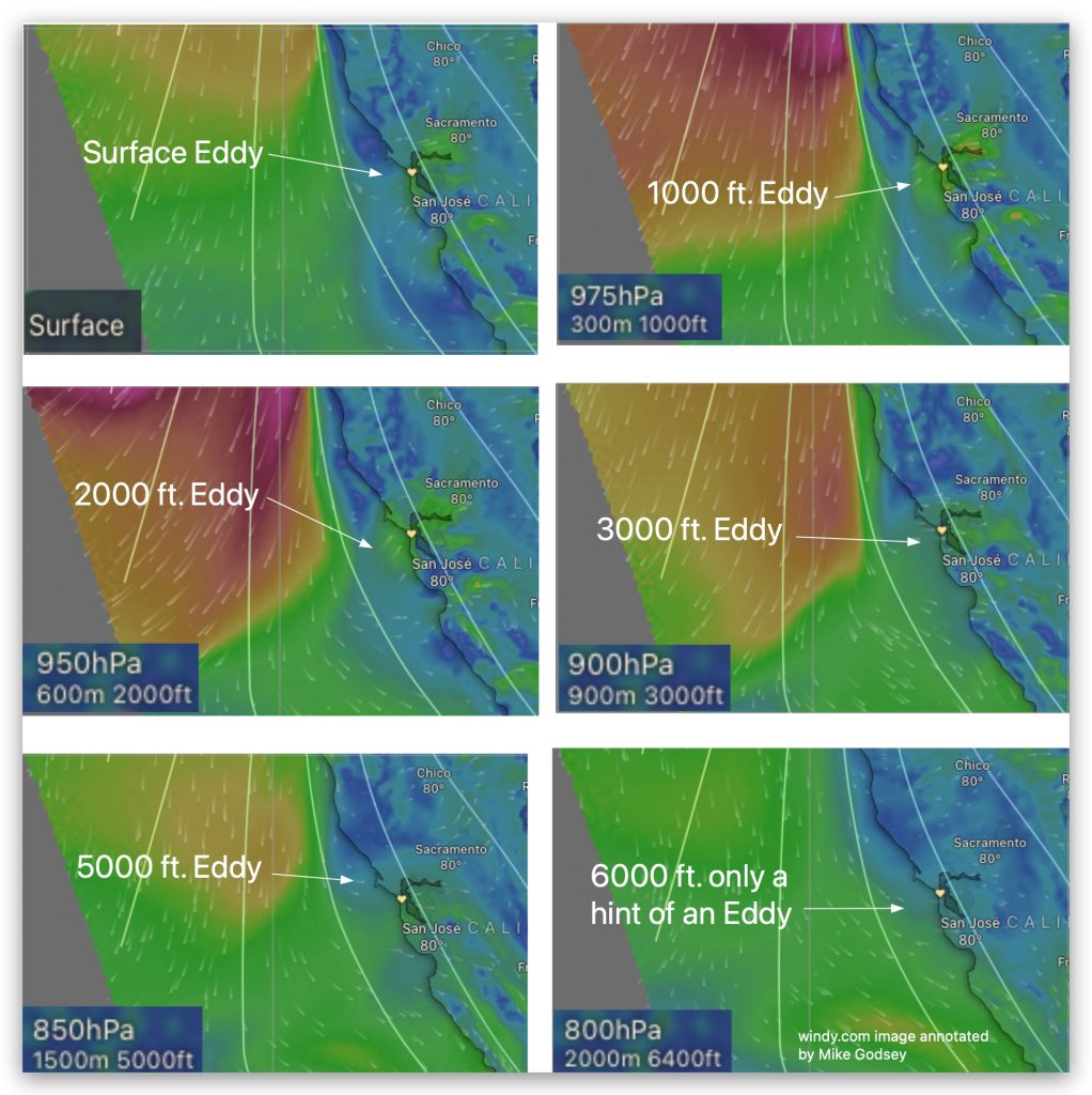
Part one of this blog below is about the smaller eddies mostly in the Bodega to Golden Gate area that have been so common during the 2019 summer season. These eddies often totally or partially die in the afternoon making for extremely difficult forecasts since the southerly eddy wind may die allowing NW wind to…
Hi Gang, Sunday, April 28: If you are a wind addicted kite or windsurfer the eddy is probably on your minds a lot recently. Either because it is wrecking your wind or because it is making great wind at your site. And right now it looks like some type of eddy continues for the next…