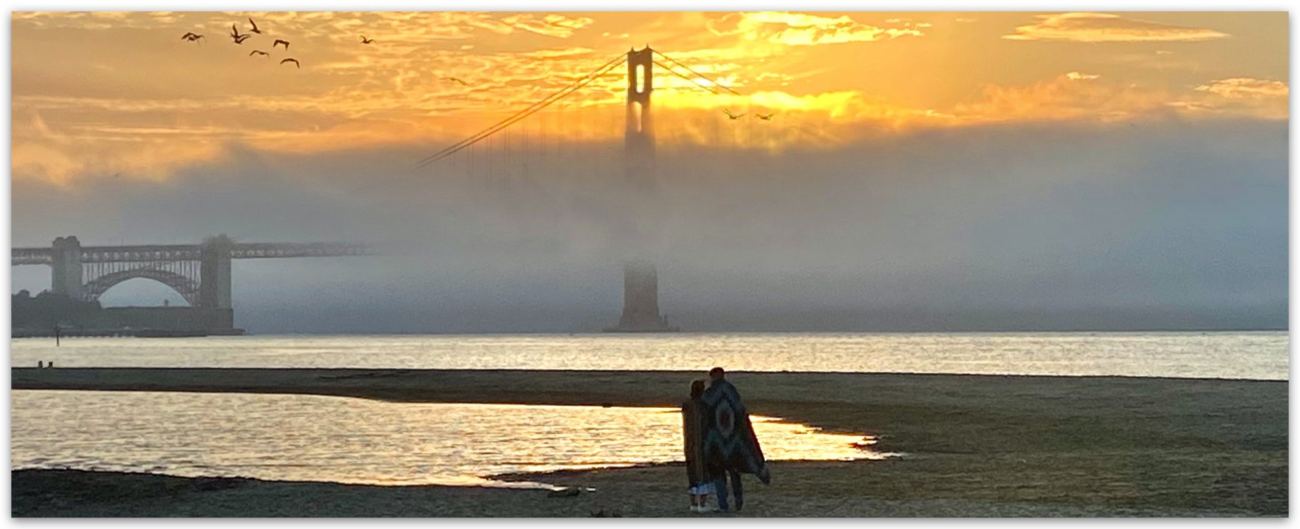
West Coast Wind Blog: Beauty and the Science, Heat, fog and amazing sunrises and sunsets. July 25, 2024 No Comments
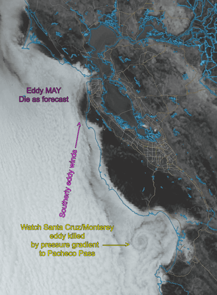
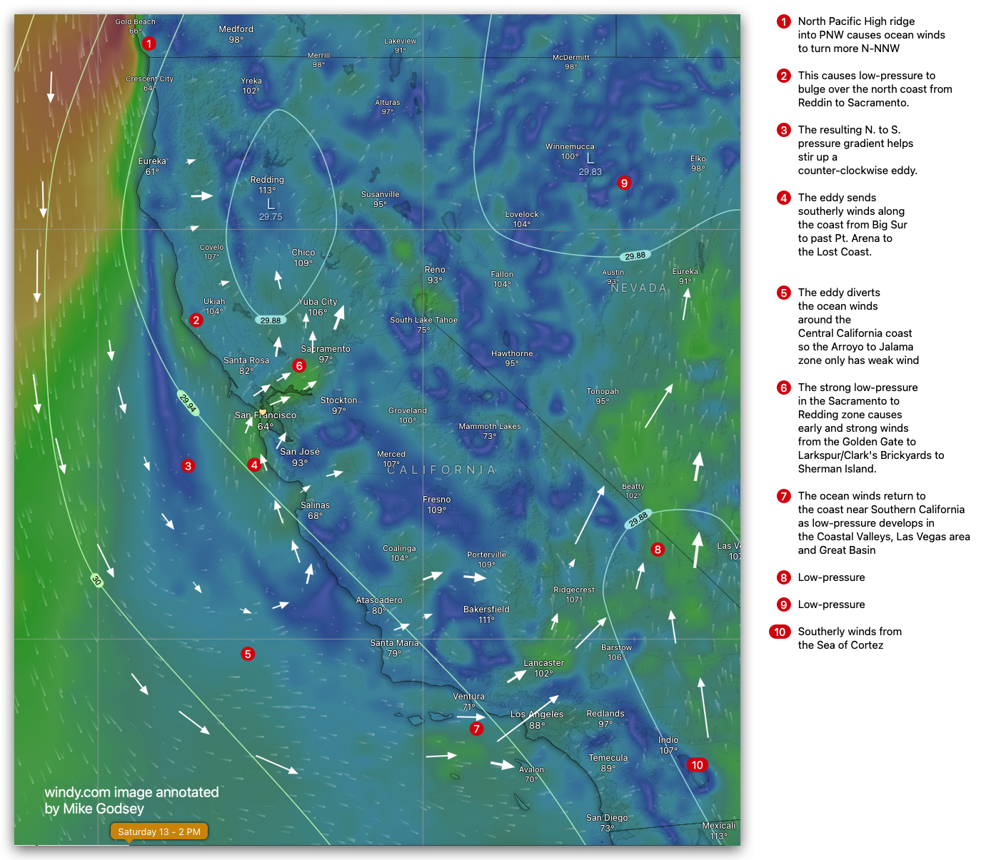
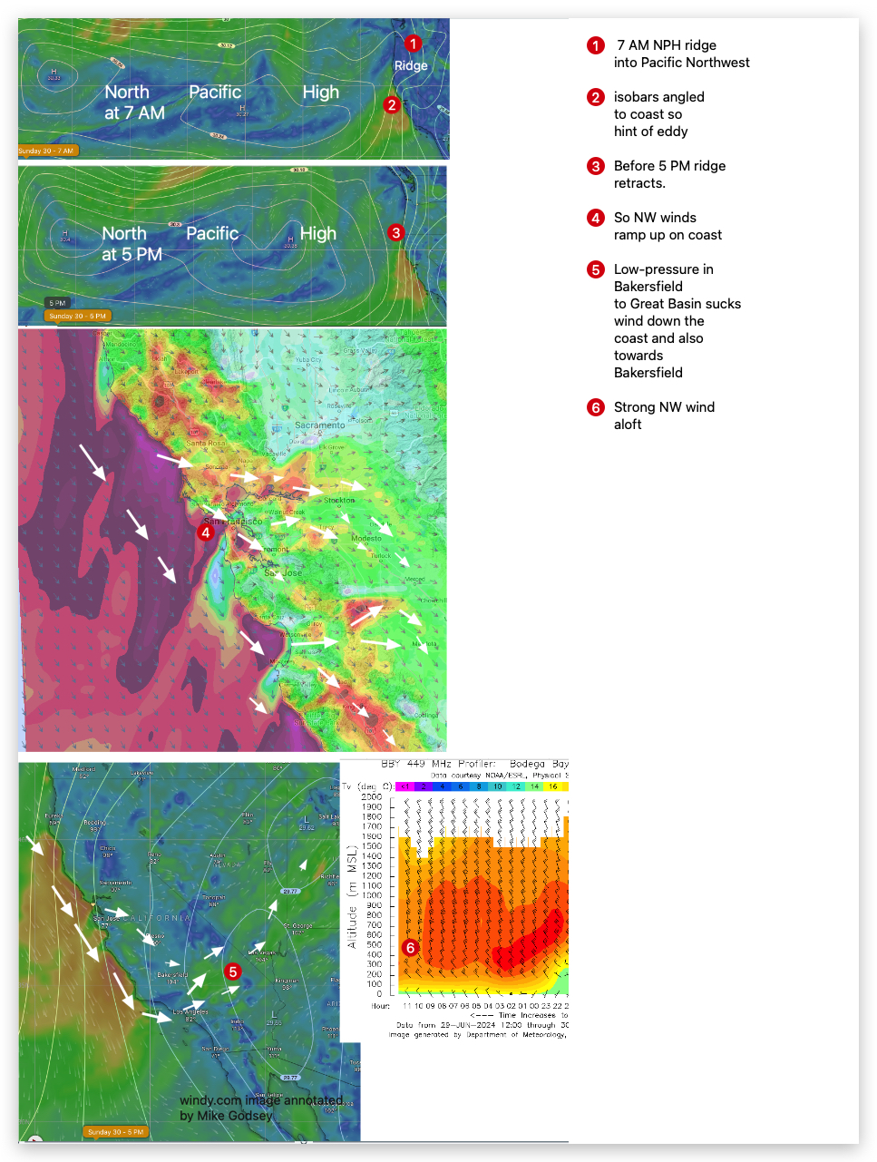
West Coast Wind Blog: huge eddy impacts San Francisco, coast and Southern California winds. July 12, 2024 No Comments
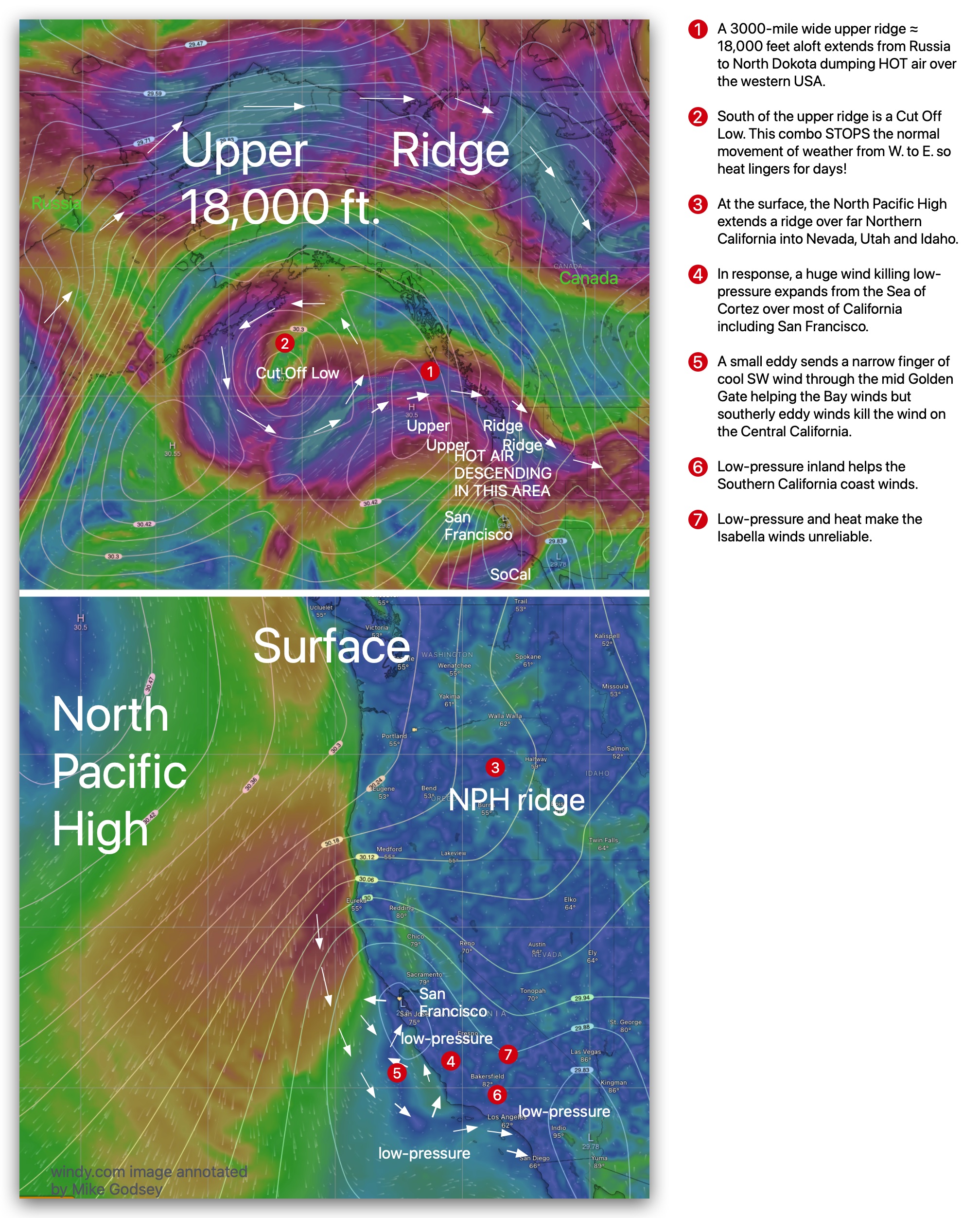
West Coast Wind Blog: Upper-level events bring on lingering heat wave impacting California winds July 3, 2024 No Comments
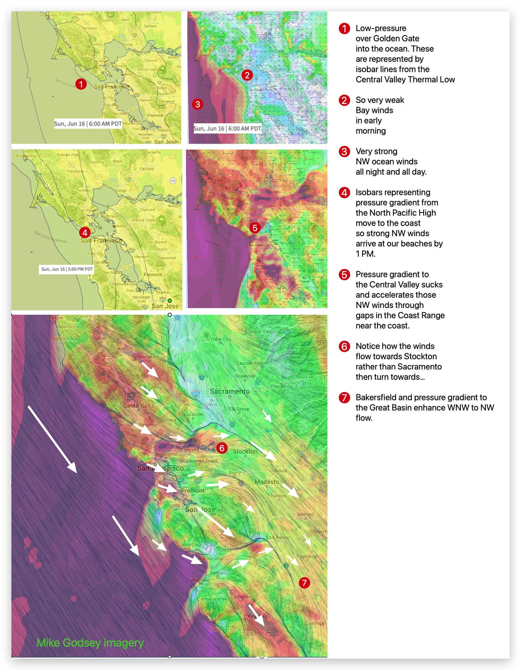
West Coast Wind Blog: San Francisco enjoys “Victory at Sea” wind conditions! June 16, 2024 No Comments