Early Spring Cold Weather Sea Breezes in the Northeast
4/10/18
Tim Kent
When some one says Sea Breeze what comes to mind???
- For me its a hot day where the cooler moist air blows in off the water moderating the temps.
- However, a Sea Breeze Defined by Google Dictionary is:
sea breezenoun
-
a breeze blowing toward the land from the sea, especially during the day owing to the relative warmth of the land.
-
So, we see that in reality the ambient temperature outside is somewhat irrelevant and that the primary factor needed for a Sea Breeze to occur is land that is comparatively warmer than nearby water. Enter Monday April 9th.
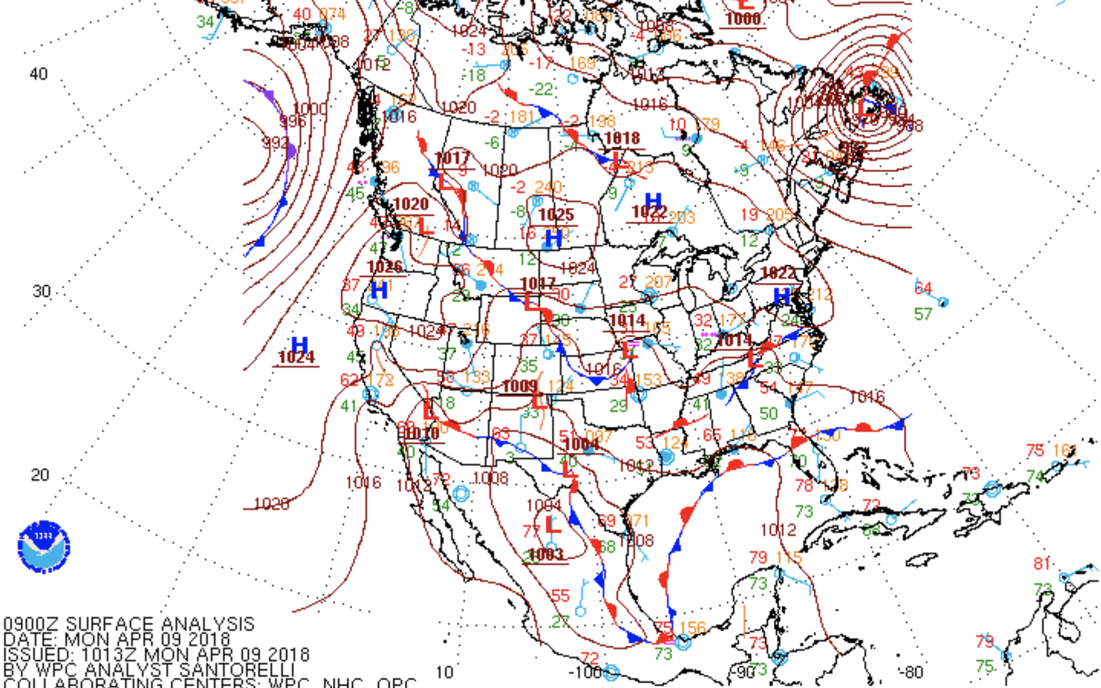
We have a postfrontal day with High pressure sliding down into the Mid Atlantic. Moderate WNW/W winds show across most of New England, while NW/WNW flow showing in New York and New Jersey, through the morning hours.
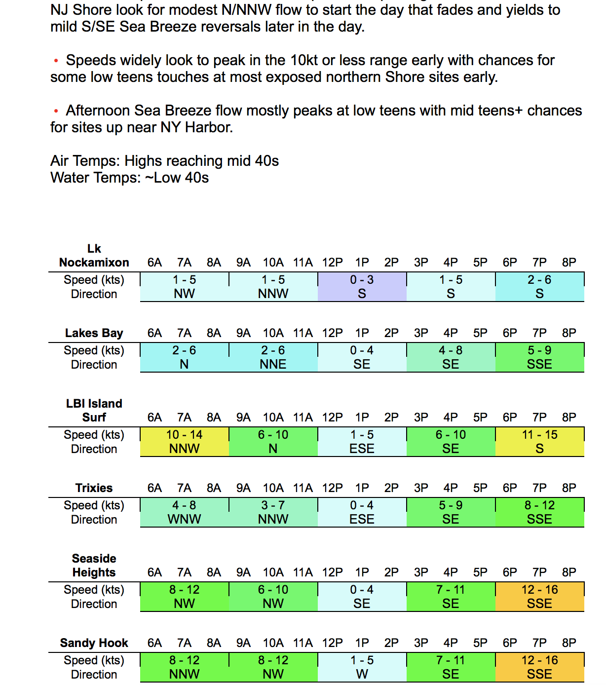
As High pressure settles into the region, the postfrontal flow was suggested to fade, and S/SW Sea Breezes were forecasted by the models to show in the late afternoon. Surface temps forecasted to top out in the low to mid 40’s with nearshore water temps hovering around 40F for the region.
By mid day we start to see surface temps hitting mid 40’s inland, while the beaches hover around upper 30’s or 40F, as the WNW/NW gradients are fading out at the surface. As noted, models had forecasted a modest to moderate late afternoon Sea Breeze reversal, but I was suspect due to the Cold temps forecasted.
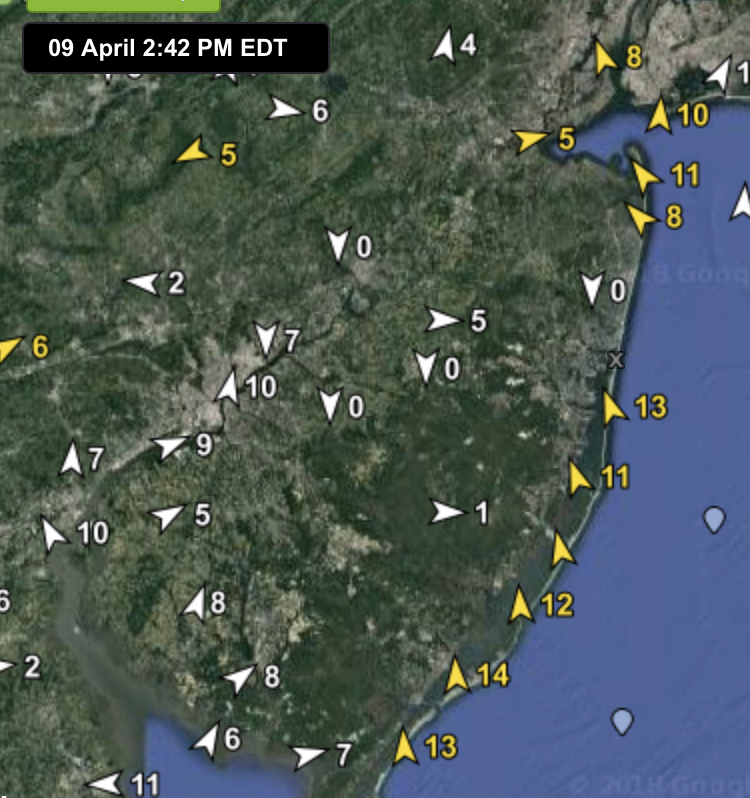
Mild but notable temperature differences in NJ seen in these mid afternoon observations.
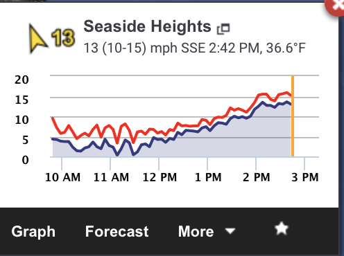
I had forecasted afternoon Sea Breezes but I was not convinced of their strength
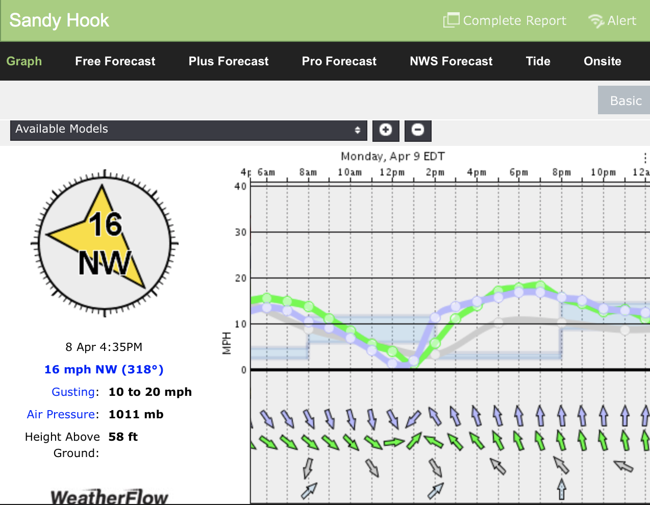
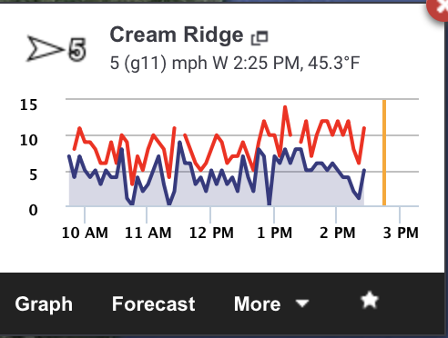
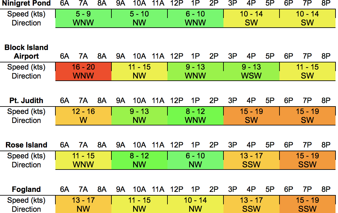
Around this time I peaked around RI to see how the forecast was coming along and I noted that S facing beaches were reporting moderate WSW/SW flow while Inner Bays were showing NW/WNW flow in the low single digits, but jumpy as is typical of WNW flow across Inner Bays.
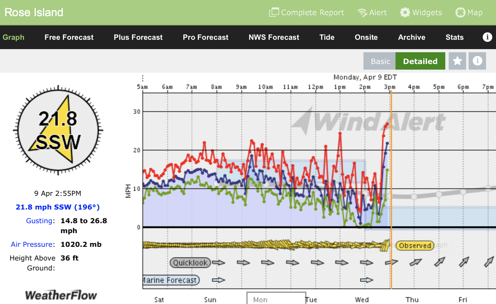
Moments later I check in and BOOM SW winds jump to 22mph at Rose Island. My AM forecast tables are a little behind and more than 6mph off so I am forced to do a special update.
So, what happened here???
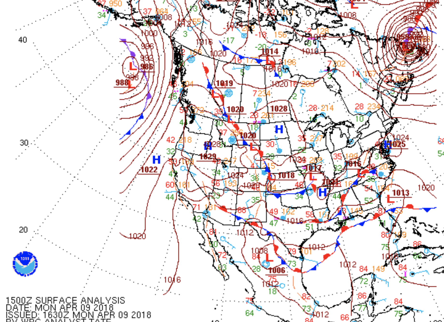
As noted about NY and NJ even the Delmarva see High pressure sliding overhead essentially knocking out the WNW gradient by mid day allowing those modest to moderate Sea Breezes to pop up in the afternoon, in a somewhat typical fashion. Why then did RI see such a drastic surge???
Lets take a look at nearby soundings

WAL in the morning suggests a fairly unidirectional mid to upper level flow with milder low level flow for the Mid Atlantic that would likely be pretty easily overcome by mild some Sea Breezing.
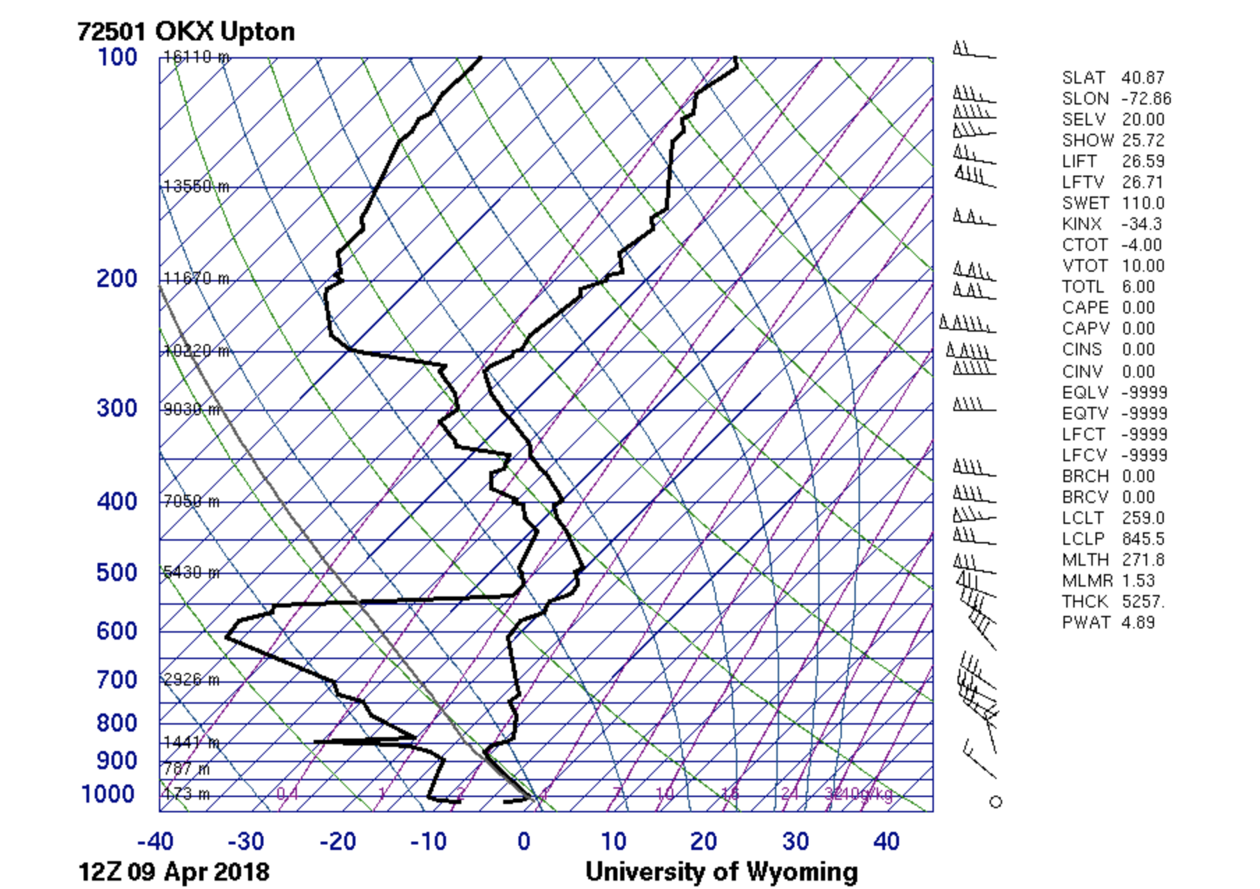
Upton NY suggests a more defined lower and mid level NW flow backing again to unidirectional W flow in the upper levels.
So, with good return flow in both areas at the mid levels and modest Temperature gradients at the surface (even though by any standards this is still very cold) we see some moderate S/SW Sea Breezes pop up, widely.
Inner Bay Rhode Island sites are special however in that:
- Geography funnels the S components of the Sea Breeze
- Geography also causes mechanical mixing of the W components in the mid levels,
- The above factors in conjunction with clear skies aiding in mixing causes coupling of the W/S components to cause the drastic surge in SW/SSW flow for the afternoon of 4/9.
In conclusion, this day serves to remind me, and now all of you that it doesn’t have to be warm outside for Sea Breezes to occur, and with some special additional factors in play certain areas can really crank even if the temps are in the 40’s or even less!!!