Early Spring Fog/Marine Layering along the SC coast
Tim Kent
3/23
(sorry in advance for strange layout of text captions)
First Visible Image of the Day
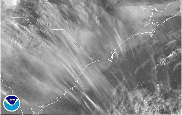
Low Level fog clearly visible along the coast below some upper level cloud streaks
Synoptic Setup for the day
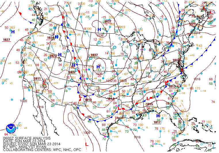
Zonal flow (Westerlys) with High pressure over the NE GOM and a slow moving front approaching the coast. Most models predicting fairly light zonal or SW flow.
Models on track with Observations
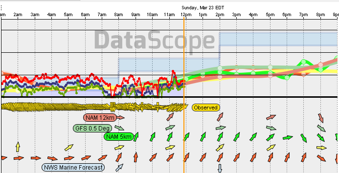
Models do a pretty good job with the wind field and the NWS was all over the potential for a widespread fog event in the Saturday pm discussion. With very light winds showing at 5AM and multiple observations confirming I took it as a given that Fog was fairly widespread while still in the dark.
Surface Fog and Sea Fog
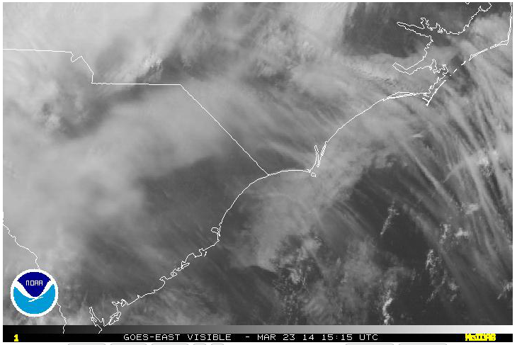
Fog has burned off over land by lunch time and westerly flow has advected much of the Sea fog into the open Atlantic. Early morning would have revealed a near continuous fog bank from land to sea (seen in the 1st image)
Moist Low Level Air over Cold Surfaces
-Dewpoints in the 50s to low 60s overnight were easily met by moderate cooling inland overnight.
-NWS forecasted for fairly solid prefrontal SW/WSW flow in the low to mid teens despite model consensus depicting considerably lighter flow.
-We know that fog and particularly Sea fog will decouple the atmosphere and not allow stronger warm winds aloft reach the Surface.
-So when the sun rose and we were able to confirm the solid fog presence the more conservative model solutions are easy to side with
Dewpoints and Wind direction play a critical role