
Many in Southern California are spending their Thanksgiving Holiday with no electrical power thanks to a powerful offshore wind event. That means no ability to cool refrigerators, that are stocked to capacity, or ovens to cook turkeys. The power is not out because winds have taken out power lines but instead, they have been shut down preemptively, Public Safety Power Shutoff- PSPS, in hopes that winds don’t bring down those lines and spark fires.
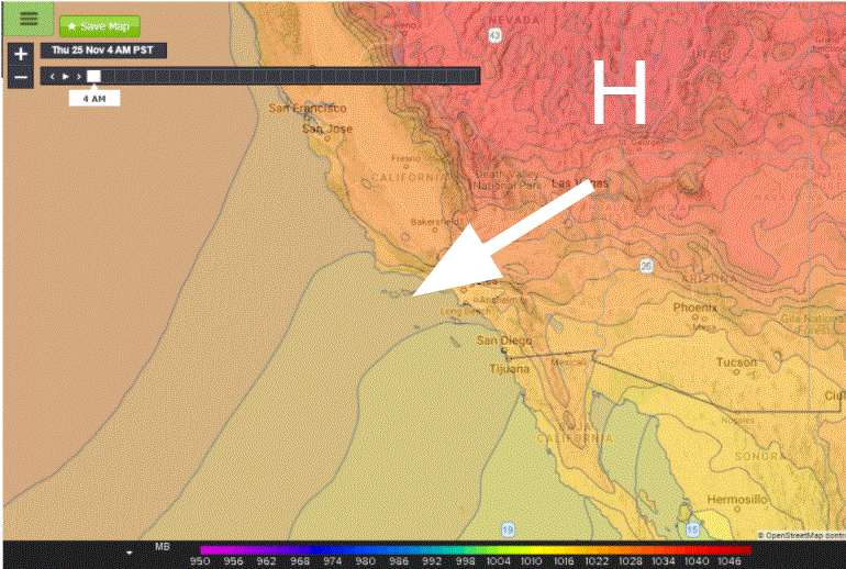
This is not the first time this area has seen power outages for the Thanksgiving Holiday. In fact, this time of the year is prime season for Northeast winds, called Santa Anas, to roar through the area due to the seasonal changes in the jet stream. The jet stream sinks southward as temperatures cool in the Northern Hemisphere. Frontal systems drag cold air toward the Great Basin, Nevada, and Utah. Consequently, pressures rise east of California setting up strong negative pressure gradients. The cold air is pulled out of the Basin toward California. The wind picks up speed, and the air dries and warms as it drops down out of the High Desert and tumbles down toward the ocean.
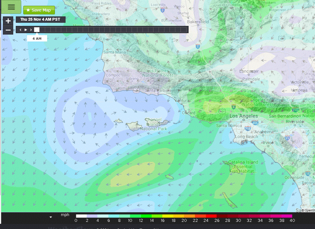
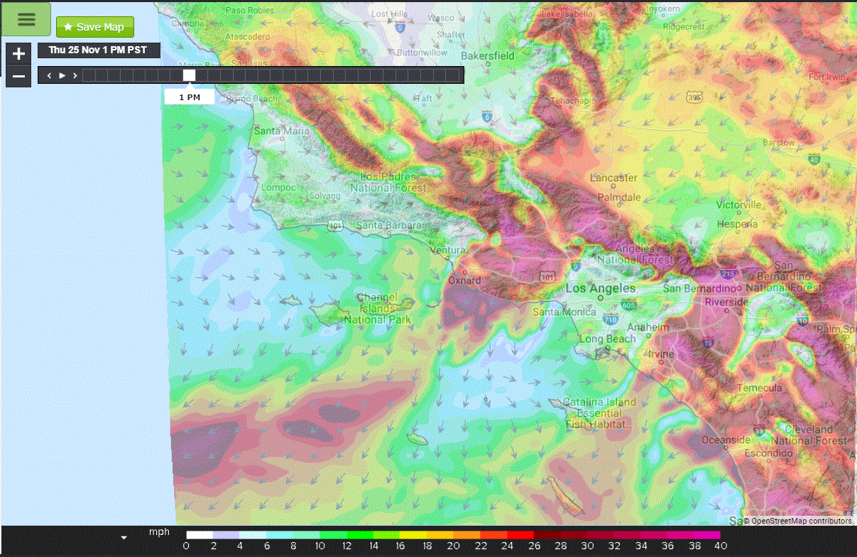
The PSPS event can be frustrating because many that are without power might not see strong winds right at their home and be confused. Southern California is covered with mountain ranges that are oriented both North to South but also East to West. The ranges can both block the wind but also accelerate it through the gaps. So there is high variability with wind speeds with locations very close to one another having large differences in the speeds of the wind. Homes in valleys may see no wind while the surrounding hilltops are seeing strong winds. Additionally, winds will pick up during the day as temperatures warm and cool, so though winds may die down for a time the event is not over.
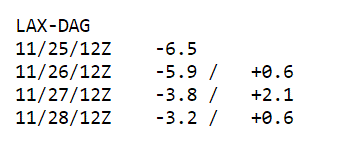
Many times these events can be short-lived but when we don’t have a strong westward push from the jet stream the cold air stays in place for longer. That is this case for this event. Models are showing that the Los Angeles to Daggett gradients stays low through Friday morning and gradients stay weakly negative for the next 72 hours. So many outages will last into Friday.