by Meteorologist, Kerry Challoner Anderson
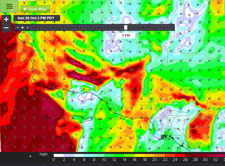
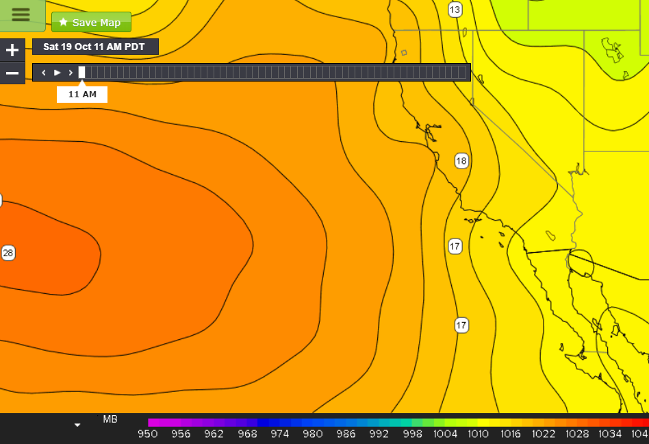
As we start to move into the heart of fall we expect the North Pacific High to slide further south and that is exactly what we are seeing this weekend and the reason the Central Coast is enjoying such strong winds. Saturday’s pressure maps showed a 1028mb High centered to the west of the Southern California coast resulting in strong coastal gradients.
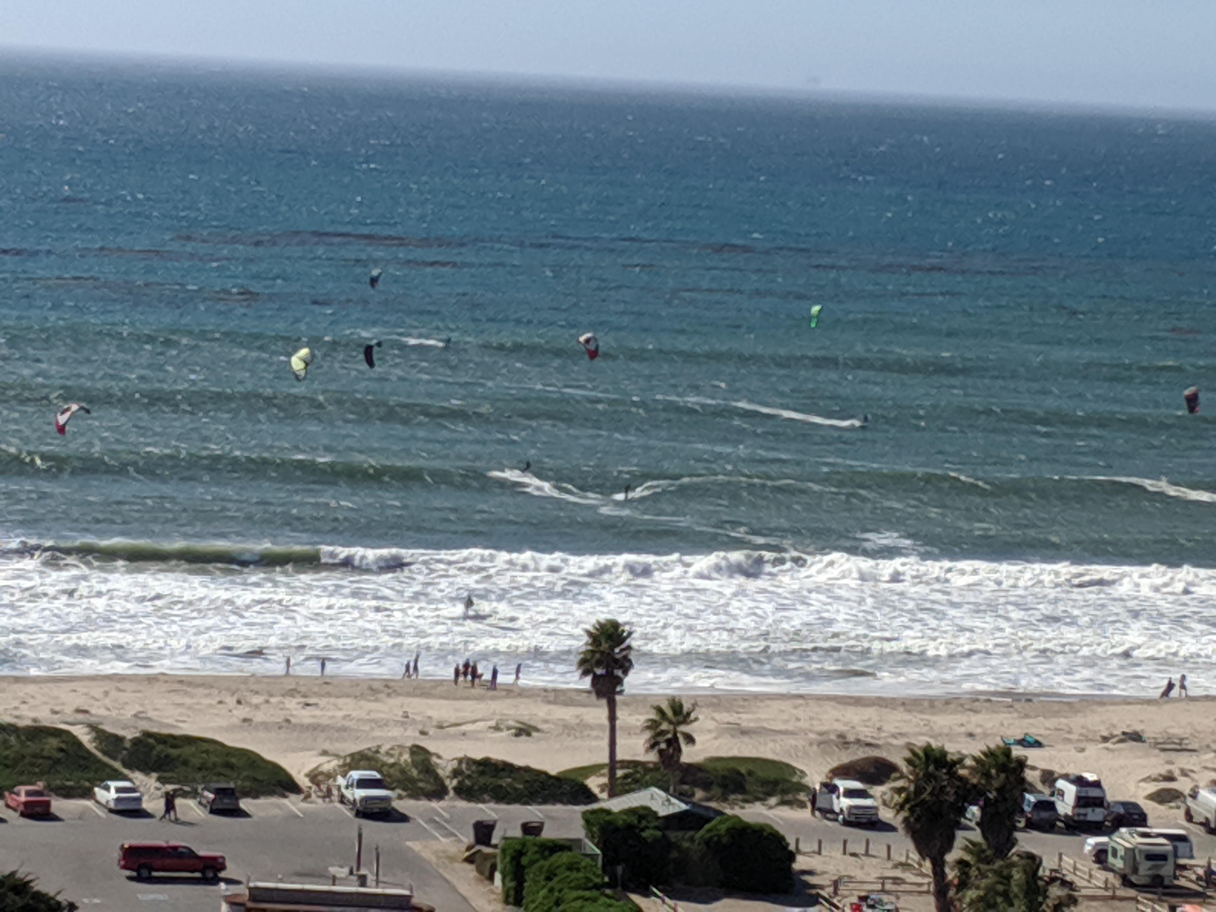
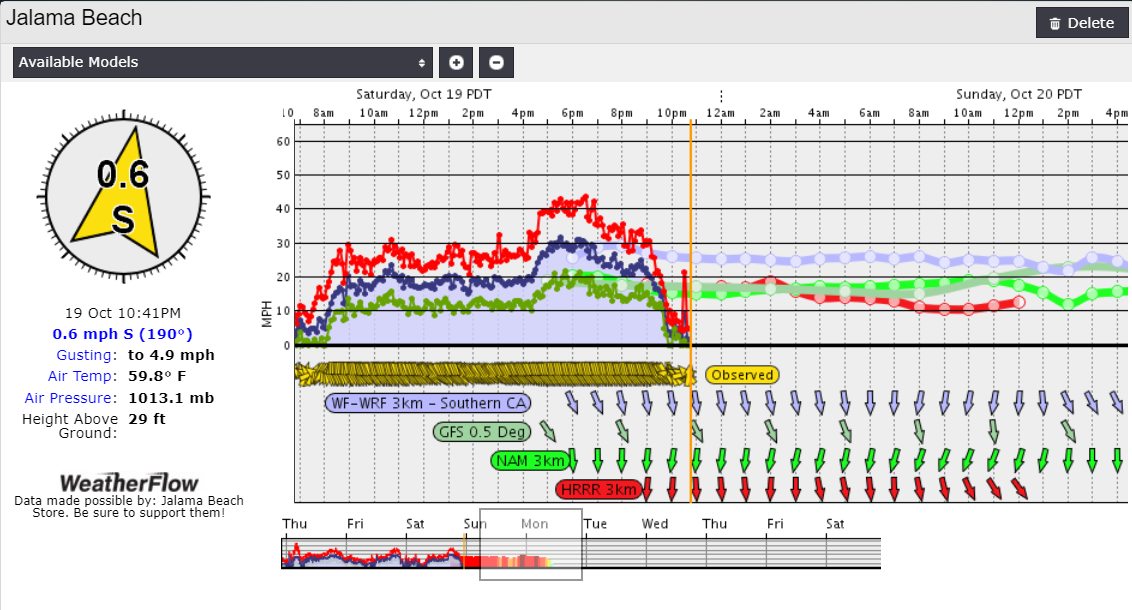
Jalama’s waters were busy as winds topped 30 knots for much of the afternoon.
Though Jalama can receive strong days in the fall, it is also tricky to forecast at this time of the year due to the High-pressure systems that move into the Great Basin behind eastward-moving cold fronts. This sets up NNE/E winds that battle against the coastal winds. The offshore winds are channeled through the East- West oriented canyons of the Santa Ynez range and can become very strong. We begin to see these winds set up later this weekend.
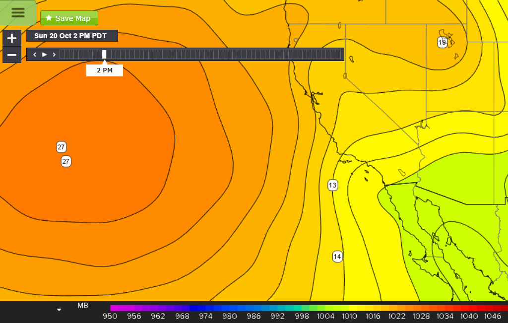
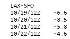
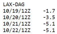
As the Pacific High strengthens and moves a little closer to the coast, the Los Angeles to San Francisco gradient increases on Sunday to -8.5mb. This will keep the coastal winds working. That will bring another strong day on Sunday for Jalama. But then the Great Basin High starts to exert its influence as the E/NE gradients start to climb. By Sunday the Los Angeles to Daggett gradient starts to increase and by Monday is at -5.1mb. So we start to watch the NE winds increase and the battle begins at the coast.
Sunday sees the coastal winds win out so expect another solid day but then forecast is not so certain.