Due to COVID restrictions, many of us will miss the skies lighting up with fireworks this 4th of July but though the celebrations will be atypical the weather will quickly shift this week into a more traditional summer pattern. Heat surges up through the center of the country over the next couple of days and so we can at least watch the temperature maps light up.

Currently, unseasonably deep Low-pressure systems have taken up residence over the Northeast and Northwest corners of the country bringing cool air across the northern third of the country and locking High pressure down in the Gulf. This pattern starts to shift later today and we pop the cork on this bottleneck.
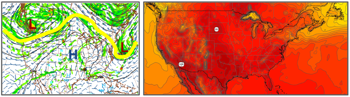
The Low over the Northwest cycles around and backs to the west while the Northeast Low scoots eastward. This allows a High-pressure ridge to surge northward through the Midwest toward the Great Lakes. Temperatures quickly climb and by Friday they are into the 100s through Texas and Oklahoma with 90s up into the Plains and much of the Great Lakes.
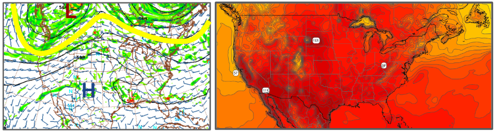
Over the weekend the High is forecast to back toward the west, while the Jet Stream retreats further north, This will expand the heat so we see much of the country starting to languish with 90s and 100s. Enjoy the holiday weekend and hopefully, you can find some way to stay cool.