by Meteorologist, Kerry Challoner Anderson
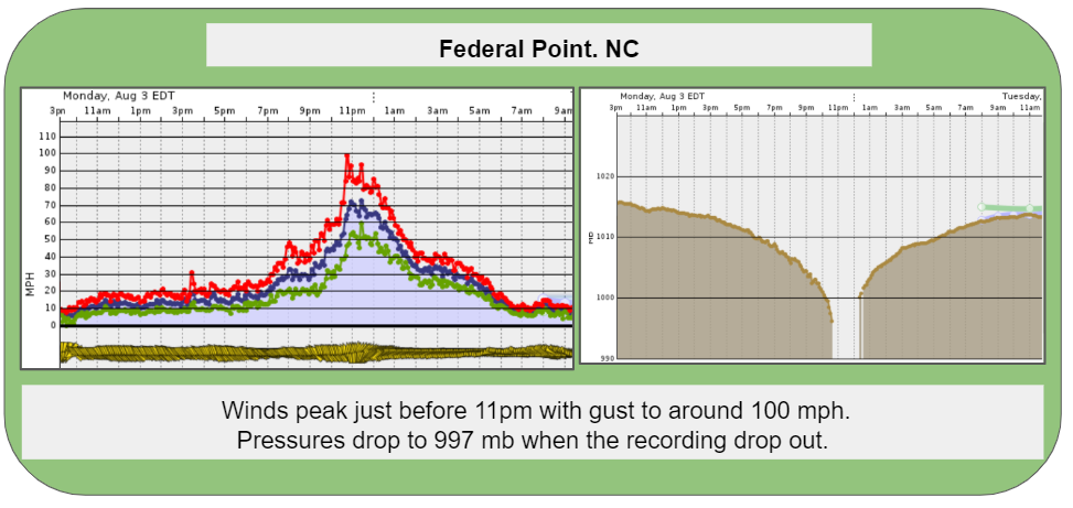
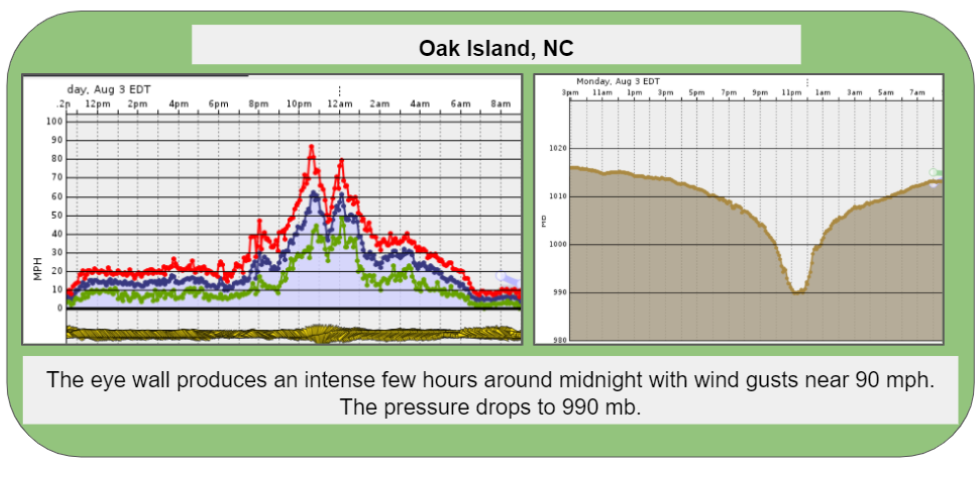
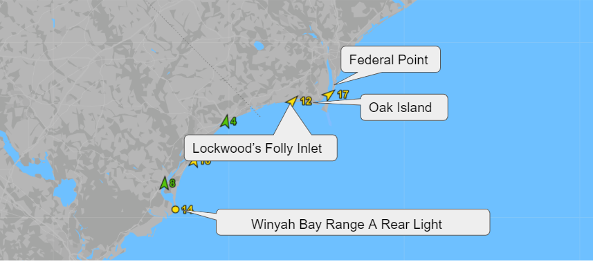
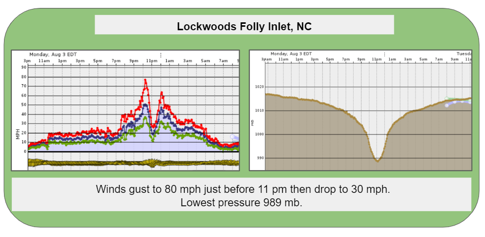
Hurricanes don’t come calling often but when they do Weatherflow wants to gather as much data as possible to aid in the study and mitigation of these storms. With our extensive network of stations, we were able to capture Hurricane Isaias as it rolled up the Eastern Seaboard on August 3, 2020. The eye made landfall in Southern North Carolina just after 11 pm and our stations picked up the classic hurricane signatures. As the eye moves inland you can see the winds ramp up as the eyewall moves in, with gust up to 100 mph. These winds quickly drop as the eye passes through only to intensify again as the eye is directed to the north and the southern eyewall moves inland. You can see the same pattern traced in the pressure readings as the barometric pressure drops within the eye.