By WeatherFlow meteorologist Shea Gibson 8/26/20 at ~11:30PM ET
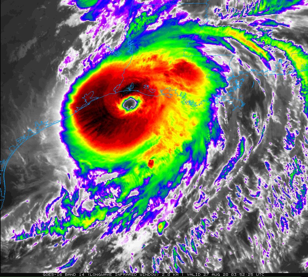
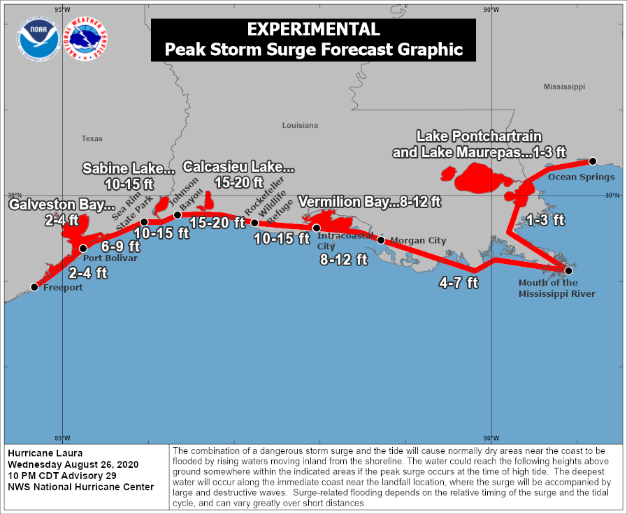
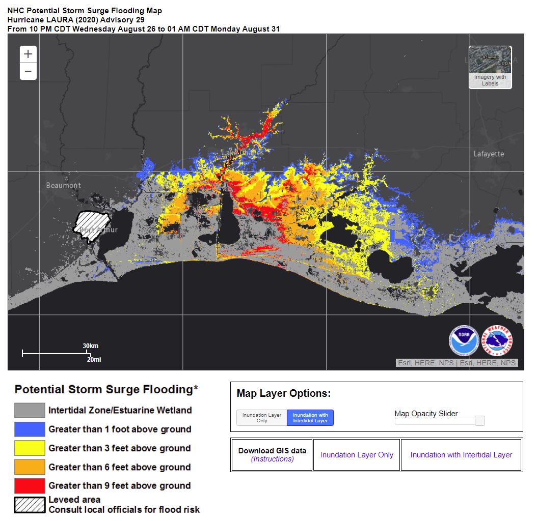
We are about to see an incredibly dangerous/catastrophic storm make landfall along the western LA coast as a strong CAT 4 with winds of 150mph. This storm has rapidly intensified over the last 24hrs as it left Cuba and wobbled across the Gulf of Mexico. Just for perspective, the criteria for rapid intensification is an increase in winds by 35mph in a 24hr period. This almost doubled that build. The storm surge is expected to reach 15-20ft for locales along and just east of the landfall as the onshore wind and storm energy push water into the coast and inland up to 40 miles.
Here are some interesting stats from Dr Phil Klotzbach of Colorado State University:
8/26/20 11:40PM ET: #Laura continues to have max winds of 150 mph. Only 4 hurricanes on record (since 1851) have had max winds >=150 mph this far north in the Gulf of Mexico: Last Island (1856), Freeport (1932), Camille (1969) and Michael (2018).
8/26/20 9:40PM ET: #Laura’s central pressure is down to 937 hPa. Only 3 #hurricanes on record (since 1851) have made landfall in Louisiana with a central pressure of <=937 hPa: Katrina (2005, 920 hPa), Last Island (1856, 934 hPa) and Rita (2005, 937 hPa). Lower pressure = stronger storm
And THIS one is really unique! 8/26/20 4:45PM ET: #HurricaneLaura‘s maximum winds have increased by 65 mph in 24 hours (from 75 mph to 140 mph). That’s the fastest 24-hr wind intensification for an Atlantic tropical cyclone since #Hurricane Maria in 2017.
Shea Gibson
WeatherFlow Meteorologist/Wind Forecaster
SE Region / East Coast / Tropics
New Stations Projects & Outreach
Twitter: @WeatherFlowCHAS
Facebook: https://www.facebook.com/WeatherFlowCHAS/Sources:
College of DuPage
NOAA NHC
Phil Klotzback on Twitter: https://twitter.com/philklotzbach