by Meteorologist, Kerry Challoner Anderson
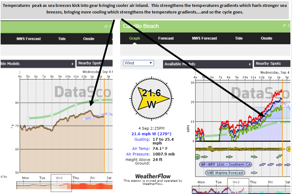
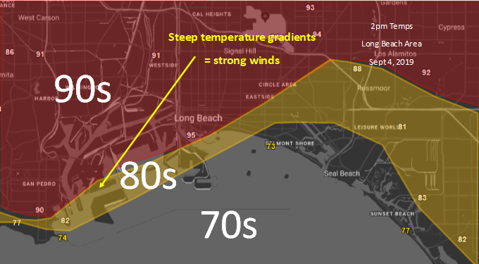
For days the Southland has been sitting under a late summer upper-level ridge that has been steadily heating the Los Angeles Basin. When this happens we watch carefully to see how close that heat comes to the beaches. Forecasting sea breeze activity is tricky. The strongest winds develop where we have the steepest temperature gradients. Due to the topography of the Basin, we have very warm air move close to the shoreline and so we see some of our strongest and most consistent sea breeze activity at Cabrillo beach. Below is the temperature profile this afternoon. You can see the heat right up to the beach. If the heat moves offshore the winds shut down but if we can get a little cooling then we have a steep temperature gradient and strong winds. I will admit it is a tough forecast because it is either feast or famine.
Today as the I prepared the Midday Update the coast had spent the morning in full sunshine due to a lack of marine clouds. The temperature profile showed the heat approaching the beach, which will shut down the sea breeze activity. I backed off from the original forecast of Low 20 winds. Just after I posted the sea breezes kicked in just enough to start to cool the beach and once that starts unless there is a strong offshore flow this will strengthen the temperature gradients which in turn strengthens the winds, resulting in these low 20s that we are now experiencing. Enjoy!