by Meteorologist Kerry Anderson
The California forecasts this week have been all about the “marine clouds”. Our winds hinge on the depth, breadth, spin, and reach of these clouds. This is not unusual at this time of the year due to the prevailing High-pressure ridges that frequent our area. It is typical to see large domes of hot air sit over California for extended time periods. These areas of high pressure push the air toward the ground and for those of us who live next to the chilly Pacific, that means that the lowest layer is forced to spend a lot of time being cooled from below. That is exactly what we have seen for the past few days here in California and that has resulted in strong temperature inversions. An inversion means that the vertical temperature profile is “inverted” from the typical warm air below and cool air above.
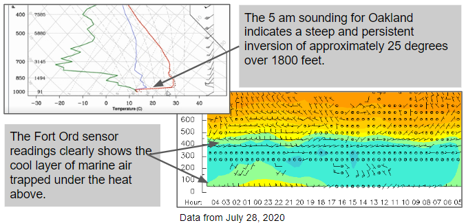
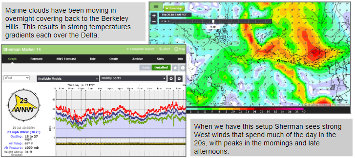
When this happens the air below condenses into clouds which can be quite dense and will cool the area that they cover. The clouds can be quite persistent because the air is trapped by the heat above and doesn’t mix easily. This can be great for our winds as it creates strong thermal contrast which results in strong winds. Sherman has felt these winds this week.
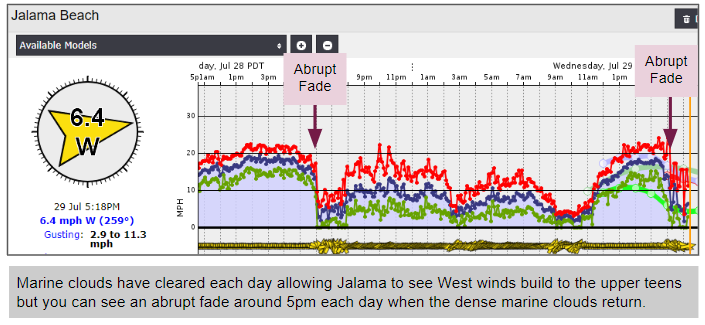
However, when these clouds move in over an area, the temperatures can plummet quickly and so can the winds. Jalama’s graphs have shown the dramatic change when the marine clouds arrive.