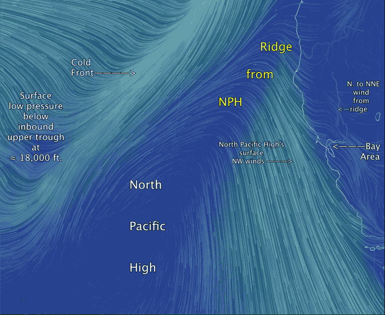
Watch upper trough shove NPH to the south.
by Mike Godsey, mike@iwindsurf.com
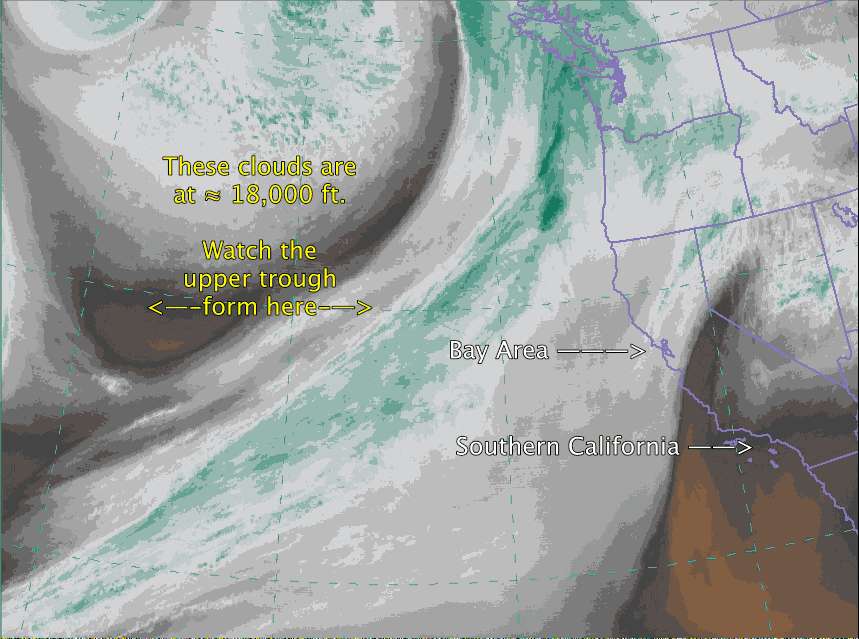
I will add text to these 2 videos tomorrow but right now focus on the upper trough at ≈ 18,000 ft. in the top video. Then in the second video notice how the inbound upper trough is causing the North Pacific High to push a ridge into the Pacific Northwest. Normally this would have killed the winds today but the ridge was small and we still had a decent pressure gradient. Notice the Cold Front in the video this point where warm moist air from the south meets cold air from the north will be over us Monday especially in the afternoon. And the North Pacific High’s surface NW winds will be mostly shoved south of the Bay Area. But once this upper trough passes the North Pacific High will lunge back towards the Bay Area Tuesday and Wednesday.