By WeatherFlow meteorologist Shea Gibson
The South Carolina coast has been seeing quite a bit of water spout activity lately – in fact pretty much on-and-off all summer. We’ve had the right conditions for these occurences on many days. Typically, water spouts are common along the SC coast in the mornings when we have offshore winds meeting the Sea Breeze front, which slowly creeps towards the coast with an onshore flow. Three things combine at once to start this occurrence:
1. Warm moist surface air wedging up from the South along the Sea Breeze front just offshore in the Atlantic.
2. Cool moist surface Land Breezes from the West/Northwest coming from inland.
3. The rising sun adding heat to the mix.
These 3 factors help create a partially to moderately unstable environment – sort of a delicate situation in the lower to mid atmosphere (not quite as intense as our typical afternoon storms). The result is a type of coastal clouding called “cumuliform clouds” that have low, flat black bottoms and billowy 3-D tops. Since they hang so low in the sky, these cloud types are easily influenced by surface rotation and can form individual or lines of storm cells. When we have 2 different directions of surface winds colliding, Water Spouts form at the water surface and work their way up. Warm waters are they key here – 80 degrees or higher is optimal. Our current water temperatures are at 83-84 degrees ,which is ideal. However, once the sun’s heat overtakes the atmosphere and rises temperatures to a certain level, the chances diminish and the immediate coast tends to dry out as the Sea Breeze front pushes onshore. There are other times with other conditions for these to happen during the day, but for now we’ll stick to the “morning only”events.
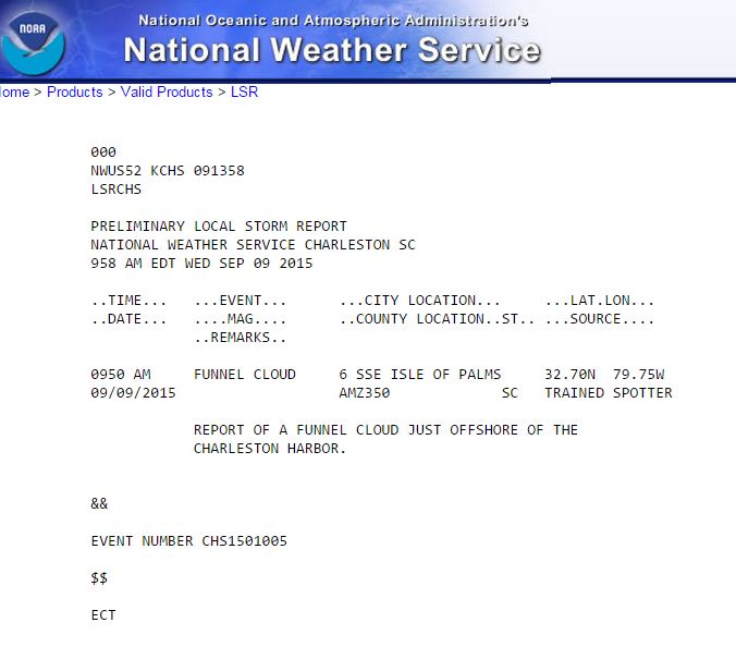
September 9, 2015: By complete coincidence, I was making observations this morning and gathering material to do this article as conditions were becoming ideal for development. I checked the National Weather Service in Charleston, SC LSR (local storm report) and found that an offshore “funnel cloud” report had come through at 9:50AM.
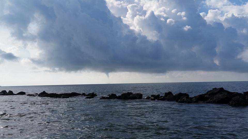
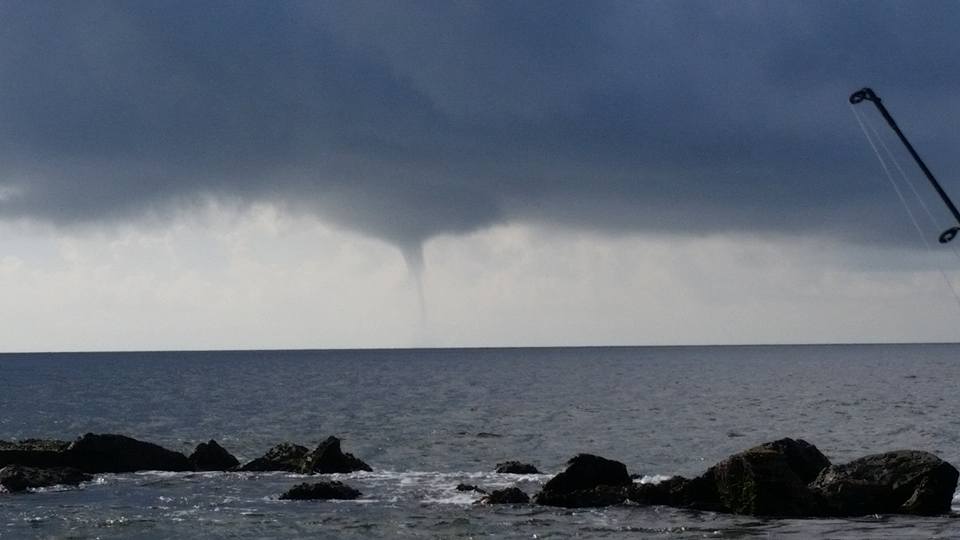
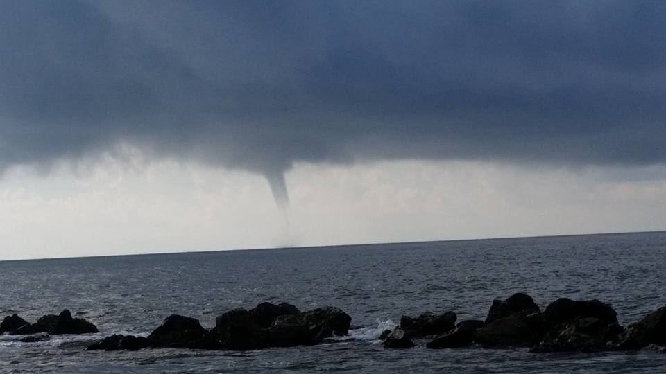
Pictures of the Water Spout taken by a friend and local fishing Captain Fritz von Kolnitz around ~9:45-10:00AM.
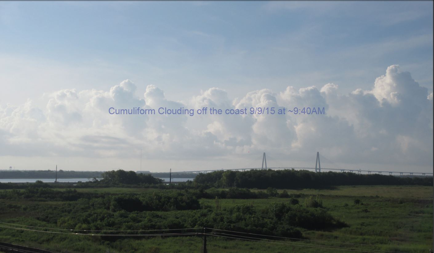
Here is the photo I had taken from the same cumuliform cloud bank just 20 minutes earlier at 9:33AM that was sitting off the coast. Notice the long flat bottoms.
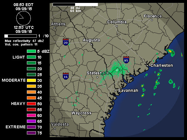
 Here is the radar loop showing the line of cumuliform cells hugging the coast.
This is the weather balloon sounding from 8:00AM…basically shows the surface and mid level winds a small time before this event.

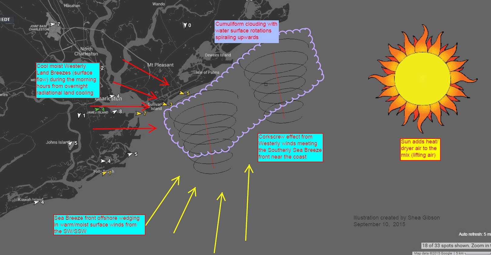
Ok so let’s take a look at the below picture to put it into perspective. Here is how this happens:
Hope this helps for the morning maritime efforts/recreationalists and meteorology fans out there!
Cheers from us at WeatherFlow!
Shea Gibson
SE/EC Forecast Team