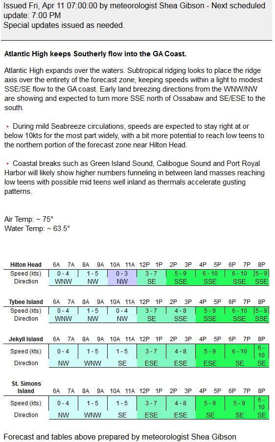
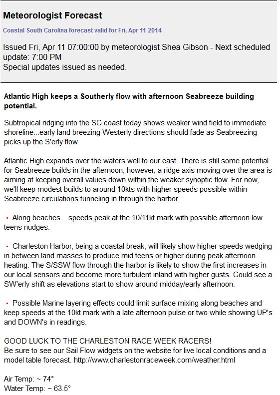
by WeatherFlow meteorologist Shea Gibson
From April 11 – April 14, High pressure entered from the Gulf, expanded across FL/GA and out into the Atlantic north of Bermuda, where it slightly built around the center and then became flattened by two areas of troughing to the north and south. To the north, a stronger frontal boundary had just lifted where the High passed underneath, and then settled back down by laying in an EAST-WEST diagonal pattern. To the south, weaker troughing + lack of significant system activity the western Gulf allowed it to expand the axis inland all the way to Louisiana and perhaps Texas. The result was mixed SSE/SE winds to the south of axis and S/SW flow to the north of axis. This made it especially difficult to predict how much angle of SSW/SW directions and potential elevations in speeds we might observe from Seabreeze circulations for several days. We mainly stayed with the weaker synoptic flow to beaches with marine layering effects tied in with our forecasts, but coastal breaks and inland locales had to be mentioned for SW directional influences to perhaps drive up a few elevations in speeds.
First let’s take a look at the APRIL 11, 2014 Surface Analysis

And the forecasts starting with GA, then SC and SENC
OUTCOME
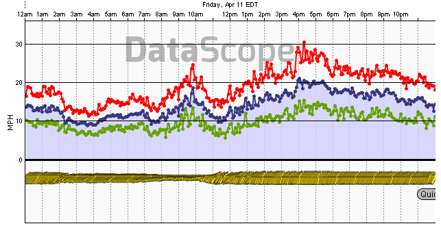
Jekyll Island, South GA (ignore the morning spikes) – came up a couple of knots higher late afternoon, but overall target met.
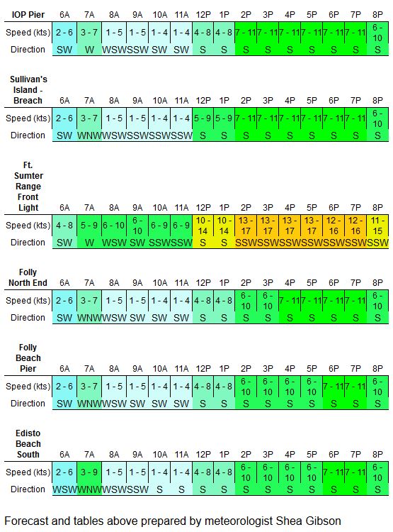
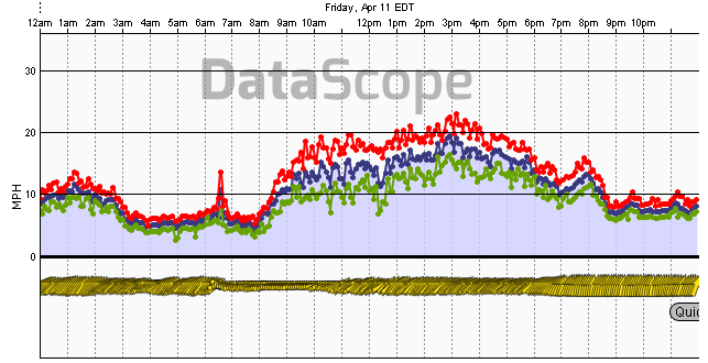
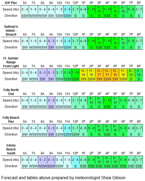
Isle of Palms, (mid SC)
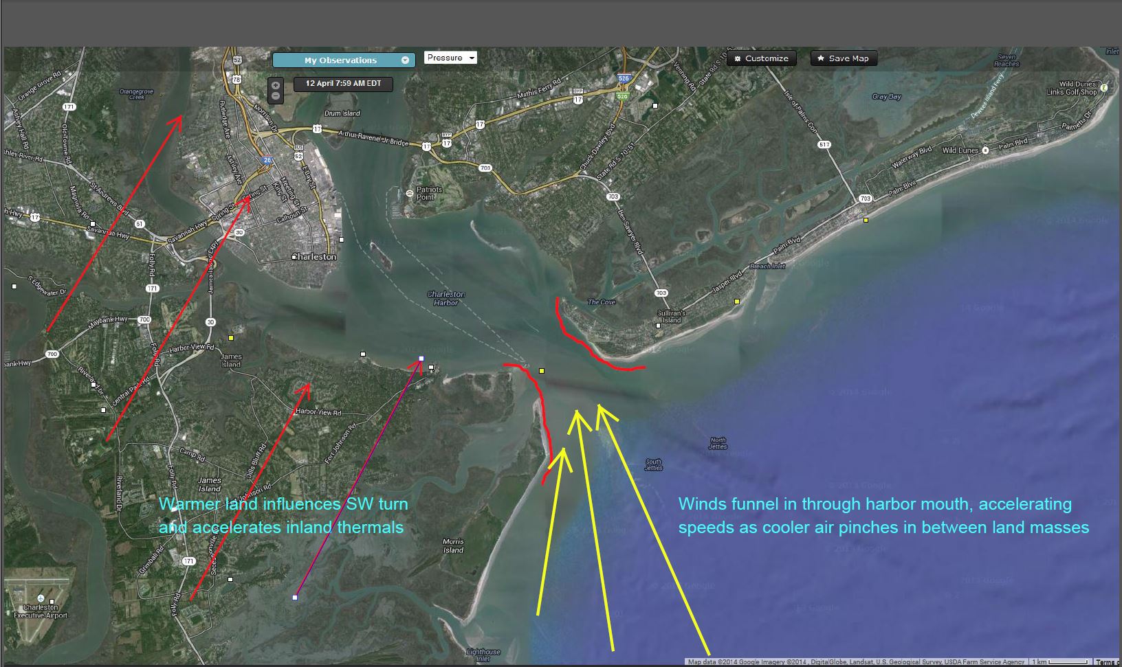
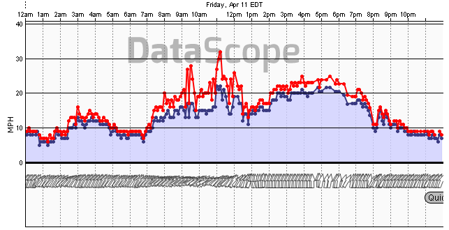
Charleston Harbor, (mid SC) – escapes some of the ridging effects..notice how well it picks up as winds funnel in between land masses during Seabreezing.
Above Charleston/Georgetown, we see activity north of axis allow for stronger builds off the Seabreezes.
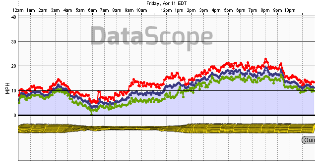
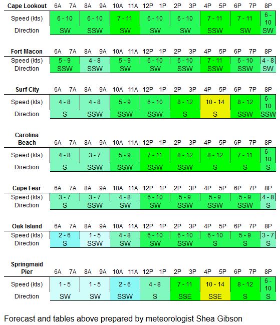
Myrtle Beach, Springmaid Pier (north SC)
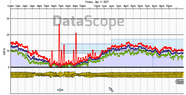
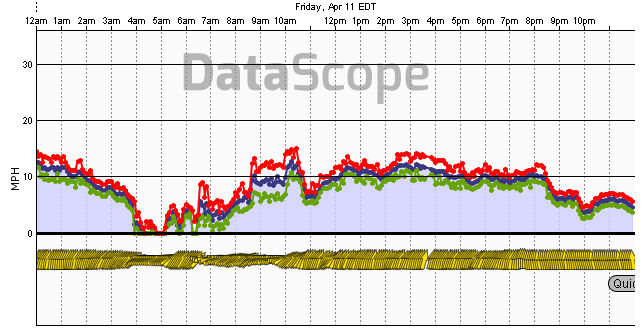
Oak Island, NC (Cape Fear area)
Fort Macon, BC (Cape Lookout area)
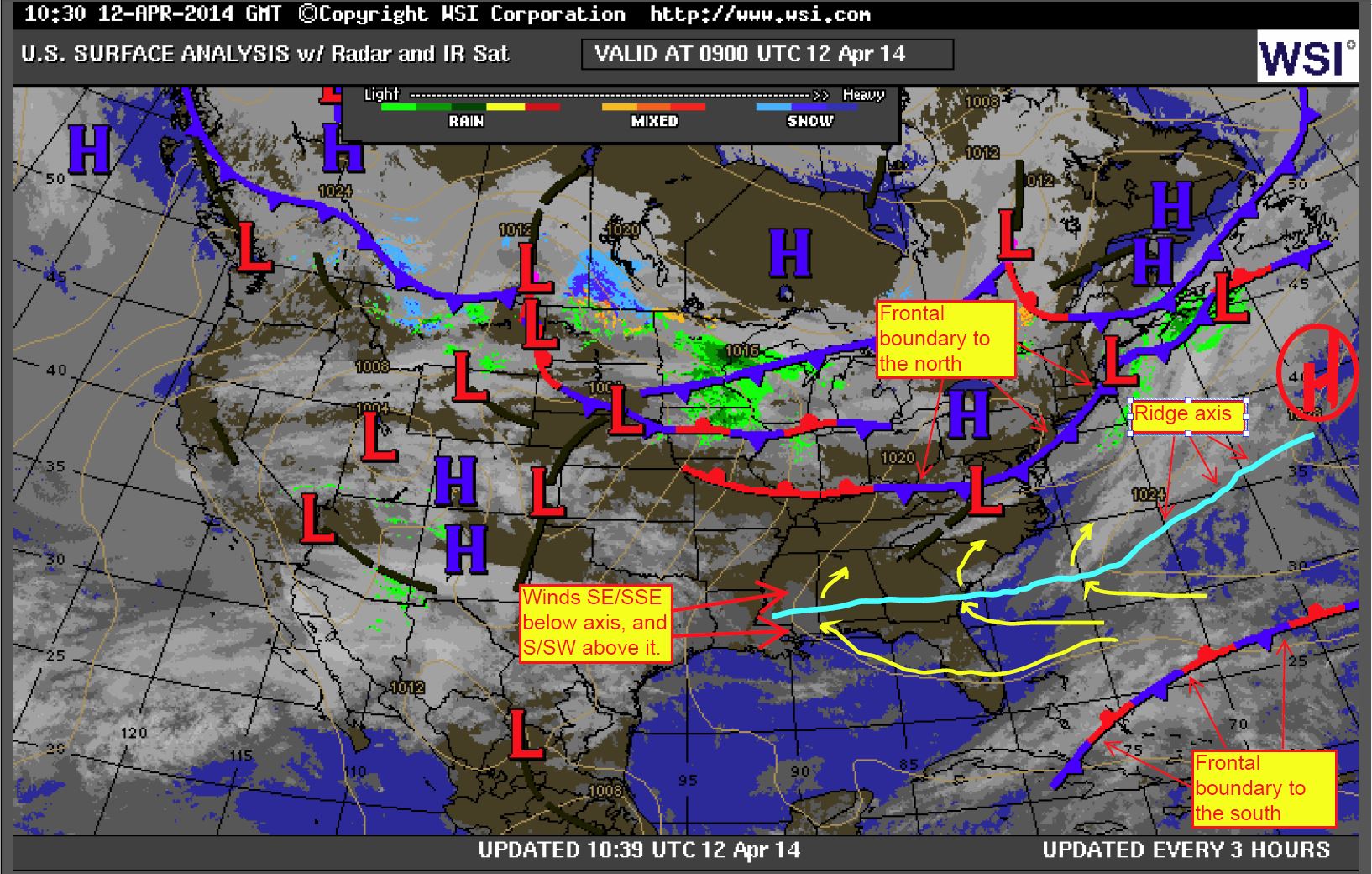
APRIL 12, 2014 Surface Analysis showing the frontal boundaries north and
south of High.
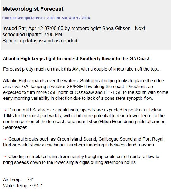
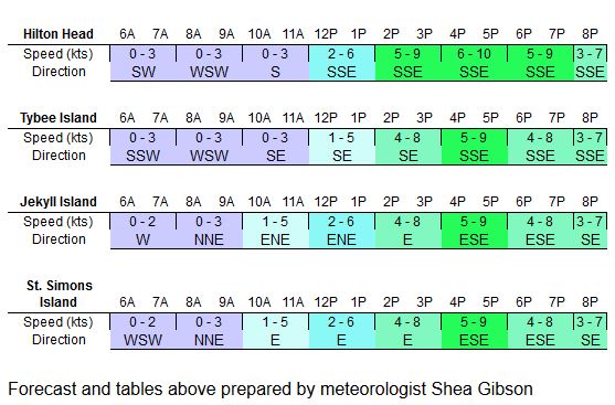
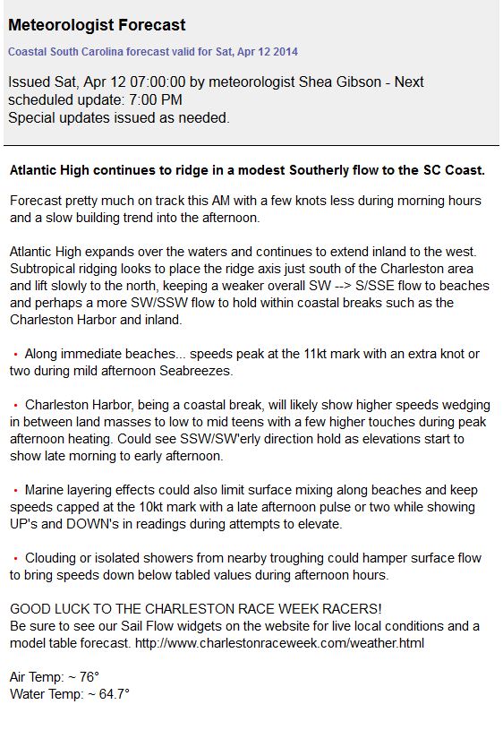
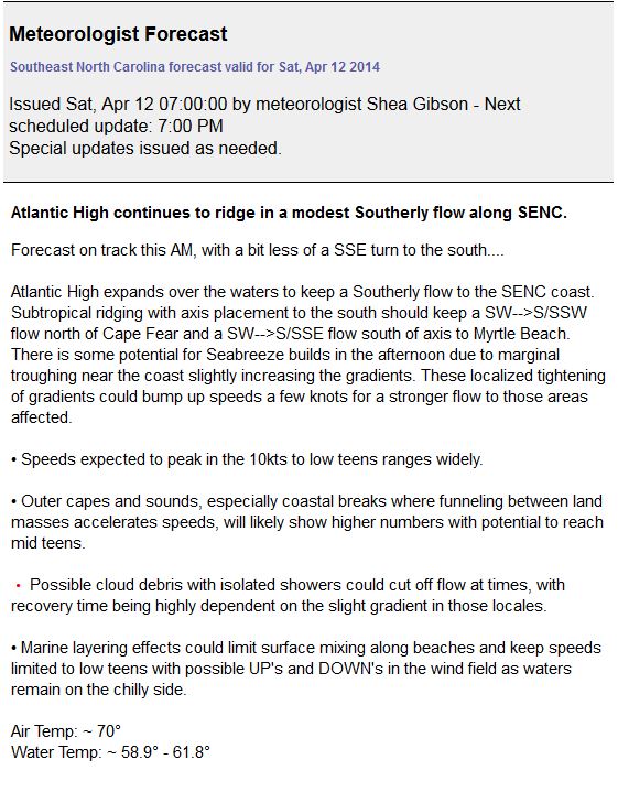
Forecast from GA, SC and SENC:
Outcomes:
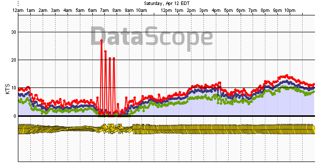
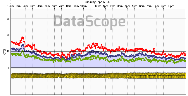
Jekyll Island, (south GA) – again ignore the spikes in the AM hours.
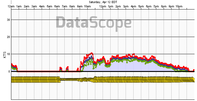
Isle of Palms, (mid SC)
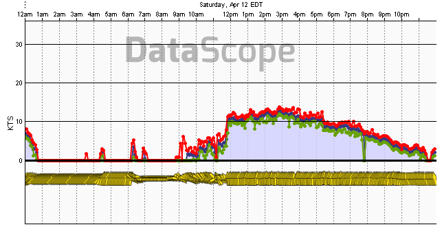
Charleston Harbor, (mid SC) – stayed several knots lower than expected.
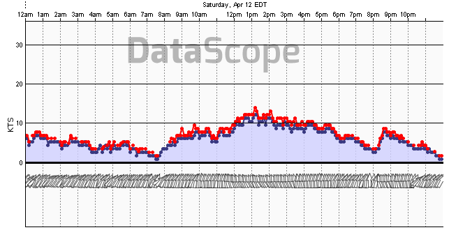
Myrtle Beach, Springmaid Pier (north SC)
Oak Island, NC (Cape Fear area)
Fort Macon, NC (Cape Lookout area)
APRIL 13, 2014 Surface Analysis shows ridge axis remaining extended across
SE states, with some meandering south to north.

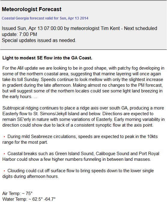
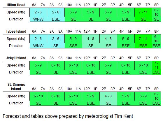
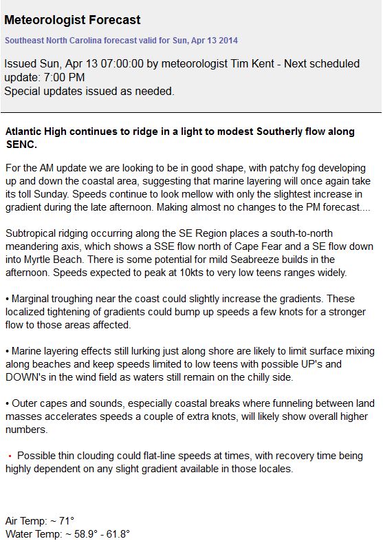
Forecast from GA, SC and SENC:
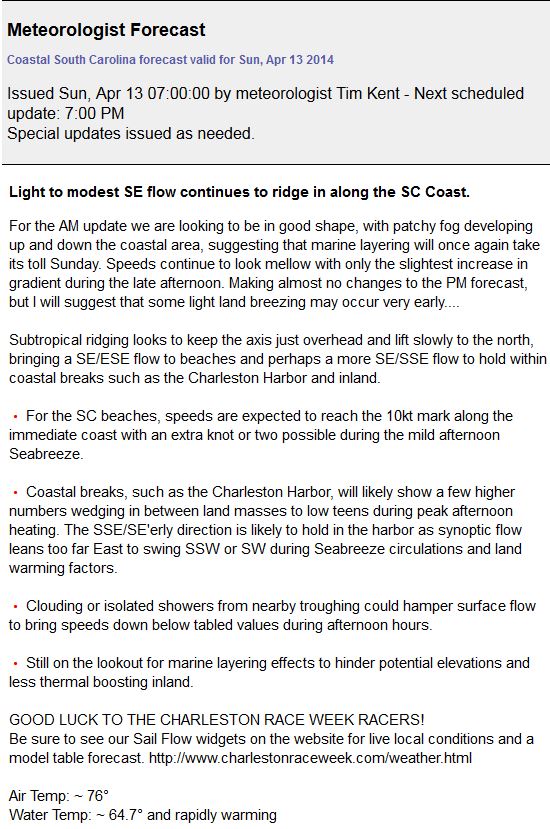
AND A MIDDAY UPDATE:

Outcomes:
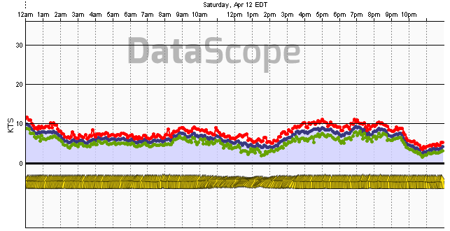
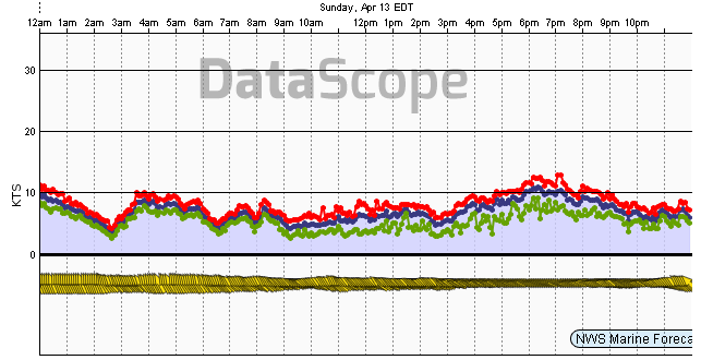
Jekyll Island, (south GA)
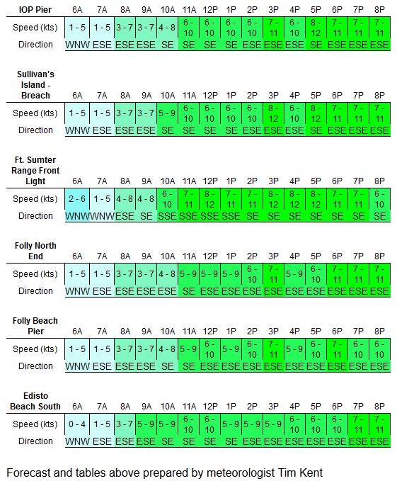
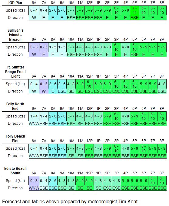
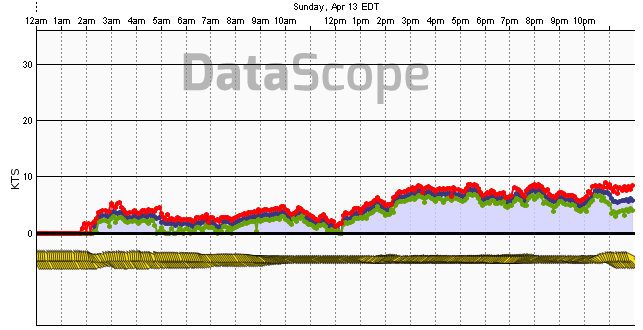
Isle of Palms, (mid SC)
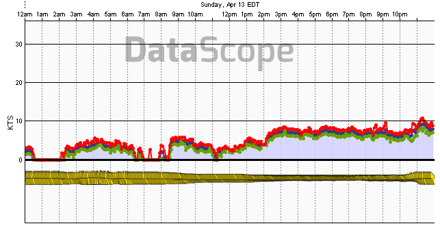
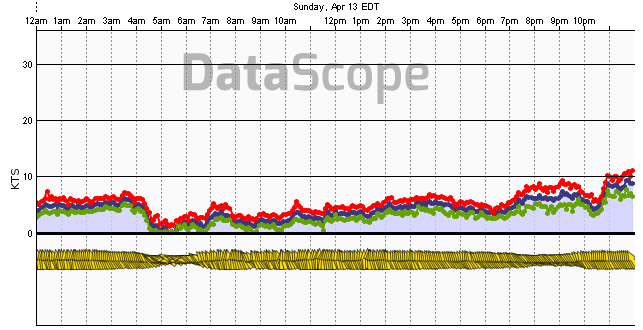
Charleston Harbor, (mid SC)
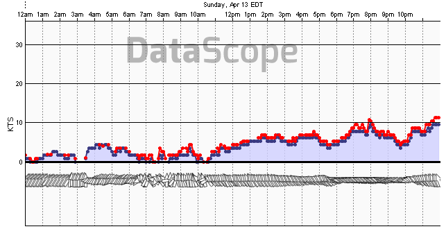
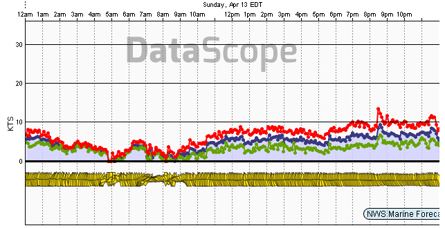
Myrtle Beach, (north SC)
Oak Island, NC (Cape Fear area)
Fort Macon, NC (Cape Lookout area)
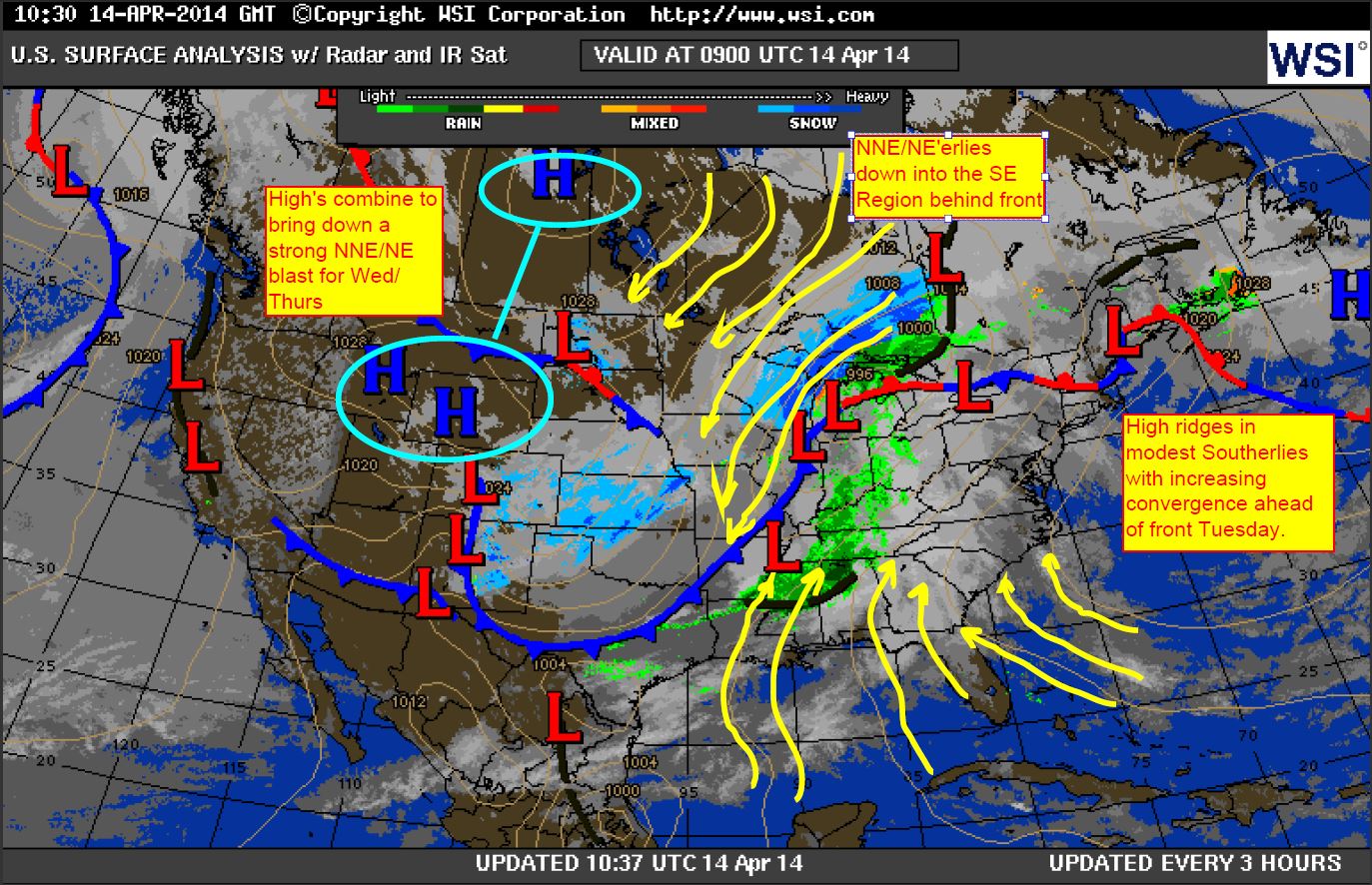
Finally, the April 14 Surface Analysis shows continued ridging starting to
show signs of retreat as cold front comes together out west.