Tricky Mesoscale Convective Vortex (MCV) attempts to spark tropical development off of SC.
By Mike Godsey
by WeatherFlow meteorologist Shea Gibson
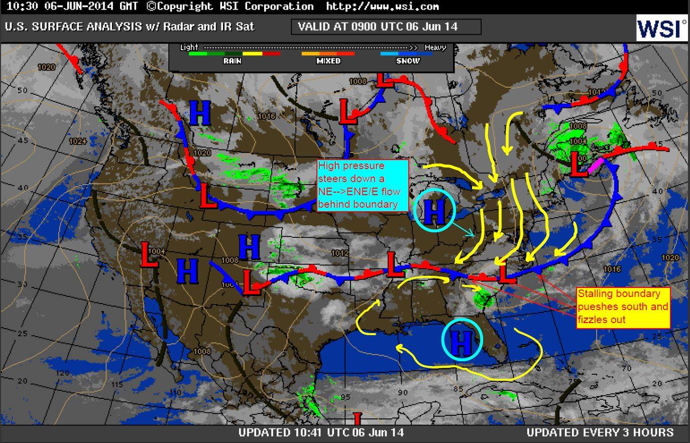
Upon doing the forecast in the AM 6/6/14, I noticed what looked similar to a derecho having larger scale rotation.
Overnight warm front activity/warm air advection just south of an EAST-WEST stationary boundary typically sparks clusters of storms but usually not in this pattern.
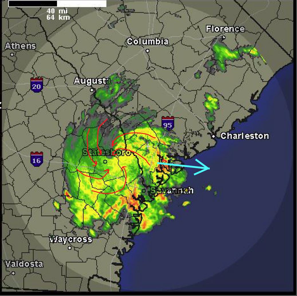
In fact, this MCV managed to take on a life of its own. This cluster came across central GA (Atlanta area) and continued to rotate as it approached the coast, turning more East and gaining some banding off the warm waters. Air temp and SST temps were right at 80°, which would have been conducive for tropical development. However, it fizzled out once it entered the Atlantic. Close call?
Overall system activity:
Here is the screenshot with the marked the rotation:
And here is the radar loop – click on this link to see the full 12 hour loop: (Can only capture 5mb or less for this blog so I had to break up the loop into 2 x .gif to stay below that thresh hold) http://weather.rap.ucar.edu/radar/displayRad.php?icao=KCLX&prod=n0r&bkgr=black&endDate=20140606&endTime=18&duration=12
Here are the 2 parts:

This is yet another one of those “tricky” situations easily overlooked that can sometimes form tropical systems very quickly… and with the recent rapid intensification process we have seen (especially with this year’s “Amanda” in the eastern Pacific), it’s something not to ignore by any means.
Reference to rapid intensification of “Amanda” can be seen in our blog by WeatherFlow meteorologist Mike Godsey: http://wp.me/p4sVyF-4aq