By WeatherFlow meteorologist Shea Gibson on Sunday, 8/22/2021.
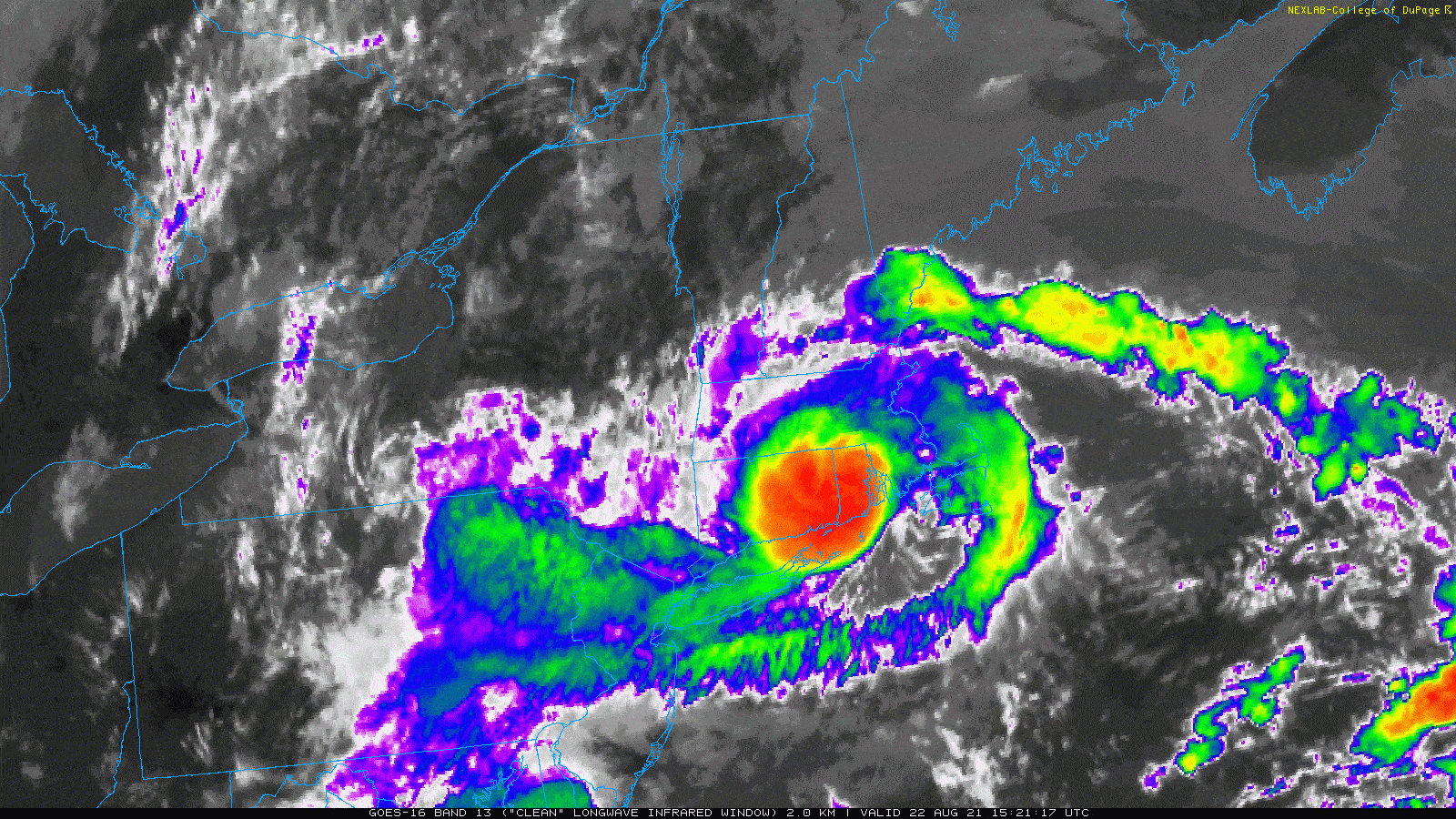
We had a rather rare event happen as Tropical Storm Henri made landfall at ~12:15PM ET near Westerly, Rhode Island with winds of 60mph.
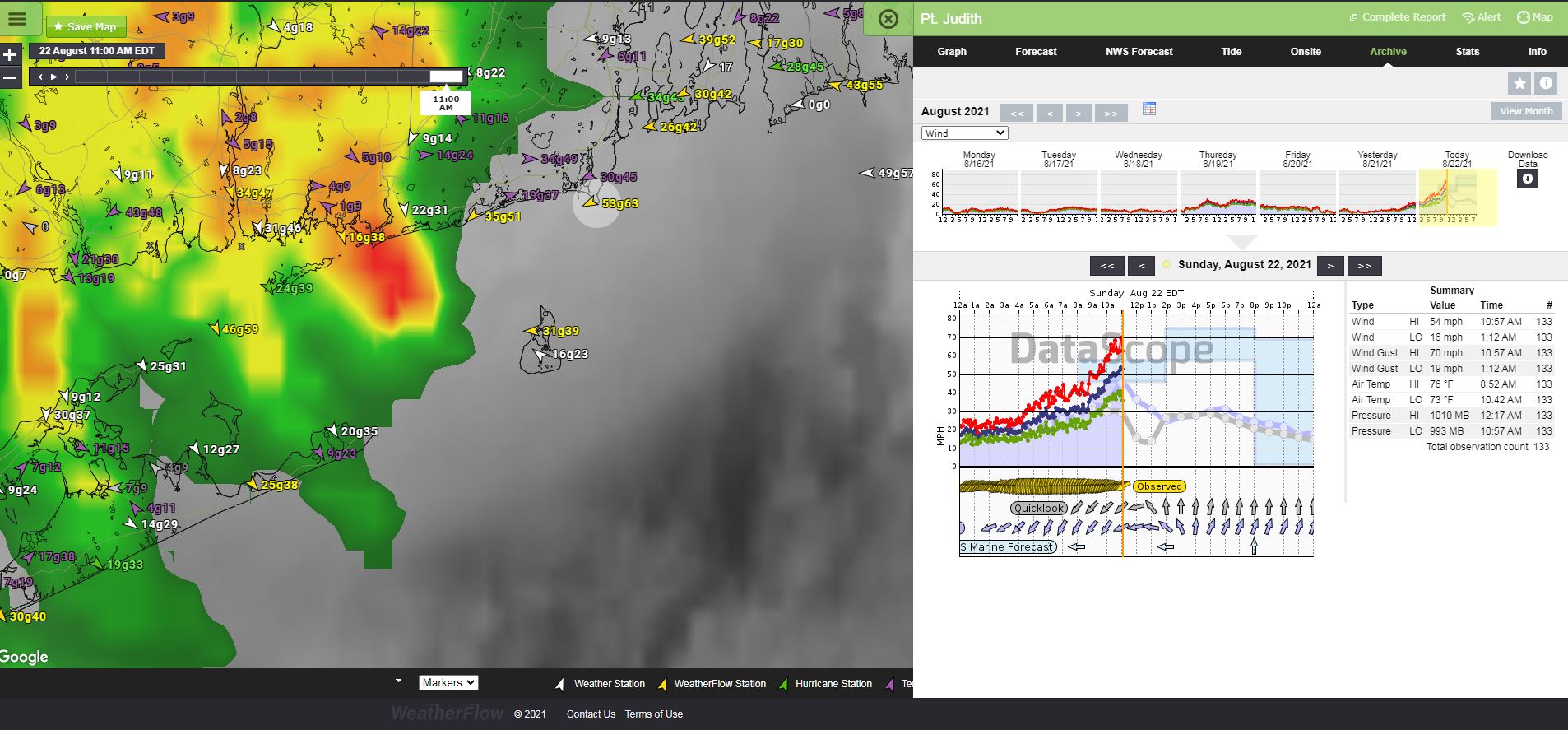
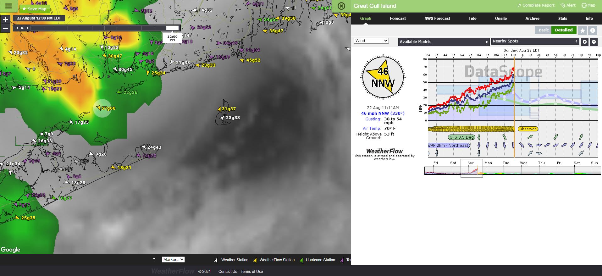
Several spots gusted to 69 and 70mph as recorded within our own Weatherflow sensors, for which the NHC referenced quite a bit in their reports.

Here is a neat link from NOAA Satellites showing GOES 16 visible satellite loop with lighting strikes at the time of landfall. https://twitter.com/NOAASatellites/status/1429492566198824960?s=20
This is the first named storm to make landfall there since Hurricane Bob on August 19, 1991 which had winds of 100mph. Keep in mind that was just over 30 year ago! In short, the New England states got rather lucky as the earlier NHC forecasts were to keep it a CAT 1 hurricane all the way into land. As Henri moved north, it was being edged into by an upper trough to its west while moving over cooler waters. These two features helped it to weaken into a strong tropical storm vs a hurricane. However, this is a stark reminder that these storms can make landfall anywhere along he East Coast (and Gulf Coast for that matter).
Stay safe and stay weather aware!
P.S. Have your hurricane kits updated and evaluation routes ready to execute if necessary. You never know who is next. It’s not a matter of if, it is when.
Sources:
Our own weather data viewable at www.windalert.com
College of Dupage: https://www.cod.edu/
NOAA NHC: https://www.nhc.noaa.gov/